
 United Kingdom
 France
 Germany
 Netherlands
 Sweden
 USA
USA
 Italy
Italy
 Spain
Spain
More From Contributor


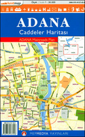
Adana Main Roads Map
Street plan of Adana from the Turkish publishers Mepmedya Yayinlari. The plan is double-sided, with a small overlap between the sides, and covers Adana with its outer districts at 1:30, 000. Only larger streets plus the districts are named. The plan indicates various facilities and places of interest, including shopping centres, educational establishments, places of worship, industrial areas, etc. There is no index. Adana’s town centre is shown on an enlargement in much greater detail at 1:10, 000, with names of smaller streets and local neighbourhoods. Map legend includes English.

Product Description
Reviews/Comments
Add New
Vouchers
No voucher codes found.
Do you know a voucher code for this product or supplier? Add it to Insights for others to use.
Do you know a voucher code for this product or supplier? Add it to Insights for others to use.
 Denmark