
 United Kingdom
 France
 Germany
 Netherlands
 Sweden
 USA
USA
 Italy
Italy
 Spain
Spain
More From Contributor


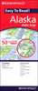


Alaska Explorer
Alaska on a double-sided map designed to be used by tourist cruising from Vancouver along its panhandle or exploring its interior in organized groups rather than to presents that state’s road network and geography in great detail.On one side is Alaska, including the panhandle and the Aleutian Islands, at 1:3, 800, 000 with shading and colouring to show its topography and indicate glaciers, national parks or forests and wildlife refuges. Main roads and the Trans-Alaska pipeline are marked. On the reverse the Inside Passage from Vancouver to Anchorage is shown at the same scale. 22 place sof interest across the whole state are highlighted on the two maps and annotated with descriptions.Also provided are notes about Alaska’s native people, wildlife and history, etc.; 14 biographical
notes describing various famous people connected with the state, from Vitus Bering to William Healey Dall (no lipstick!); plus a time chart from 1648 to 1989.
notes describing various famous people connected with the state, from Vitus Bering to William Healey Dall (no lipstick!); plus a time chart from 1648 to 1989.

Product Description
Reviews/Comments
Add New
Vouchers
No voucher codes found.
Do you know a voucher code for this product or supplier? Add it to Insights for others to use.
Do you know a voucher code for this product or supplier? Add it to Insights for others to use.
 Denmark