
 United Kingdom
 France
 Germany
 Netherlands
 Sweden
 USA
USA
 Italy
Italy
 Spain
Spain
More From Contributor


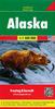


Alaska ITMB
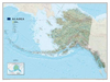
Alaska at 1:1, 500, 000 on an indexed, double-side map from ITMB with altitude colouring to show the topography and highlighting for the state’s numerous national parks and protected areas. The main part of the state is divided north/south with a small overlap between the sides. The panhandle is shown as an inset at the same scale as the main map; Aleutian Islands are on another panel but at 1:3, 750, 000.Topography is presented by altitude colouring in broad bands, with heights for main peaks (in feet). Road network includes selected local tracks and winter only routes. Railway lines and ferry connections are included; local airports and seaplane bases are marked. Symbols indicate locations of various recreational activities and facilities. Various locations are annotated with brief
historical notes. Each side of the map has a separate index. Latitude and longitude lines are drawn at 2° intervals.To see other regional titles from ITMB covering USA please click on the series link.
historical notes. Each side of the map has a separate index. Latitude and longitude lines are drawn at 2° intervals.To see other regional titles from ITMB covering USA please click on the series link.

Product Description
Reviews/Comments
Add New
Vouchers
No voucher codes found.
Do you know a voucher code for this product or supplier? Add it to Insights for others to use.
Do you know a voucher code for this product or supplier? Add it to Insights for others to use.
 Denmark