
 United Kingdom
 France
 Germany
 Netherlands
 Sweden
 USA
USA
 Italy
Italy
 Spain
Spain
More From Contributor


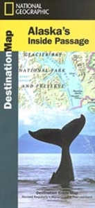
Alaska`s Inside Passage Destination Map
Alaska’s Inside Passage on a waterproof and tear-resistant map at 1:880, 000 from the National Geographic Society, with extensive notes about places of interest, plus on the reverse a map of Alaska and more information about its protected areas, etc.On one side is the map the Inside Passage along the straights of the state’s panhandle, showing shipping routes, towns and settlements, roads and airports for scheduled air or seaplane services, and highlighting the region`s numerous national parks and other protected nature areas. The map is accompanied by notes about the islands, wildlife, water features and tides, weather, etc.On the reverse is a map showing the whole of Alaska with the Aleutian Islands at 1:4, 000, 000 with towns, the road network, main ferry connections,
airports and the national parks or reserves. Also provided are extensive notes about various aspects of Alaska, including the Klondike Gold Rush National Historical Park, plus a table showing various facilities in Alaska’s national parks.
airports and the national parks or reserves. Also provided are extensive notes about various aspects of Alaska, including the Klondike Gold Rush National Historical Park, plus a table showing various facilities in Alaska’s national parks.

Product Description
Reviews/Comments
Add New
Vouchers
No voucher codes found.
Do you know a voucher code for this product or supplier? Add it to Insights for others to use.
Do you know a voucher code for this product or supplier? Add it to Insights for others to use.
 Denmark