More From Contributor
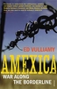
£5.50
Amersfoort in a series of handy size, detailed & indexed city centre street plans of main towns in the Netherlands & Flanders including Brussels from Falk, highlighting recommended walks & places of interest, with six best sights prominently marked & cross-referenced to brief descriptions. The plans also indicate publishers’ recommendations for shopping and/or bars & restaurants. The network of streets & small connecting passages is very clearly presented. Metro stations are marked & tram routes are shown with line numbers & stops. The plans show cycle paths & for drivers indicate main traffic arteries & car parks. Symbols show various facilities such as tourist information centres, markets, canal cruise offices, etc. On the reverse, the street index is accompanied by a calendar of main events, a list of museums, plus contact details for publishers’ recommendations. Map legend & all the text about recommended sights, etc, include English. To see the list of other titles in this series please click on the series link. ...
Archived Product
£17.99
Kadaster, Holland`s national survey organization, produces one of the most attractive topographic surveys in Europe. The maps are very colourful, with their characteristic patchwork of polders & an unusually large amount of land use information: meadows, arable l&, different types of forest, marshes, sand dunes, etc. Contours are shown at 5-metre intervals with numerous spot heights &, with such a large part of the country below the sea level, ”spot depths”. Each map covers an area of Approx. 25 x 20 km / 15 x 12 miles, with some sheets slightly larger. The maps have a 1-km Dutch national grid, plus latitude & longitude at intervals of 1`. Map legend

Includes::
English.IMPORTANT
- PLEASE NOTE BEFORE ORDERING: both the west (W) & the east (O) sheet of each number has the same name, although the town after which the two maps are named appears only on one of the sheets. For example: maps 41W & 41O are both called Arnhem, although the city of Arnhem appears only on sheet 40W, etc. To see the list of titles available in this series please click on the series link.


...
Archived Product
£2.95
Amersham in 1897 in a fascinating series of reproductions of old Ordnance Survey plans in the Alan Godfrey Editions, ideal for anyone interested in the history of their neighbourhood or family. Selected towns in Great Britain & Ireland are covered by maps showing the extent of urban development in the last decades of the 19th & early 20th century. In this title: the map mapcovers the 'old town' of Amersham, shortly before the great changes brought by the Metropolitan Railway. The station, opened in 1892, is in the north-eastern corner, some distance from the town which is centred on the High Street. Features here include St Mary's church, Workhouse, Town Hall, malthouse, Crown Farm, Bury Farm, River Misbourne, brewery, cemetery, Whielden Street. To the east is Bury End, with Bury Mill, but otherwise Amersham appears as a small country town. A 1903 directory of Amersham is on the reverse. About the Alan Godfrey Editions of the 25 ...
Archived Product
£8.99
Amexica provides a full account of the war along the US-Mexico border. An area of land more than 2, 000 miles long & 100 miles wide, it has become a battleground where drugs, guns & killings are the currency of everyday existence. Journalist Ed Vulliamy went on a four month road trip along the entire border where, in the last three years, more than 23, 000 people have been murdered in Amexica as criminal drug cartels fight each other. These narcotic rivers flow only one way – to America, in a frightening pastiche of the global economy. Amexica looks at the causes & consequences of this under-reported war & on the impact it has on the everyday life which somehow goes on around it. ...
Archived Product
£28.61
Colloquial Amharic is the essential guide to learning this beautiful language. Specially written by an experienced teacher for self-study or class use, the course offers you a step-by-step approach to written & spoken Amharic. No prior knowledge of the language is required.
Colloquial Amharic is:
interactive
- with lots of exercises for regular practice
clear
- with concise grammar notes
practical
- with useful vocabulary & pronunciation guide
complete
-

Includes::
answer key & special reference section.
Two 60 minute cassettes are also available to help you with listening & pronunciation skills.


...
Archived Product
£11.99
A monumental literary event: the newly discovered final novel by seminal Harlem Renaissance writer Claude Mc Kay, a rich & multilayered portrayal of life in 1930s Harlem & a historical protest for black freedom This colourful, dramatic novel centres on the efforts by Harlem intelligentsia to organize support for the liberation of fascist-controlled Ethiopia, a crucial but largely forgotten event in American history. At once a penetrating satire of political machinations in Depression-era Harlem & a far-reaching story of global intrigue & romance, Amiable with Big Teeth plunges into the concerns, anxieties, hopes & dreams of African-Americans at a moment of crisis for the soul of Harlem
- & America.
...
Archived Product
£6.99
Street plan of Amiens at 1:13, 000 with an enlargement showing the town centre in greater detail, plus a road map of the city’s environs. This title is part of an extensive series of street plans of French towns from Blay-Foldex, the country’s largest, oldest & most experienced publisher of urban mapping. Blay plans include outer suburbs &, where appropriate, adjoining localities forming part of the urban agglomeration & provide brief descriptions of the town’s main sights, contact details for hotels & other places of interest, etc. The plans show one way streets, car parks & pedestrian zones. Important public buildings are clearly marked & identified. Blay street maps are usually double-sided & include an enlargement for the town centre & a street index with separate lists of “edifices publics”: main public buildings, places of worship, schools, sport facilities, stations, etc. Each of the outer suburbs or the adjoining localities, identified with its postcode, has a separate index. Many titles also provide a road map of the environs. All the text is in French only.PLEASE NOTE: to see the list of Blay-Foldex street plans of French towns & cities please click on the series link – the series description also

Includes::
a comparison between Blay & IGN street plans.

...
Archived Product
£11.50
Topographic survey of France at 1:25, 000 in IGN`s excellent TOP25 / Série Bleue series. All the maps are GPS compatible, with a 1km UTM grid plus latitude & longitude lines at 5’ intervals. Contours are at 5m intervals except for mountainous areas where the maps have contours at 10m intervals, vividly enhanced by hill shading & graphics for rocky terrain. Colouring with graphics indicates different types of vegetation or land use (deciduous or coniferous forests, moors, orchards, vineyards, etc). PLEASE NOTE: coverage of France at this scale is currently being revised – the format & the presentation of each title are indicated by the letters at the end of its Sheet Reference number (e.g. 0416ET, 3531ETR, 1923SB, etc.)MAPS WITH FULL TOURIST OVERPRINT & AN ENGLISH MAP LEGEND: all TOP25 maps & the SB editions of Série Bleue have an overprint highlighting waymarked walking trails including long-distance GR routes &, where appropriate, ski routes. Symbols indicate campsites, gîtes d’etape, refuges, equestrian centres & other recreational facilities or sites, tourist information centres, cultural heritage, etc. Towns & locations of particular interest are highlighted.- ET or OT = single-sided TOP25 map covering approx. 29x 21 km / 18x 13 miles.- ETR or OTR = waterproof & tear resistant TOP25 map covering the same area as the corresponding ET or OT number, but double-sided, printed on a smaller size sheet with a good overlap between the sides.- SB = Série Bleue map with full tourist overprint; these maps, first introduced in summer 2014, each cover approx. 29x 24km / 18x 15 miles.SÉRIE BLEUE maps with numbers ending in E (Est) or O (Ouest): most editions now indicate the GR routes, but do not show any other tourist information. Map legend is in French only. Each map covers approx. 14x 20km / 9x 12 miles. ...
Archived Product
£6.99
Amiens
- Arras Michelin Centenary Map-Pack, a set of two maps showing the area at 1:200, 000: a current road map from 2014 plus
...
Archived Product

Amexica SUPERCEDED

Amexica provides a full account of the war along the US-Mexico border. An area of land more than 2, 000 miles long and 100 miles wide, it has become a battleground where drugs, guns and killings are the currency of everyday existence. Journalist Ed Vulliamy went on a four month road trip along the entire border where, in the last three years, more than 23, 000 people have been murdered in Amexica as criminal drug cartels fight each other. These narcotic rivers flow only one way
RIP - This product is no longer available on our network. It was last seen on 25.09.2019

This page now acts as a permanent archive for this product. Add more information using the comments box below to ensure it can still be found by future generations.

Use our search facility to see if it is available from an alternative contributor.
  • Availability: Out Of Stock
  • Supplier: Stanfords
  • SKU: 9781847921284
Availability: In Stock
£20.00

Product Description

Amexica provides a full account of the war along the US-Mexico border. An area of land more than 2, 000 miles long & 100 miles wide, it has become a battleground where drugs, guns & killings are the currency of everyday existence. Journalist Ed Vulliamy went on a four month road trip along the entire border where, in the last three years, more than 23, 000 people have been murdered in Amexica as criminal drug cartels fight each other. These narcotic rivers flow only one way

Reviews/Comments

Add New

Intelligent Comparison

Oooops!
We couldn't find anything!
Perhaps this product's unique.... Or perhaps we are still looking for comparisons!
Click to bump this page and we'll hurry up.

Price History

Vouchers

No voucher codes found.
Do you know a voucher code for this product or supplier? Add it to Insights for others to use.

Facebook

Jargon Buster

Month - A period of time originally related to the phases of the earths moon.
Road - a manmade lane or a path that is used to speed up travel.
Wide - Something with a large width.

Supplier Information

Stanfords
Stanfords was established in 1853 and opened their iconic Covent Garden flagship store in 1901. They have become the top retailer of maps, travel books and accessories in the UK and arguably offer the largest selection of maps and travel books worldwide. Famous names such as Captain Robert Falcon Scott, Ranulph Fiennes and Michael Palin have purchased from Stanfords. They now have a shop in Bristol and both stores together with other venues operate a calendar of events including talks, book signings and exhibitions. As a specialist map retailer, the map selection is comprehensive and includes road maps, street maps and walking maps from worldwide destinations, as well as a selection of world atlases and wall maps. Books include travel guides and travel literature. Stanfords also stock globes, from miniatures made of blue marble to magnificent floor-standing globes. The website features a selection of interesting articles on travel topics.
Page Updated: 2023-11-12 20:15:36

Community Generated Product Tags

Oh No! The productWIKI community hasn't generated any tags for this product yet!
Menu