-
Home
-
Contributors
-
International
-
Account
-
Information
More From Contributor
- in Yashim`s eyes
- ultimately ineffective, he is the only man who makes him afraid. & now Yashim must confront the secret that Fevzi Pasha has been keeping all these years, a secret whose roots lie deep in the tortured atmosphere of the sultan`s harem, where normal rules are suspended, & women can simply disappear. Once again, Yashim & his friends encounter treachery & politics, played out against the backdrop of 1840s Istanbul. ...
- taking its readers deep inside this iconic university & the inner ...
- more distinctively
- the straw plait industry, for which it assumed an importance surpassed only by neighbouring Bedfordshire. The twentieth century witnessed the rise of printing, pharmaceuticals, a film industry & the extraction of aggregates. All these areas of activity are explored in detail as is the long history of settlement in the county, from the Palaeolithic period to the garden cities & new towns. Printed in full colour, & with a fold-out parish map, the Historical Atlas is an essential tool for the local historian & anyone with an interest in this fascinating county. ...
Includes:: the essential historical context & practical information to help you discover places unknown to many Parisians. Written with humor & a flair for the unusual & authentic, the text is illustrated with original photos & local maps. It
Includes:: a unique guide to using the excellent local train network. ...
- a war they continued after the Armistice because no one told them to stop. Primarily a gripping story of the men & women swept up by the passions of love & battle, William Boyd`s magnificently entertaining novel also elicits the cruel futility & tragedy of it all. ” An Ice-cream War” will be loved by fans of ” Any Human Heart” & ”A Good Man in Africa”, as well as readers of Ben Macintyre, Sebastian Faulks, Nick Hornby & Hilary Mantel. ” Compulsively readable”. (” Observer”). ” He has a black-edged laughter of his own.. .quite outstanding”. (” Sunday Times”). William Boyd has received world-wide acclaim for his novels. They are: ”A Good Man in Africa” (1981, winner of the Whitbread Award & the Somerset Maugham Prize), ” An Ice Cream War” (1982, shortlisted for the 1982 Booker Prize & winner of the John Llewellyn Rhys Prize), ” Stars & Bars” (1984), ” The New Confessions” (1987), ” Brazzaville Beach” (1990, winner of the Mc Vitie Prize & the James Tait Black Memorial Prize), ” The Blue Afternoon” (1993, winner of the 1993 Sunday Express Book of the Year Award & the Los Angeles Times Book Award for Fiction, 1995), ” Armadillo” (1998), & ” Any Human Heart” (2002, winner of the Prix Jean Monnet). He is also the author of a collection of screenplays & a memoir of his school days, ” School Ties” (1985); & three collections of short stories: ” On the Yankee Station” (1981), ” The Destiny of Nathalie `X`” (1995) & ” Fascination” (2004). He also wrote the speculative memoir ” Nat Tate: an American Artist”
- the publication of which, in the spring of 1998, caused something of a stir on both sides of the Atlantic. A collection of his non-fiction writings, 1978-2004, entitled ” Bamboo”, was published in October 2005. His ninth novel, ” Restless”, was published in September 2006 (Costa Book Award, Novel of the Year 2006) & his tenth novel, ” Ordinary Thunderstorms”, published September 2009. His most recent novel is ” Waiting For Sunrise” which published in February 2011. ...

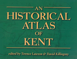
An Historical Atlas Of Kent
whether a resident, or virgin traveller.
This page now acts as a permanent archive for this product. Add more information using the comments box below to ensure it can still be found by future generations.
Use our search facility to see if it is available from an alternative contributor.
- Availability: Out Of Stock
- Supplier: Stanfords
- SKU: 9781860772559
Product Description
“ An Historical Atlas of Kent” is an atlas that seeks to show the varied historical background of ‘the Garden of England’; with it, authors David Killingray & Terence Lawson fill a notable gap in the published histories of the county. It
Includes:: 250 newly-drawn & reader-friendly maps covering topics ranging from the earliest Stone-Age occupation to such modern developments as the growth of leisure industries. Several other areas not usually covered by other county atlases include the introduction of public water & gas supplies in the nineteenth century, together with the expansion of banking services & the local press. Virtually every aspect of Kent’s history is mapped & explained in this atlas, & will make an already important of England that much more interesting, whether a resident, or virgin traveller.
Reviews/Comments
Add New
Intelligent Comparison
We couldn't find anything!
Perhaps this product's unique.... Or perhaps we are still looking for comparisons!
Click to bump this page and we'll hurry up.
Price History
Vouchers
Do you know a voucher code for this product or supplier? Add it to Insights for others to use.


 United Kingdom
 France
 Germany
 Netherlands
 Sweden
 USA
USA
 Italy
Italy
 Spain
Spain


 Denmark