More From Contributor

£7.99
Anchorage, Fairbanks & Juneau in Alaska on an indexed street plan from Rand Mc Nally in their extensive range of maps covering cities in the United States. The main plan covers Anchorage, with additional panels covering Juneau, Fairbanks Ketchikan & Sitka. Also provided are small road maps showing the areas around each of these towns. Other communities covered by this title include College, Collegiate Park, Pennock Isl&, South Bjerremark, Totem Park & West Fairwest. Rand Mc Nally street plans provide coverage of cities with their outer suburbs, clearly indicating main traffic arteries: highways (distinguishing between free & toll access), plus primary & secondary routes. Road numbers and/or names are clearly displayed & exit numbers are indicated. Locations of service & rest areas are marked & one way streets are shown. Longer streets are annotated with block numbers for easier identification of addresses. The maps show railway, bus &, where appropriate, metro stations. A range of symbols indicate various places of interest including cultural & academic institutions, various municipal facilities, golf courses, etc. The plans have extensive street indexes, supplemented by lists of points of interest, parks & recreational areas, shopping malls, stations, schools, etc. Descriptions of individual titles indicate if an enlargement of the downtown area or any other additional features are also provided. ...
Archived Product
£6.50
Anchorage, Fairbanks & Juneau in Alaska on an indexed street plan from Rand Mc Nally in their extensive range of maps covering cities in the United States. The main plan covers Anchorage, with additional panels covering Juneau, Fairbanks Ketchikan & Sitka. Also provided are small road maps showing the areas around each of these towns. Other communities covered by this title include College, Collegiate Park, Pennock Isl&, South Bjerremark, Totem Park & West Fairwest. Rand Mc Nally street plans provide coverage of cities with their outer suburbs, clearly indicating main traffic arteries: highways (distinguishing between free & toll access), plus primary & secondary routes. Road numbers and/or names are clearly displayed & exit numbers are indicated. Locations of service & rest areas are marked & one way streets are shown. Longer streets are annotated with block numbers for easier identification of addresses. The maps show railway, bus &, where appropriate, metro stations. A range of symbols indicate various places of interest including cultural & academic institutions, various municipal facilities, golf courses, etc. The plans have extensive street indexes, supplemented by lists of points of interest, parks & recreational areas, shopping malls, stations, schools, etc. Descriptions of individual titles indicate if an enlargement of the downtown area or any other additional features are also provided. ...
Archived Product
£6.95
Topographic coverage of mainland Spain at 1:50, 000 in the MTN50 (Mapa Topográfico Nacional) series from the Centro Nacional de Información Geografica, the country’s civilian survey organization. The maps have contours at 20m intervals, enhanced by relief shading, plus colouring and/or graphics to show different types of terrain, vegetation or land use. Boundaries of national parks & other protected areas are marked. In addition to all the usual information featured on topographic mapping at this scale, detailed presentation of the road & rail networks, rural tracks & paths, etc, the maps also show campsites & mountain refuges. On more recent editions some GRs, the official long-distance hiking routes, are also marked (although not as clearly as on hiking maps from other publishers). Each map covers 29.5x 18.5 km (with adjustments in the border or coastal areas). The maps have a 1-km UTM grid, plus margin ticks for latitude & longitude at 1` intervals. Map legend is in Spanish only.HOW TO CHOOSE THE RIGHT 50K MAP: all the titles in CNIG’s 200K Provincial Road Maps series at 1:200, 000 are overprinted with the grid for the 1:50, 000 maps & can be used to see the area covered by each 50K title. TO SEE THE LIST OF TITLES IN THIS SERIES PLEASE CLICK ON THE SERIES LINK.PLEASE NOTE
- MAP TITLES: the grids shown on our website serve both the civilian & the military 1:50, 000 topographic series. Although the areas covered by maps in both series are identical (apart from some border or coastal sheets), occasionally map titles differ – only one title is shown on the grid, usually the military one. In Galicia, the Basque country & in the Catalan speaking areas the tendency now is to use local place names rather than the often better known Castilian ones. Where possible, both versions are included in our titles. Map titles listed on our website are based on information received by us at the time of publication, but sometimes maps arrive showing a completely different title! As long as the map number is as ordered, the correct map has been supplied.
...
Archived Product
£29.95
Presenting ”the real deal” of American antiquity-as opposed to the hyped fare of many cable TV shows-Kenneth Feder invites readers to explore the stunning technological, architectural, engineering, & artistic achievements of America`s first peoples. Part travel guide, part friendly reference, Ancient America showcases fifty iconic & publicly-accessible sites located across the contiguous United States-including monumental pyramids of earth, ”castles” ensconced in cliff niches, & vast rock art galleries. Among the places profiled are four World Heritage Sites (Chaco Canyon, NM; Mesa Verde, CO; Cahokia, IL; Poverty Point, LA); numerous Historic Landmarks & National Monuments (including Crystal River, FL; Town Creek Mound, NC; Casa Grande, AZ; & Hovenweep, UT); & stunningly diverse sites ranging from Serpent Mound (OH) & Horsethief Lake (WA) to Canyon de Chelly (AZ) & Nine Mile Canyon (UT). In addition to practical visitor information, Feder tells the fascinating stories of each site as revealed by archaeological research. Introductory chapters delve into the deep past of Native America; historical & cultural details as well as original photography round out the site entries. Readers will be inspired to visit these remarkable places where the past continues to resonate in the present. ...
Archived Product
£16.95
The Khmer civilization centered on Angkor was one of the most remarkable to flourish in Southeast Asia. Between the 8th & the 13th centuries, a succession of Hindu & Buddhist kings created magnificent temples in stone. Their elaborate carvings & intricate architecture amazed the first Europeans who visited in the 19th century & continue to fascinate today, when after many years of political turmoil, Angkor is once again accessible. The renowned French scholar, Claude Jacques, has studied Angkor & its history for the past 30 years, while Michael Freeman has made many photographic trips there during a 15 year period. Ancient Angkor embodies the fruits of their collaboration &

Includes::
the results of new research & discoveries made during recent excavations. Detailed plans & descriptions unravel the complex reliefs of Angkor Wat & the Bayon, while small but interesting temples not covered in other books are also described. Grouping the temples into easy-to-visit itineraries, & with useful hotel & travel information, Ancient Angkor will serve both as a history of the temples in its own right & an invaluable companion guide.

...
Archived Product
£21.99
Patrick E. Mc Govern takes us on a fascinating journey through time to the dawn of brewing when our ancestors might well have made a Palaeo-Brew of fruits, honey, cereals & botanicals. Early beverage-makers must have marvelled at the process of fermentation, their amazement growing as they drank the mind-altering drinks which were to become the medicines, religious symbols & social lubricants of later cultures. Mc Govern circles the globe-to China, Turkey, Egypt, Italy, Scandinavia, Honduras, Peru & Mexico-interweaving archaeology & science to tell stories of making liquid time capsules. Accompanying homebrew interpretations & matching meal recipes help bring the past alive, as our senses & imaginations travel ” Back to the Future”. ...
Archived Product
£6.25
Ancient Britain’s sites, monuments & related museums overprinted on a large, double-sided present day map of the country at 1:625, 000 from the Ordnance Survey, plus numerous panels, maps & photos providing extensive additional information. The base map has altitude colouring to indicate the topography & shows the present day road network. Symbols arranged according to the period (Palaeo/ Mesolithic, Neolithic, Bronze, Iron, Roman, & Medieval) & use (civil, defence, domestic, industrial, religious/ritual, & funerary/burial) show locations of the sites. Also marked are related museums, as well as linear works, trackways, & Roman roads. The map is overprinted with British National Grid. Surrounding the map are numerous panels providing further information including contact details of relevant organizations, photos, drawings & profiles, a glossary of archaeological terms, a chronological table placing British events in a wider historical context, reading recommendations, etc. Many panels describing important archaeological remains are accompanied by extracts from OS Landranger maps at 1:50, 000 showing their exact location. The map has been compiled by the national heritage bodies maintained by Historic Engl&, Historic Environment Scotland & the Royal Commission on the Ancient & Historical Monuments of Wales. Publications date of this edition: February 2016. ...
Archived Product
£5.99
Become an eyewitness to the story of an incredible land & its people, from the B.C Bronze Age to the end of the great Qing Empire in the 20th century. This title helps you discover what kind of weapons were used in early battles, find out about the fabled Silk Route & see the remarkable tools used for Chinese calligraphy. Easily accessible for projects & general reference, this spectacular & informative guide will bring the history of ancient China to life. ...
Archived Product
£40.00
The kings of Aksum formally became Christian during the second quarter of the fourth century, making Ethiopia the second country in the world (after Armenia) officially to adopt the new faith. This landmark book is the first to integrate historical, archaeological, & art-historical evidence to provide a comprehensive account of Ethiopian Christian civilization & its churches
- both built & rock-hewn
- from the Aksumite period to the thirteenth century. David W. Phillipson, a foremost authority on Ethiopia`s archeology, situates these churches within the development of Ethiopian society, illuminating the exceptional continuity of the country`s Christian civilization. He offers a fresh view of the processes which gave rise to this unique African culture as well as the most detailed treatment of the rock-hewn churches at Lalibela World Heritage Site ever published. Abundantly illustrated, filled with original insights, & incorporating new chronological findings, this book will be of enormous interest to a wide international circle of students, scholars, & travelers.

...
Archived Product
£7.99
DK Eyewitness Ancient Egypt is a spectacular & informative guide to one of history's most remarkable civilisations, the Egyptians. Amazing colour photographs offer your child a unique 'eyewitness' view of these incredible empires. Travel back in time & show your child what life was like & how ordinary Egyptians & Pharaohs lived. They'll also discover what's inside the Great Pyramid at Giza to how Tutankhamun's tomb was found. Then use the giant pull-out wall chart to decorate their room. Great for projects or just for fun, make sure your child learns everything they need to know about Ancient Egypt. Find out more & download amazing clipart images at our associated website. ...
Archived Product

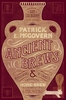
Ancient Athens On 5 Drachmas A Day

Hot on the heels of the authors previous book ”Ancient Rome on 5 Denarii a Day”, here is another informative and entertaining guide, this time to everything that any tourist needs for a journey back in time to ancient Athens in 432 bc. You need only pack your imagination and a toothbrush this guide provides the rest, describing all the best places to stay and shop, what to do, and what to avoid. Brought to life with wonderful computer generated reconstructions of ancient Athens, this highly original, witty book will appeal to tourists, armchair travelers and history buffs.
RIP - This product is no longer available on our network. It was last seen on 25.09.2019

This page now acts as a permanent archive for this product. Add more information using the comments box below to ensure it can still be found by future generations.

Use our search facility to see if it is available from an alternative contributor.
  • External links may include paid for promotion
  • Availability: Out Of Stock
  • Supplier: Stanfords
  • SKU: 9780500051573
Availability: In Stock
£12.95

Product Description

Hot on the heels of the authors previous book ” Ancient Rome on 5 Denarii a Day”, here is another informative & entertaining guide, this time to everything that any tourist needs for a journey back in time to ancient Athens in 432 bc. You need only pack your imagination & a toothbrush this guide provides the rest, describing all the best places to stay & shop, what to do, & what to avoid. Brought to life with wonderful computer generated reconstructions of ancient Athens, this highly original, witty book will appeal to tourists, armchair travelers & history buffs.

Reviews/Comments

Add New

Intelligent Comparison

Oooops!
We couldn't find anything!
Perhaps this product's unique.... Or perhaps we are still looking for comparisons!
Click to bump this page and we'll hurry up.

Price History

Vouchers

No voucher codes found.
Do you know a voucher code for this product or supplier? Add it to Insights for others to use.

Facebook

Jargon Buster

Computer - A programmable electronic machine which stores and manipulates data.
hot - An indication of the temperature being high and a sensation of heat to the tough
History - Anything that happens in the past. An acedemic subject.
Day - The time it takes a planet or other space objects to complete one rotation.
Wonderful - Another word for describing something that is extremely good, marvellous.

Supplier Information

Stanfords
Stanfords was established in 1853 and opened their iconic Covent Garden flagship store in 1901. They have become the top retailer of maps, travel books and accessories in the UK and arguably offer the largest selection of maps and travel books worldwide. Famous names such as Captain Robert Falcon Scott, Ranulph Fiennes and Michael Palin have purchased from Stanfords. They now have a shop in Bristol and both stores together with other venues operate a calendar of events including talks, book signings and exhibitions. As a specialist map retailer, the map selection is comprehensive and includes road maps, street maps and walking maps from worldwide destinations, as well as a selection of world atlases and wall maps. Books include travel guides and travel literature. Stanfords also stock globes, from miniatures made of blue marble to magnificent floor-standing globes. The website features a selection of interesting articles on travel topics.
Page Updated: 2023-11-12 20:15:36

Community Generated Product Tags

Oh No! The productWIKI community hasn't generated any tags for this product yet!
Menu