More From Contributor
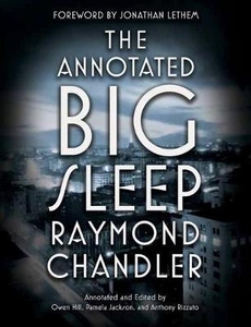
£3.50
Annfield Plain in 1896 in a fascinating series of reproductions of old Ordnance Survey plans in the Alan Godfrey Editions, ideal for anyone interested in the history of their neighbourhood or family. The map covers the mining village of Annfield Plain, just west of Stanley. Coverage stretches from Catchgate eastward to Oxhill & also

Includes::
West Kyo & East Kyo. Several railways cross the map: the NER Annfield Plain Branch & NER Pontop & South Shields Branch, which meet at Annfield Plain Junction (the former is now part of the C2C cycleway) & Morrison Pit Wagonway. Collieries include South Moor Colliery (Charley Pit); South Tanfield Colliery, with coke ovens; South Derwent Colliery, at Annfield Plain, & this

Includes::
the Willie Pit, Pontop coke ovens, Bankfoot coke ovens, engine shed. Also shown are Oxhill Farm, old wagonway, Bessy Bell Hill, Quakinghouse Cottages, South Moor Colliery (Pea Pit), Kyo Laws, Lizzie Square, South Derwent Colliery (Carrmyers Shaft), etc. On the reverse is a directory of Collierley parish which included Catchgate & Annfield Plain. About the Alan Godfrey Editions of the 25” OS Series: Selected towns in Great Britain & Ireland are covered by maps showing the extent of urban development in the last decades of the 19th & early 20th century. The plans have been taken from the Ordnance Survey mapping & reprinted at about 15 inches to one mile (1:4, 340). On the reverse most maps have historical notes & many also include extracts from contemporary directories. Most maps cover about one mile (1.6kms) north/south, one & a half miles (2.4kms) across; adjoining sheets can be combined to provide wider coverage.FOR MORE INFORMATION & A COMPLETE LIST OF ALL AVAILABLE TITLES PLEASE CLICK ON THE SERIES LINK.


...
Archived Product
£8.99
The island of Antigua is a magical place: growing up there should be a sojourn in paradise for young Annie John. But, as in the basket of green figs carried on her mother`s head, there is a snake hidden somewhere within. Annie John begins by adoring her beautiful mother, but inexplicably she comes to hate her. Adolescence takes this brilliant, headstrong girl into open rebellions & secret discoveries
- & finally to a crisis of emotions that wrenches her away from her island home.
...
Archived Product
£8.99
`A contemporary masterpiece` Guardian THE FIRST VOLUME OF THE EXTRAORDINARY SOUTHERN REACH TRILOGY
- NOW A MAJOR MOTION PICTURE
...
Archived Product
£22.99
The best rides in the freeride hot spots of the Alps – this is the simple formula of the Freeride Maps. The first map available to freeriders is making the locals freeride knowledge available to a broad public. All ridable slopes, drops & couloirs are marked as freeride corridors in different colours for three difficulty ratings: blue for technically easy terrain, yellow requires advanced to very advanced ability & red is extremely difficult terrain that is partially exposed & therefore reserved to crack riders. Short ascents are marked with red lines. The Freeride Maps are based on topographic maps 1:25, 000. They contain all essential information about the terrain that is necessary for planning & going freeriding. The maps are printed on water resistant & indestructible paper. On the back side, the maps include all relevant planning, safety & rescue information. ...
Archived Product
£7.99
Topographic survey of France at 1:25, 000 in IGN`s excellent TOP25 / Série Bleue series. All the maps are GPS compatible, with a 1km UTM grid plus latitude & longitude lines at 5’ intervals. Contours are at 5m intervals except for mountainous areas where the maps have contours at 10m intervals, vividly enhanced by hill shading & graphics for rocky terrain. Colouring with graphics indicates different types of vegetation or land use (deciduous or coniferous forests, moors, orchards, vineyards, etc). PLEASE NOTE: coverage of France at this scale is currently being revised – the format & the presentation of each title are indicated by the letters at the end of its Sheet Reference number (e.g. 0416ET, 3531ETR, 1923SB, etc.)MAPS WITH FULL TOURIST OVERPRINT & AN ENGLISH MAP LEGEND: all TOP25 maps & the SB editions of Série Bleue have an overprint highlighting waymarked walking trails including long-distance GR routes &, where appropriate, ski routes. Symbols indicate campsites, gîtes d’etape, refuges, equestrian centres & other recreational facilities or sites, tourist information centres, cultural heritage, etc. Towns & locations of particular interest are highlighted.- ET or OT = single-sided TOP25 map covering approx. 29x 21 km / 18x 13 miles.- ETR or OTR = waterproof & tear resistant TOP25 map covering the same area as the corresponding ET or OT number, but double-sided, printed on a smaller size sheet with a good overlap between the sides.- SB = Série Bleue map with full tourist overprint; these maps, first introduced in summer 2014, each cover approx. 29x 24km / 18x 15 miles.SÉRIE BLEUE maps with numbers ending in E (Est) or O (Ouest): most editions now indicate the GR routes, but do not show any other tourist information. Map legend is in French only. Each map covers approx. 14x 20km / 9x 12 miles. ...
Archived Product
£10.99
Topographic survey of Catalonia at 1:50, 000 from the Institut Cartogràfic de Catalunya, with vivid presentation of the terrain & an overprint for long-distance GR hiking trails. The series provides an excellent alternative to the much smaller sheets in the civilian or military surveys produced for the whole of Spain. The Catalan 50K series has not only a much larger area per sheet (each map covers one comarca, an administrative division of a province) than the maps from the national surveys, but also has more colourful, elegant & clear cartography with contours at 20m intervals, hill shading & fine graphics to portray the relief, vegetation types & landmarks. Most maps also have more tourist-related information, with an overprint highlighting long-distance GR trails & the Via Verde routes. Mountain refuges are marked & a range symbols indicate various places of interest including historical monuments, sport & recreational facilities, etc. Four different types of interesting locations are highlighted: picturesque towns or villages, individual isolated building or monuments, natural sites, & hydrographic features such as waterfalls. The maps have a 5km UTM grid, with latitude & longitude values shown for the map corners. Map legend is in Catalan only. To see other titles in this series please click on the series link. ...
Archived Product
£9.99
Longer! Higher! Steeper! The sequel to the bestselling 100 Greatest Cycling Climbs is packed with another century of stunning ...
Archived Product
£10.99
James Ciment, in his enthralling history Another America, shows that the settlers struggled to balance their high ideals with their prejudices. On the steamy shores of West Africa, they re-created the only social order they knew, that of an antebellum Dixie, with themselves as the master caste, ruling over a native population that outnumbered them twenty to one. They built plantations, held elegant dances, & worked to protect their fragile independence from the predations of foreign powers. Meanwhile, they fought, abused, & even helped to enslave the native Liberians. The persecuted became the persecutors
- until a lowly native sergeant murdered their president in 1980, ending 133 years of Americo-Liberian rule & inaugurating a quarter century of civil war. Riven by caste, committed to commerce, practicing democratic & Christian ideals haphazardly, the Americo-Liberians created a history that is, to a surprising degree, the mirror image of our own.
...
Archived Product
£14.99
Another America is the first book to present rare & seldom-seen maps made by Native Americans. These maps, which lay little known & little studied for the last three hundred years, open a window on the North American continent as it was understood & experienced by its original inhabitants. With meticulous research, this book brings to life the people, the places, & events of this Native American history. Each map is the focal point for a narrative on the traditions & experiences of the people involved with its creation. The historical & cultural context of the maps is used to illuminate the web of human, animal, natural, & spiritual relationships that shaped the Native American world. The maps record the efficiency of their oral traditions & the fullness with which the land was named, understood, & inhabited. They add a new depth of time to the North American landscape, & are a testament to human endurance & survival. ...
Archived Product
£8.99
They used to be inseparable. They used to be young, brave & brilliant
- amazingly beautiful & terrifyingly alone. August, Sylvia,
...
Archived Product

Annotated Big Sleep

The first fully annotated edition of Raymond Chandler`s 1939 classic The Big Sleep, with an introduction by Jonathan Lethem and hundreds of illuminating notes and photographs alongside the full text, is an essential addition to any crime fiction fan`s library.A masterpiece of noir, Raymond Chandler`s The Big Sleep helped to define a genre and remains one of the most celebrated and stylish novels of the twentieth century. Now, this comprehensive annotated edition offers a fascinating look behind the scenes of the novel, bringing the gritty and seductive world of Chandler`s iconic private eye Philip Marlowe into full color. Notes on the historical context of Chandler`s Los Angeles; excerpts from the author`s personal letters and source texts; explorations of the issues of gender,
sexuality, and race that permeate the story; and important interpretations and clarifications enrich the reader`s understanding and situate the novel within the tradition of crime fiction that Chandler both built upon and made new.
RIP - This product is no longer available on our network. It was last seen on 25.09.2019

This page now acts as a permanent archive for this product. Add more information using the comments box below to ensure it can still be found by future generations.

Use our search facility to see if it is available from an alternative contributor.
  • Availability: Out Of Stock
  • Supplier: Stanfords
  • SKU: 9780804168885
Availability: In Stock
£18.99

Product Description

The first fully annotated edition of Raymond Chandler`s 1939 classic The Big Sleep, with an introduction by Jonathan Lethem & hundreds of illuminating notes & photographs alongside the full text, is an essential addition to any crime fiction fan`s library.A masterpiece of noir, Raymond Chandler`s The Big Sleep helped to define a genre & remains one of the most celebrated & stylish novels of the twentieth century. Now, this comprehensive annotated edition offers a fascinating look behind the scenes of the novel, bringing the gritty & seductive world of Chandler`s iconic private eye Philip Marlowe into full color. Notes on the historical context of Chandler`s Los Angeles; excerpts from the author`s personal letters & source texts; explorations of the issues of gender, sexuality, & race that permeate the story; & important interpretations & clarifications enrich the reader`s understanding & situate the novel within the tradition of crime fiction that Chandler both built upon & made new.

Reviews/Comments

Add New

Intelligent Comparison

Oooops!
We couldn't find anything!
Perhaps this product's unique.... Or perhaps we are still looking for comparisons!
Click to bump this page and we'll hurry up.

Price History

Vouchers

No voucher codes found.
Do you know a voucher code for this product or supplier? Add it to Insights for others to use.

Facebook

Jargon Buster

Eye - An organ which detects light
Stylish - A desirable design or layout
World - A physical grouping, commonly used to describe earth and everything associated with ti
Personal - Something that belongs more to an individual due to it affecting them more by relating to them.
Classic - Something that is still like it was originally a high quality standard.
Fan - A piece of equipment that has blades that rotate to cool the air, can be installed within other equipment,

Supplier Information

Stanfords
Stanfords was established in 1853 and opened their iconic Covent Garden flagship store in 1901. They have become the top retailer of maps, travel books and accessories in the UK and arguably offer the largest selection of maps and travel books worldwide. Famous names such as Captain Robert Falcon Scott, Ranulph Fiennes and Michael Palin have purchased from Stanfords. They now have a shop in Bristol and both stores together with other venues operate a calendar of events including talks, book signings and exhibitions. As a specialist map retailer, the map selection is comprehensive and includes road maps, street maps and walking maps from worldwide destinations, as well as a selection of world atlases and wall maps. Books include travel guides and travel literature. Stanfords also stock globes, from miniatures made of blue marble to magnificent floor-standing globes. The website features a selection of interesting articles on travel topics.
Page Updated: 2023-11-12 20:15:36

Community Generated Product Tags

Oh No! The productWIKI community hasn't generated any tags for this product yet!
Menu