More From Contributor

£20.00
In December 1941 the Japanese invaded Burma. For the British, the longest land campaign of the Second World War had begun. 100, 000 African soldiers were taken from Britain`s colonies to fight the Japanese in the Burmese jungles. They performed heroically in one of the most brutal theatres of war, yet their contribution has been largely ignored. Isaac Fadoyebo was one of those ` Burma Boys`. At the age of sixteen he ran away from his Nigerian village to join the British Army. Sent to Burma, he was attacked & left for dead in the jungle by the Japanese. Sheltered by courageous local rice farmers, Isaac spent nine months in hiding before his eventual rescue. He returned to Nigeria a hero, but his story was soon forgotten. Barnaby Phillips travelled to Nigeria & Burma in search of Isaac, the family who saved his life, & the legacy of an Empire. Another Man`s War is Isaac`s story. ...
Archived Product
£9.99
In December 1941 the Japanese invaded Burma. For the British, the longest land campaign of the Second World War had begun. 100, 000 African soldiers were taken from Britain`s colonies to fight the Japanese in the Burmese jungles. They performed heroically in one of the most brutal theatres of war, yet their contribution has been largely ignored. Isaac Fadoyebo was one of those ` Burma Boys`. At the age of sixteen he ran away from his Nigerian village to join the British Army. Sent to Burma, he was attacked & left for dead in the jungle by the Japanese. Sheltered by courageous local rice farmers, Isaac spent nine months in hiding before his eventual rescue. He returned to Nigeria a hero, but his story was soon forgotten. Barnaby Phillips travelled to Nigeria & Burma in search of Isaac, the family who saved his life, & the legacy of an Empire. Another Man`s War is Isaac`s story. ...
Archived Product
£35.00
Following the success of ”IMAGES` first 100 of the World`s Best Houses” book, we searched the globe for another collection of amazing houses. The result of this search is ” Another 100 of the World`s Best Houses”. Each house in this new volume has been selected for its unique & extraordinary qualities. The overwhelming theme is the way in which architects use their remarkable skills to relate these masterpieces to their various contexts & landscapes. Locations are as diverse as the houses themselves & include the coast of Peru, inner-city London, rugged Australian coastal sites, urban Sao Paulo, spectacular New Zealand alpine retreats & coastal hideaways, American prairies, frosty Oslo, the gorgeous West Indies, tropical Southeast Asia, suburban Lithuania, Costa Rica, & many other fascinating sites. ...
Archived Product
£10.99
There are things he does alone, & things that he alone does. Jacques Anquetil was a cyclist with an aristocratic demeanor & a relaxed attitude to rules & morals. His womanising & frank admissions of doping appalled 1960s French society, even as his five Tour de France wins enthralled it. Paul Fournel was besotted with him from the start (” Too young to underst&, I was nevertheless old enough to admire”) & followed Anquetil`s career with the passion of a fan & the eye of a poet. In this stunningly original biography of a complex & divisive character, Fournel
- author of the seminal Velo (or Need for the Bike)- blends the story of Anquetil`s life with scenes from his own, to create a classic of cycling literature.
...
Archived Product
£9.99
Shortlisted for the Sports Book Awards 2018 for Biography of the Year & Cycling Book of the Year There are things he does alone, & things that he alone does. Jacques Anquetil was a cyclist with an aristocratic demeanor & a relaxed attitude to rules & morals. His womanising & frank admissions of doping appalled 1960s French society, even as his five Tour de France wins enthralled it. Paul Fournel was besotted with him from the start (” Too young to underst&, I was nevertheless old enough to admire”) & followed Anquetil`s career with the passion of a fan & the eye of a poet. In this stunningly original biography of a complex & divisive character, Fournel
- author of the seminal Velo (or Need for the Bike)- blends the story of Anquetil`s life with scenes from his own, to create a classic of cycling literature.
...
Archived Product
£6.95
Topographic coverage of mainland Spain at 1:50, 000 in the MTN50 (Mapa Topográfico Nacional) series from the Centro Nacional de Información Geografica, the country’s civilian survey organization. The maps have contours at 20m intervals, enhanced by relief shading, plus colouring and/or graphics to show different types of terrain, vegetation or land use. Boundaries of national parks & other protected areas are marked. In addition to all the usual information featured on topographic mapping at this scale, detailed presentation of the road & rail networks, rural tracks & paths, etc, the maps also show campsites & mountain refuges. On more recent editions some GRs, the official long-distance hiking routes, are also marked (although not as clearly as on hiking maps from other publishers). Each map covers 29.5x 18.5 km (with adjustments in the border or coastal areas). The maps have a 1-km UTM grid, plus margin ticks for latitude & longitude at 1` intervals. Map legend is in Spanish only.HOW TO CHOOSE THE RIGHT 50K MAP: all the titles in CNIG’s 200K Provincial Road Maps series at 1:200, 000 are overprinted with the grid for the 1:50, 000 maps & can be used to see the area covered by each 50K title. TO SEE THE LIST OF TITLES IN THIS SERIES PLEASE CLICK ON THE SERIES LINK.PLEASE NOTE
- MAP TITLES: the grids shown on our website serve both the civilian & the military 1:50, 000 topographic series. Although the areas covered by maps in both series are identical (apart from some border or coastal sheets), occasionally map titles differ – only one title is shown on the grid, usually the military one. In Galicia, the Basque country & in the Catalan speaking areas the tendency now is to use local place names rather than the often better known Castilian ones. Where possible, both versions are included in our titles. Map titles listed on our website are based on information received by us at the time of publication, but sometimes maps arrive showing a completely different title! As long as the map number is as ordered, the correct map has been supplied.
...
Archived Product
£11.50
Ansbach in a series of GPS compatible recreational editions of the Bavarian topographic survey at 1:25, 000, with waymarked hiking trails & cycling routes, campsites & youth hostels, etc. Contours used in this map vary between 5 to 20m according to the terrain, with 20m interval predominantly used for hilly areas. Varied colouring show different types of landscape: woods, vineyards, fields etc. Maps in this series feature extensive overprint highlighting local & long-distance footpaths & cycle routes, including King Ludwig Way or different variants of the Way of St James, indicating their waymarking. Symbols highlight different types of accommodation (campsites, youth hostels, refuges, etc), sport & recreational facilities, various places of interest, etc. The maps have a 1-km UTM grid. Map legend & all the text are in German only. To see other titles in this series please click on the series link. ...
Archived Product
£8.50
The newest addition to this postcard series

Includes::
work that was largely unpublished & unknown during Adams'

...
Archived Product
£30.00
For many people images of the major national parks in th US exist in the mind`s eye as Ansel Adams photographs. A dedicated environmentalist as well as renowned artist, he was one of the 20th century`s most ardent champions of the parks system. Through his photos, essays & letter-writing campaigns, he helped create new parks & better protect existing ones. He worked in more than 40 national parks over 50 years
- including Shenandoah, the Great Smoky Mountains & Acadia in the East
- & his work in the California High Sierra resulted in some of the most indelible images of the natural world ever made with a camera. 50 of the images in this volume have not been published in any authorized Ansel Adams book previously; many more are rarely seen. A substantial essay by photographic critic & historian Richard B. Woodward lays out Adams` significant role tracing the history of American conservation. The selection of photographs was made by Andrea G. Stillman, Adams` assistant late in life & a foremost expert on his work. A group of thumbnail images with brief narratives, enlivened by"ations from Adams, appears at the back of the book.

...
Archived Product
£6.50
Here is the perfect impulse gift for Ansel Adams fans--a postcard anthology of his most celebrated & striking images, from Moonrise to Clearing Winter Storm. The 30 postcards can be sent through the mail, posted on a wall or bulletin board, or enjoyed just as they are. ...
Archived Product

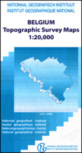
Ans - Liège 20K NGI Belgium Survey Map No. 42/1-2

Topographical survey of Belgium at 1:20, 000 from Nationaal Geografisch Instituut / Institut Géographique National, the country’s national survey organization. Each 20K map covers one quarter of the corresponding 1:50, 000 map (with adjustments in the border and coastal areas). The maps provide all the information expected of topographic mapping at this scale and additionally have an unusually large amount of vegetation and/or land use information (different types of woodlands, gardens, orchards, heath, etc). The maps have a 1-km UTM grid, with margin ticks for latitude and longitude at intervals of 1`. Map legend and a glossary of terms used on the maps include English.Stanfords keeps as regular stock 20K maps for the World War I battlefields around the Ypres, Messines and
Passchendaele, and for the area of the Battle of Waterloo. The 1:20, 000 survey covers the whole of Belgium and maps for other regions can be supplied as special orders. To see the list of titles in this series please click on the series link.PLEASE NOTE: the Long-Distance Footpaths Map of Belgium at 1:300, 000 which shows the division of Belgium into the 50K survey sheets can also be used to see in more detail coverage by the 20K maps.
RIP - This product is no longer available on our network. It was last seen on 25.09.2019

This page now acts as a permanent archive for this product. Add more information using the comments box below to ensure it can still be found by future generations.

Use our search facility to see if it is available from an alternative contributor.
  • Availability: Out Of Stock
  • Supplier: Stanfords
  • SKU: 9781129302008
Availability: In Stock
£9.50

Product Description

Topographical survey of Belgium at 1:20, 000 from Nationaal Geografisch Instituut / Institut Géographique National, the country’s national survey organization. Each 20K map covers one quarter of the corresponding 1:50, 000 map (with adjustments in the border & coastal areas). The maps provide all the information expected of topographic mapping at this scale & in addition have an unusually large amount of vegetation and/or land use information (different types of woodlands, gardens, orchards, heath, etc). The maps have a 1-km UTM grid, with margin ticks for latitude & longitude at intervals of 1`. Map legend & a glossary of terms used on the maps include English. Stanfords keeps as regular stock 20K maps for the World War I battlefields around the Ypres, Messines & Passchendaele, & for the area of the Battle of Waterloo. The 1:20, 000 survey covers the whole of Belgium & maps for other regions can be supplied as special orders. To see the list of titles in this series please click on the series link.PLEASE NOTE: the Long-Distance Footpaths Map of Belgium at 1:300, 000 which shows the division of Belgium into the 50K survey sheets can also be used to see in more detail coverage by the 20K maps.

Reviews/Comments

Add New

Intelligent Comparison

Oooops!
We couldn't find anything!
Perhaps this product's unique.... Or perhaps we are still looking for comparisons!
Click to bump this page and we'll hurry up.

Price History

Vouchers

No voucher codes found.
Do you know a voucher code for this product or supplier? Add it to Insights for others to use.

Facebook

Jargon Buster

World - A physical grouping, commonly used to describe earth and everything associated with ti
Km - Kilometre. A unit of measurement equal to 1000 metres.
Large - something that takes up more space than normal.

Supplier Information

Stanfords
Stanfords was established in 1853 and opened their iconic Covent Garden flagship store in 1901. They have become the top retailer of maps, travel books and accessories in the UK and arguably offer the largest selection of maps and travel books worldwide. Famous names such as Captain Robert Falcon Scott, Ranulph Fiennes and Michael Palin have purchased from Stanfords. They now have a shop in Bristol and both stores together with other venues operate a calendar of events including talks, book signings and exhibitions. As a specialist map retailer, the map selection is comprehensive and includes road maps, street maps and walking maps from worldwide destinations, as well as a selection of world atlases and wall maps. Books include travel guides and travel literature. Stanfords also stock globes, from miniatures made of blue marble to magnificent floor-standing globes. The website features a selection of interesting articles on travel topics.
Page Updated: 2023-11-12 20:15:36

Community Generated Product Tags

Oh No! The productWIKI community hasn't generated any tags for this product yet!
Menu