
 United Kingdom
 France
 Germany
 Netherlands
 Sweden
 USA
USA
 Italy
Italy
 Spain
Spain
More From Contributor


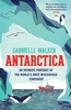
Antarctica
Topographic map of Antarctica taken from Landsat Satellite images that have been digitally merged.The cartography includes bathymetry, elevation, ice/rock limits, ice shelves and scientific research stations. The map contains information on Antarctica in the form of an Antarctica Facts table and two diagrams displaying the seasonal extents of the Antarctic ice, and also displays the Antarctic Polar Front.When completely unfolded it measures 73x90cm. The map is at a scale of 1:10, 000, 000.Projection: Polar StereographicHorizontal Datum: WGS84Limits 90
Product Description
Reviews/Comments
Add New
Intelligent Comparison
Archived Product
Antarctica Stanfords
£4.99
Archived Product

Antarctica Stanfords
£14.99
Archived Product
Antarctica Stanfords
£14.39
Archived Product

Antarctica Stanfords
£24.95
Archived Product

Antarctica Stanfords
£45.00
Archived Product

Antarctica Stanfords
£95.00
Archived Product
Arctica Stanfords
£40.00
Archived Product

Arctic Stanfords
£20.00
Vouchers
No voucher codes found.
Do you know a voucher code for this product or supplier? Add it to Insights for others to use.
Do you know a voucher code for this product or supplier? Add it to Insights for others to use.
 Denmark