
 United Kingdom
 France
 Germany
 Netherlands
 Sweden
 USA
USA
 Italy
Italy
 Spain
Spain
More From Contributor


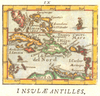
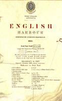
Antigua: English Harbour 1863
Detailed map and chart of the harbour and port area from 1863, surveyed by J. Parsons RN and originally published by the Admiralty. The channel and harbour are marked with soundings and bathymetric countours as on a modern navigational chart. Relief on the the land overlooking the harbour is shown by shading with spot heights for the forts and gun emplacements. Roads are marked and various dockside buildings and features are identified eg. ordnance stores, officers quarters. Reproduced on heavyweight, parchment effect paper, with a generous border area.Paper size: 49.2 x 66 cm (19 3/8 x 26 inches)Map size: 45 x 62 cm (17 3/4 x 24 1/2 inches)

Product Description
Reviews/Comments
Add New
Vouchers
No voucher codes found.
Do you know a voucher code for this product or supplier? Add it to Insights for others to use.
Do you know a voucher code for this product or supplier? Add it to Insights for others to use.
 Denmark