More From Contributor

£124.95
One of the most decorative old maps, the beautifully drawn world map by Hendrik Hondius the Elder published in 1630 during the golden age of Dutch cartography, reproduced as wallpaper in eight separate sections which combined offer a spectacular large mural of 251 x 416 cm (8’3” x 13’8” approx). Easy to trim to fit smaller surfaces, easy to mount with the provided instructions & wallpaper paste, & easy to remove without damaging the wall, this wallpaper set offers a unique & exciting way to decorate any room whether at home, in offices, or in any private or public places. Hondius’s map is the quintessential map of its period; the four elements, the sun, the moon & the stars surround the map, while the mapmaker’s own portrait is accompanied by those of Ptolemy, Mercator & Caesar. The original image has been enlarged from its original size into this huge wallpaper set using the best available techniques & printed on recyclable materials. ...
Archived Product
£2.95
Antiqued Parchment Replica Maps (British Counties, European Cities & World Countries) by the Old Map Company are reproductions of the maps created in the early seventeenth century, primarily between 1610 & 1623 for the famous atlas of the period by the master map maker John Speede Esq. The Old Map Company has recreated the antique maps of British counties, European cities & World countries originally crafted by master map maker John Speede Esq. whose work had accuracy & quality not surpassed for centuries. Each map is treated & presented on specially crafted paper then h&-treated giving it texture & an aged appearance before being beautifully engraved & detailed. ...
Archived Product
£15.95
Every significant antique fair or market in England is detailed in this unique guidebook. Packed with details of great value ...
Archived Product
£65.00
This architectural history, starting with Egypt & Mesopotamia traces the development of building styles & techniques down to the Christianisation of the Roman Empire & the rise of Byzantium. It is magnificently illustrated throughout, although this is no coffee table book
- the focus is very much on the text which is clear, concise & neatly argued. Tadgell throughout relates architectural developments to their historical & cultural contexts.
...
Archived Product
£10.99
Since his mysterious disappearance in an unarmed reconnaissance plane in July 1944, Antoine de Saint-Exupery has been the focus for romantic fascination. This biography brings back to life a 20th-century hero
- a man of passion who combined the dangerous career of pioneering aviator with that of bestselling author of classic works such a The Little Prince.
...
Archived Product
£4.99
This delightful colouring book introduces children to one of the world`s most recognized & admired architects, Antoni Gaudi. His masterpiece, the still-uncompleted Sagrada Familia Basilica of Barcelona, is one of the most visited monuments in Spain. The Catalonian architect is especially appealing to children, who will marvel at the organic forms inspired by nature he employed in his buildings & designs. This engaging activity book will inspire learning & creativity in children, & will encourage young readers to build their own Gaudi-like creations. ...
Archived Product
£7.00
Antoni Gaudi is one of history`s most recognized & beloved architects & designers. His masterpiece, the still-uncompleted Sagrada Familia, is one of the most visited monuments in Spain. But this Catalonian architect is especially inspiring to children, who marvel at the non-traditional forms he employed in his buildings & designs. Using pages of colourful stickers to inspire learning & creativity, this entertaining book will encourage young readers to build their own Gaudi-like creations, while teaching them much about the architect`s life & accomplishments. ...
Archived Product
£14.99
Antonio Carluccio's Italia is a gastronomic tour embracing every region of the country. Each chapter weaves together fascinating information on the region's traditions, its typical products & its characteristic regions. Antonio's knowledge of Italy stems from his childhood when his family moved around the country following his father's job as a railway stationmaster. As a young man working as a wine merchant, Antonio toured the country deepening his knowledge of its different regions. This book, photographed in Italy by Alastair Hendy, distils Antonio's passion for his mother country & brings real insight to the different factors that influence its food & cooking. The breathtaking visual content celebrates the gastronomic life of Italy with stunning photographs of countryside & architecture, of people & food products, & of mouth-watering recipes. ...
Archived Product
£9.99
Antonio Carluccio`s Simple Cooking is a coming together of all the `secrets` that Antonio has learned over his many years of cooking. Packed with easy, reliable & delicious dishes, it is the perfect cookbook for the novice & enthusiast alike. All the mouthwatering recipes featured are very easy to cook, perfect for those with little experience or who are short of time. Throughout, Antonio has also included clever suggestions for how to `upgrade` the basic recipe by adding a `luxury` ingredient or an extra component
- an anchovy or two, perhaps, some chilli & capers, or an accompanying sauce. There are also ingenious recipes for using up leftovers, with Antonio always remaining budget-conscious. &, of course, all the dishes are completely delicious, for they are Antonio`s favourites, employing the basic tenets of the finest Italian cooking: finest top quality ingredients prepared simply & served without fuss. The recipes are illustrated with fabulous photography by Alistair Hendy, including several step-by-step sequences. Antonio Carluccio`s Simple Cooking is a distillation of a lifetime of passion, full of Antonio`s firm belief that cooking, whether for oneself or for family & friends, is one of the most loving of human skills.
...
Archived Product
£3.50
Antrim & Ballyclare in 1900 in the Alan Godfrey Edition of historical Ordnance Survey mapping at one inch to one mile. The map covers a broad area of Co. Antrim stretching from Randalstown & Lough Neagh eastward to Whitehouse, & from Legoniel northward to Ballynure. Features include the long lost railway lines to Randalstown, Ballyclare & Doagh, the north Belfast suburbs of Legoniel & Whitehouse with Belfast Castle & Cave Hill, the Aldergrove area, part of Lough Neagh, Shanes Castle, Upton Castle, Muckamore Abbey, etc. Other locations covered by this map include Aldergrove, Ballyeaston, Ballynure, Carnomney, Doagh, Jordanstown, Killead, Legoniel, Mossley, Oldpark, Randalstown, Templepatrick, Whitehouse Lower & Whitehouse Upper. On the reverse is a detailed map of the village of Doagh, including the station, Fisherwick, Doagh Mill, Ballyhamage House & Hunterstown Bridge. About Alan Godfrey Editions of OS 1” to 1 mile maps of Ireland: The maps provide an invaluable overview of a wider area, typically 18 x 12 miles (29 x 19kms approx.), & offer historical mapping for small villages not covered by the more detailed series for which the Godfrey Editions are better known. All the maps include historical notes & all, unless indicated in the individual description, also include a large scale map of a small town or village in the area. ...
Archived Product

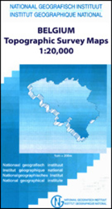
Antoing - Leuze-en-Hainaut 20K NGI Belgium Survey Map No. 37/7-8

Topographical survey of Belgium at 1:20, 000 from Nationaal Geografisch Instituut / Institut Géographique National, the country’s national survey organization. Each 20K map covers one quarter of the corresponding 1:50, 000 map (with adjustments in the border and coastal areas). The maps provide all the information expected of topographic mapping at this scale and additionally have an unusually large amount of vegetation and/or land use information (different types of woodlands, gardens, orchards, heath, etc). The maps have a 1-km UTM grid, with margin ticks for latitude and longitude at intervals of 1`. Map legend and a glossary of terms used on the maps include English.Stanfords keeps as regular stock 20K maps for the World War I battlefields around the Ypres, Messines and
Passchendaele, and for the area of the Battle of Waterloo. The 1:20, 000 survey covers the whole of Belgium and maps for other regions can be supplied as special orders. To see the list of titles in this series please click on the series link.PLEASE NOTE: the Long-Distance Footpaths Map of Belgium at 1:300, 000 which shows the division of Belgium into the 50K survey sheets can also be used to see in more detail coverage by the 20K maps.
RIP - This product is no longer available on our network. It was last seen on 25.09.2019

This page now acts as a permanent archive for this product. Add more information using the comments box below to ensure it can still be found by future generations.

Use our search facility to see if it is available from an alternative contributor.
  • External links may include paid for promotion
  • Availability: Out Of Stock
  • Supplier: Stanfords
  • SKU: 9781129301834
Availability: In Stock
£9.50

Product Description

Topographical survey of Belgium at 1:20, 000 from Nationaal Geografisch Instituut / Institut Géographique National, the country’s national survey organization. Each 20K map covers one quarter of the corresponding 1:50, 000 map (with adjustments in the border & coastal areas). The maps provide all the information expected of topographic mapping at this scale & in addition have an unusually large amount of vegetation and/or land use information (different types of woodlands, gardens, orchards, heath, etc). The maps have a 1-km UTM grid, with margin ticks for latitude & longitude at intervals of 1`. Map legend & a glossary of terms used on the maps include English. Stanfords keeps as regular stock 20K maps for the World War I battlefields around the Ypres, Messines & Passchendaele, & for the area of the Battle of Waterloo. The 1:20, 000 survey covers the whole of Belgium & maps for other regions can be supplied as special orders. To see the list of titles in this series please click on the series link.PLEASE NOTE: the Long-Distance Footpaths Map of Belgium at 1:300, 000 which shows the division of Belgium into the 50K survey sheets can also be used to see in more detail coverage by the 20K maps.

Reviews/Comments

Add New

Intelligent Comparison

Oooops!
We couldn't find anything!
Perhaps this product's unique.... Or perhaps we are still looking for comparisons!
Click to bump this page and we'll hurry up.

Price History

Vouchers

No voucher codes found.
Do you know a voucher code for this product or supplier? Add it to Insights for others to use.

Facebook

Jargon Buster

World - A physical grouping, commonly used to describe earth and everything associated with ti
Km - Kilometre. A unit of measurement equal to 1000 metres.
Large - something that takes up more space than normal.

Supplier Information

Stanfords
Stanfords was established in 1853 and opened their iconic Covent Garden flagship store in 1901. They have become the top retailer of maps, travel books and accessories in the UK and arguably offer the largest selection of maps and travel books worldwide. Famous names such as Captain Robert Falcon Scott, Ranulph Fiennes and Michael Palin have purchased from Stanfords. They now have a shop in Bristol and both stores together with other venues operate a calendar of events including talks, book signings and exhibitions. As a specialist map retailer, the map selection is comprehensive and includes road maps, street maps and walking maps from worldwide destinations, as well as a selection of world atlases and wall maps. Books include travel guides and travel literature. Stanfords also stock globes, from miniatures made of blue marble to magnificent floor-standing globes. The website features a selection of interesting articles on travel topics.
Page Updated: 2023-11-12 20:15:36

Community Generated Product Tags

Oh No! The productWIKI community hasn't generated any tags for this product yet!
Menu