-
Home
-
Contributors
-
International
-
Account
-
Information
More From Contributor
Includes:: lists of various institutions & services, with a separate section for the docks area providing a list of docks, locks, tunnels, bridges, etc, plus addresses of customs offices, police, fire brigade, etc. Map legend
Includes:: English. Explanatory text for the index is in French & Dutch only. ...
Features:- 100 pieces magnetic puzzle- dimensions: a puzzle surface of 26cm x 35 cm-
Dimensions of the box: height 9 cm; diameter 7 cm- up-to-date cartography supplied by by Falk Verlag- Made in Germany To see the list of other titles in this series please click on the series link. ...
- a second-h&-book dealer
- comes across a pile of photographs from police archives, he decides to exhibit them. ...
- lived from the beginning to the end of the twentieth century
- ...

Antwerp Province
local paths. The maps also indicate administrative subdivisions of the provinces into districts and communes.The maps have latitude and longitude lines at intervals of 5’. Titles covering larger provinces are double-sided. The index booklet supplied with each map covers the whole country and, where appropriate, list alternative versions of place names. Map legend and explanatory text in the booklet include English.
This page now acts as a permanent archive for this product. Add more information using the comments box below to ensure it can still be found by future generations.
Use our search facility to see if it is available from an alternative contributor.
- External links may include paid for promotion
- Availability: Out Of Stock
- Supplier: Stanfords
- SKU: 9789059345928
Product Description
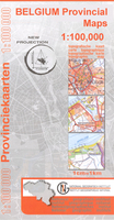
Antwerp Province at 1:100, 000 in a series of GPS compatible topographic maps from the Nationaal Geografisch Instituut/ Institut Géographique National, Belgium`s national survey organization, each with a separate index booklet covering the whole country. Described by the publishers as a topographic series, the maps do carry all the information expected of topographic mapping at this scale, but are not contoured & show altitude only by spot heights. Colours & graphics present the terrain & land cover: rocks, dunes, moors & heathl&, orchards, woodlands, swamps & marshl&, etc. Road network is finely graded according to width & the number of lanes. Footpaths are marked, but the maps do not distinguish between waymarked hiking paths or long-distance GR routes & other local paths. The maps also indicate administrative subdivisions of the provinces into districts & communes. The maps have latitude & longitude lines at intervals of 5’. Titles covering larger provinces are double-sided. The index booklet supplied with each map covers the whole country &, where appropriate, list alternative versions of place names. Map legend & explanatory text in the booklet include English.
Reviews/Comments
Add New
Intelligent Comparison
We couldn't find anything!
Perhaps this product's unique.... Or perhaps we are still looking for comparisons!
Click to bump this page and we'll hurry up.
Price History
Vouchers
Do you know a voucher code for this product or supplier? Add it to Insights for others to use.


 United Kingdom
 France
 Germany
 Netherlands
 Sweden
 USA
USA
 Italy
Italy
 Spain
Spain


 Denmark