
 United Kingdom
 France
 Germany
 Netherlands
 Sweden
 USA
USA
 Italy
Italy
 Spain
Spain
More From Contributor
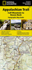


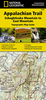

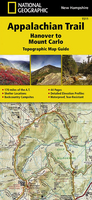
Appalachian Trail: Hanover To Mount Carlo Hiking Atlas, NH/ME
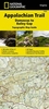
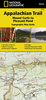
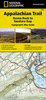
A 170 miles long section of the Appalachian Trail across New Hampshire, from Hanover to Mount Carlo in Maine, presented in a handy size, waterproof and tear-resistant atlas at 1:63, 360 from the National Geographic with contoured and GPS compatible topographic mapping overprinted with extensive tourist information, plus a list of camping options, etc.Each 11x24cm atlas in this series covers a section of the trail between 125 and 220 miles (200 and 350 km approx) long, presenting it on mapping with contours at 50 feet intervals with shading and spot heights, plus colouring to indicate national/state parks or forests and other types of protected areas. The course of the Appalachian Trail is prominently highlighted and annotated with sections markers in both directions plus hiking
distances which are also shown on other trails in the surrounding mountains. An extensive range of symbols indicate various facilities and places of interest, including different types of accommodation, restaurants and groceries, drinking water and hiking supplies, visitor centres, viewpoints, wildlife viewing areas, etc. Road network indicates improved or 4WD roads, etc. as well as scenic byways, roadside pullouts and car parks, etc. Each page has a 1 mile UTM grid with latitude and longitude margin ticks at 1’ intervals, plus provides a route profile. Additional information in each atlas includes general advice for hikers, a list of camping options along its section, street plans of main locations near the trail indicating local facilities, useful addresses, etc.To see
the list of titles in this series please click on the series list.

Product Description
Reviews/Comments
Add New
Vouchers
No voucher codes found.
Do you know a voucher code for this product or supplier? Add it to Insights for others to use.
Do you know a voucher code for this product or supplier? Add it to Insights for others to use.
 Denmark