
 United Kingdom
 France
 Germany
 Netherlands
 Sweden
 USA
USA
 Italy
Italy
 Spain
Spain
More From Contributor


Ardrossan South 1895
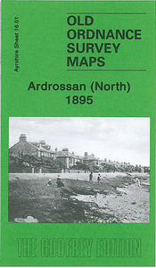
Ardrossan South in 1895 in a fascinating series of reproductions of old Ordnance Survey plans in the Alan Godfrey Editions, ideal for anyone interested in the history of their neighbourhood or family. The map covers the southern part of Ardrossan with much of the town centre. Features include the southern part of Glasgow Street, Eglinton Dock, Old Dock, Tidal Basins, Montgomerie Pier station, Winton Pier station, SWouth Beach station, GSWR railway and main station, Castle Hill, South Beach, St Andrew`s church, Gaelic church, Crinan Rock, etc. A selection of trade directory entries is on the reverse.About the Alan Godfrey Editions of the 25” OS Series:Selected towns in Great Britain and Ireland are covered by maps showing the extent of urban development in the last decades
of the 19th and early 20th century. The plans have been taken from the Ordnance Survey mapping and reprinted at about 15 inches to one mile (1:4, 340). On the reverse most maps have historical notes and many also include extracts from contemporary directories. Most maps cover about one mile (1.6kms) north/south, one and a half miles (2.4kms) across; adjoining sheets can be combined to provide wider coverage.FOR MORE INFORMATION AND A COMPLETE LIST OF ALL AVAILABLE TITLES PLEASE CLICK ON THE SERIES LINK.
of the 19th and early 20th century. The plans have been taken from the Ordnance Survey mapping and reprinted at about 15 inches to one mile (1:4, 340). On the reverse most maps have historical notes and many also include extracts from contemporary directories. Most maps cover about one mile (1.6kms) north/south, one and a half miles (2.4kms) across; adjoining sheets can be combined to provide wider coverage.FOR MORE INFORMATION AND A COMPLETE LIST OF ALL AVAILABLE TITLES PLEASE CLICK ON THE SERIES LINK.
Product Description
Reviews/Comments
Add New
Intelligent Comparison
Archived Product
Ardrossan North 1895 Stanfords
£3.50
Archived Product
Abersychan South 1899 Stanfords
£2.95
Archived Product
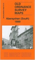
Abersychan South 1899 Stanfords
£3.50
Archived Product
Arbroath South 1901 Stanfords
£2.95
Vouchers
No voucher codes found.
Do you know a voucher code for this product or supplier? Add it to Insights for others to use.
Do you know a voucher code for this product or supplier? Add it to Insights for others to use.
 Denmark