More From Contributor

£11.99
Augsburg
- Dachau
- Fürstenfeldbruck area of Bavaria between Munich & Augsburg on a detailed, GPS compatible map at 1:50,

...
Archived Product
£10.99
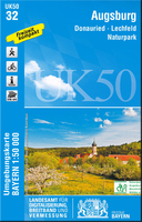
Augsburg & its Western Environs in northern Bavaria on a detailed, GPS compatible map at 1:50, 000 from Kompass with local & long-distance footpaths, cycling routes, accommodation, etc, printed on durable, waterproof & tear-resistant synthetic paper.KOMPASS HIKING & RECREATIONAL MAPS: this title is part of an extensive series covering Austria, much of Germany & the Slovenian Alps – TO SEE OTHER TITLES IN THIS SERIES PLEASE CLICK ON THE SERIES LINK. Kompass are Europe’s largest publishers of hiking maps; their mapping of other countries, including expanding coverage of Italy, is listed on our website separately.CARTOGRAPHY: the maps are contoured with additional shading, graphic relief & colouring to provide a more detailed picture of the terrain, vegetation and/or land use. Contour interval varies from 10m in the coastal areas of Northern Germany to 40 or 50 metres in the mountainous regions. All the maps highlight local & long-distance waymarked footpaths, including climbing trails. Most titles also show cycling routes, mountain bike trails, &, the in mountainous areas, ski routes. The maps indicate various types of accommodation (selected inns & hotels, youth hostels, campsites, mountain refuges), as well as recreational facilities, places of interest, etc. Latest editions also show access by public transport with bus stops and/or Park+ Ride facilities.GEOGRAPHICAL COORDINATES: unless indicated to the contrary in the individual description, the maps have a UTM grid for GPS users. MAP LEGEND: most maps now include full English legend, particularly titles covering the Alpine areas. Some maps covering mainly eastern Austria or the less popular parts of Germany may still have a legend in German only.OTHER

Features:
selected titles include on the reverse panorama drawings of their area with names of villages, peaks, valleys, etc. and/or have a booklet with pictures of local wild flowers with their Latin names. Many titles are now published as competitively priced sets of two or more maps, offering a wider coverage.BOOKLETS: PLEASE NOTE BEFORE ORDERING
- many titles come with a booklet describing the area and/or various hiking routes. Unless indicated in the individual description that the booklet

Includes::
English, these booklets are IN GERMAN only. The booklets are not necessary to use the maps since, as stated above, full English language map legend is provided.


...
Archived Product
£10.99
Augsburg & Environs on a waterproof, tear-resistant, GPS compatible cycling map at 1:75, 000 from the ADFC (Allgemeiner Deutscher Fahrrad-Club
- the official German cycling federation), in a series of maps with extensive overprint for long-distance & local cycling routes. GPS waypoints, route profiles, details of online links for information about accommodation etc. are also provided. Maps included in this series are contoured & the interval varies according to the type of the terrain. Steep sections are annotated with gradient markings. Colouring and/or graphics show various types of landscape: woods, vineyards, etc. An overprint highlights both the national long-distance cycling routes & the shorter local cycling trails, each clearly identified by a symbol and/or an abbreviation of its name. Sections with heavy traffic and/or poor road surface are clearly marked. Symbols indicate various facilities, such as railway stations with cycle hire, cycle repair shops, campsites, youth hostels, shelters, country restaurants/bars, sport & leisure facilities. Maps have a UTM grid for measuring distances & for determining location using GPS device & they are printed on weather resistant & tear-resistant paper. Each map covers an area of Approx. 87 x 130 km & the map legend is in German only. To see all the titles in this series please click on the series link.
...
Archived Product
£7.95
Map No. 162, Augsburg & its Western Environs, in a series of hiking maps from Kompass providing extensive coverage of Austria & Germany plus the Slovenian Alps, with hiking routes on a topographic base, various types of accommodation, recreational facilities, places of interest, etc. Many titles are now published as competitively priced sets of two or more maps, offering a wider coverage. Kompass are Europe ...
Archived Product
£6.50
About Falk City Pocket Plans: Street maps covering a slightly smaller area than that represented on the Falk Extra edition, thus folding down to a more handy size (10 x 17cm). Some of them are drawn with a varying scale which, for clarity, presents the city centre at a slightly larger scale than the outer districts. Main landmarks & public buildings are indicated, also one-way streets, car parks & all the public transport facilities eg. tram & bus routes, U-bahns. These plans of larger cities include a separate map of the town centre at a more detailed scale & a diagram of the U-Bahn & the suburban rail network. The plans also show the postal divisions & have an extensive street index on the reverse side which, where appropriate, shows individual postal codes for each street. Also included is a smaller scale map of the city & its immediate environs, showing main roads & railways. Map legend

Includes::
English.

...
Archived Product
£9.99
Street plan of the Augsburg conurbation in Falk’s Special Fold format, designed to show only a small section of the map at one time. The whole map can be opened but it will be cut in several places. Many find these street plans very user-friendly & easier to handle than conventional maps, others simply hate them!* About Falk street plans:* The plans indicate main landmarks & public buildings & show all the public transport facilities, one way streets & car parks. Plans of larger cities include a separate diagram of the public transport network & an enlargement of the town centre at a more detailed scale. The plans also show postal divisions & have an extensive street index which, where appropriate, shows individual postal codes for each street. * Map legend

Includes::
English.* Falk street plans are published in three different map formats, plus in a series of regional street atlases.* Falk Extra* plans are folded in a standard way, where the whole map can be opened to view the entire area it covers. In most plans on the reverse is a road map of the surrounding area. Latest editions have a UTM grid.* Falk Special Fold* plans, published only for larger cities, have a folding system designed to show only a small section of the map at one time. The whole map can be opened but it will be cut in several places. Many find these street plans very user-friendly & easier to handle than conventional maps, others simply hate them!* Falk City Plans*, published only for main cities, use the same mapping but cover a smaller area then the Extra plans & have a larger map of the city centre.

...
Archived Product
£10.99
” One word of truth shall outweigh the whole world”. (Aleksandr Solzhenitsyn). In the first month of the First World War the Russian campaign against the Germans creaks into gear. Crippled by weak, indecisive leadership the Russian troops battle desperately, even as the inevitability of failure & their own sacrifice dawns. Solzhenitsyn`s astounding work of historical fiction is a portrait of pre-revolutionary Russia, a tragic war story, & an epic novel in the great Russian tradition. ...
Archived Product
£7.99
A gripping literary novel from a striking new voice in American fiction. New York City. By day, JT Savage is a labourer on the Upper East Side; by night an insomniac in an East Village tenement. His had been a superficially normal childhood in Yonkers, New York; a time of beers by the river, of working in his friend`s father`s garage, of studying to go to college. Then, one night, everything changed. ` August & then some` is a taut & gripping family drama, in which horrifying secrets kept between father & daughter, & mother & son, explode during one tragic night. Set over the course of two summers, it is a novel of revenge & the difficulty of repentance & forgiveness. Jaggedly beautiful & intensely realised, tightly plotted yet expansive, this debut novel is the coming-of-age of a striking new voice in American fiction. ...
Archived Product
£7.99
The lazy, slow month of August at the height of the Sicilian summer is, Montalbano assures his girlfriend Livia as they prepare for a relaxing holiday in a villa he has found for them, far too hot for any murders to be committed. But when Livia`s friends` young son goes missing, a chain of events is sparked which will certainly ruin the Chief Inspector`s pleasant interlude. A secret apartment & a grisly find in an old trunk are just the beginning, as Montalbano navigates his way though the case, as well as coping with the sweltering heat, the suspicious death of an Arab labourer & the tempting lure of a beautiful girl. ...
Archived Product
£7.99
August Heat by Andrea Camilleri, is the tenth instalment in the Inspector Montalbano series, adapted as a major BBC4 television series. This edition featuring a stunning redesigned cover. Montalbano quickly slammed the trunk shut & sat down on top of it. When the beam from Livia`s torch shone on his face, he automatically smiled. ` What`s in the trunk?` Livia asked. ` Nothing. It`s empty.` How could he possibly have told her there was a corpse inside? The lazy, slow month of August at the height of the Sicilian summer is, Inspector Montalbano assures his girlfriend Livia as they prepare for a relaxing holiday in a villa he has found for them, far too hot for any murders to be committed. But when Livia`s friends` young son goes missing, a chain of events is sparked which will certainly ruin the Chief Inspector`s pleasant interlude. A secret apartment & a grisly find in an old trunk are just the beginning, as Montalbano navigates his way though the case, as well as coping with the sweltering heat, the suspicious death of an Arab labourer & the tempting lure of a beautiful girl... August Heat is followed by the eleventh book in the series, The Wings of the Sphinx. ...
Archived Product

Augsburg EXTRA

Falk, one of Germany`s leading publishers of street plans, produce their town plans in two different formats. Falk Extra plans are folded in a standard way, where the whole map can be opened to view the entire area it covers. For larger cities, the same mapping is also published with a special folding system designed to show only a small section of the map at one time. The whole map can be opened but it will be cut in several places. Many find these street plans very user-friendly and easier to handle than conventional maps. The plans, which cover towns with their outer suburbs, indicate main landmarks and public buildings and show all the public transport facilities, one way streets and car parks. Plans of lager cities include a separate map of the town centre at a more detailed
scale and a diagram of the underground and the suburban rail network. The plans also show the postal divisions and have an extensive street index which, where appropriate, shows individual postal codes for each street. Map legend includes English. Falk Extra plans also include on the reverse a road map of the surrounding area.
RIP - This product is no longer available on our network. It was last seen on 25.09.2019

This page now acts as a permanent archive for this product. Add more information using the comments box below to ensure it can still be found by future generations.

Use our search facility to see if it is available from an alternative contributor.
  • Availability: Out Of Stock
  • Supplier: Stanfords
  • SKU: 9783827921857
Availability: In Stock
£7.99

Product Description

Falk, one of Germany`s leading publishers of street plans, produce their town plans in two different formats. Falk Extra plans are folded in a standard way, where the whole map can be opened to view the entire area it covers. For larger cities, the same mapping is also published with a special folding system designed to show only a small section of the map at one time. The whole map can be opened but it will be cut in several places. Many find these street plans very user-friendly & easier to handle than conventional maps. The plans, which cover towns with their outer suburbs, indicate main landmarks & public buildings & show all the public transport facilities, one way streets & car parks. Plans of lager cities include a separate map of the town centre at a more detailed scale & a diagram of the underground & the suburban rail network. The plans also show the postal divisions & have an extensive street index which, where appropriate, shows individual postal codes for each street. Map legend

Includes::
English. Falk Extra plans also include on the reverse a road map of the surrounding area.

Reviews/Comments

Add New

Price History

Vouchers

No voucher codes found.
Do you know a voucher code for this product or supplier? Add it to Insights for others to use.

Facebook

Jargon Buster

Germany - A country in Central Europe.
Car - A machine used for transport which runs on roads
Network - A link and communication between things. Often computers or people.
Small - something that takes up less space than normal.
Road - a manmade lane or a path that is used to speed up travel.
Individual - A single separate item or person.
Transport - Something that carries people or goods.

Supplier Information

Stanfords
Stanfords was established in 1853 and opened their iconic Covent Garden flagship store in 1901. They have become the top retailer of maps, travel books and accessories in the UK and arguably offer the largest selection of maps and travel books worldwide. Famous names such as Captain Robert Falcon Scott, Ranulph Fiennes and Michael Palin have purchased from Stanfords. They now have a shop in Bristol and both stores together with other venues operate a calendar of events including talks, book signings and exhibitions. As a specialist map retailer, the map selection is comprehensive and includes road maps, street maps and walking maps from worldwide destinations, as well as a selection of world atlases and wall maps. Books include travel guides and travel literature. Stanfords also stock globes, from miniatures made of blue marble to magnificent floor-standing globes. The website features a selection of interesting articles on travel topics.
Page Updated: 2023-11-12 20:15:36

Community Generated Product Tags

Oh No! The productWIKI community hasn't generated any tags for this product yet!
Menu