More From Contributor

£12.95
Bands on the Road presents over 100 drawings, sketches & stories created by some of the world's top indie stars while on tour. The people behind this collection, teacher Silke Leicher & music journalist Manuel Schreiner, asked various famous musicians to name their favorite situation & location. The first part of the book shows the detailed, colorful or dark little works of art that each artist made in response to that question. The second half of the book contains stories from the likes of John Duffy of The Coral, who remembers trips to the zoo with his dad, or Coldplays Guy Berryman reminiscing about getting lost in the Pompidou Centre. This idiosyncratic collection shows a totally different side to some of the music scenes biggest heroes, & will be seized on by music aficionados as well as graphic designers, artists & comic book fans. ...
Archived Product
£6.99
Bandstands are a distinctive feature of the public parks & boardwalks all over Britain. But what do we actually know about them? Why did they appear in Britain`s earliest parks? When were they erected, & who made them?
This book explores & provides answers to these questions, showing how they evolved from the buildings of the early Victorian Pleasure Gardens, how they appeared in nearly every public park of the time, were influenced by the great landscape designers, & how a very small number of Scottish foundries cornered the market across the world, from Bradford to Brazil. From parks, seaside resorts & civic spaces, bandstands have appeared & disappeared but are once again re-appearing, being restored & are now enjoying a new lease of life.
No other book has been written on this subject & the timing could not be better with over 80 bandstands having been restored in the last 5 years as a result of the incredible re-investment in our public parks. The love affair is back on!

...
Archived Product
£20.00
Bandstands of Britain is a historical celebration of one of the best-loved features still found in many of our Victorian parks, open spaces, squares & seaside towns. They are a reminder of a forgotten age of outdoor music & theatre. They act as a lingering memory of the class & sophistication that prevailed in the Victorian age. This book celebrates the bandstand in Britain
- showcasing the elaborate & iconic pieces of Victorian architecture for what they are. Beautiful full-colour images are accompanied by a potted history of the evolution & devolution of the British bandst&.
...
Archived Product
£7.99
The town of Bandung on Java on a double-sided map from the Singapore based Periplus, combining a street plan of the city at 1:20, 000 with on the reverse a map of its environs 1:60, 000. Both highlight various places of interest, including tourist accommodation. The street plan clearly indicates main traffic arteries & highlights facilities such as banks, restaurants, shopping centres, markets, etc. Street index also lists neighbourhoods & important buildings including hotels. On the reverse is a road map of Bandung’s environs. Topography is very effectively shown by altitude colouring & relied shading. The map is not indexed. ...
Archived Product
£9.99
Banff National Park on one side & Jasper National Park on the other &

Includes::
hiking trails. The Banff National

...
Archived Product
£8.99
Banff & the Canadian Rockies in the Frommer's Day By Day series is a pocket-sized guide ideal for short trips, covering a variety of budgets. The best sights of each destination are listed in convenient full-day tours for one, two or three days such as: thematic tours for interests including art, architecture & history are described, allowing you to get the most out of your time; walking tours take you around each destination ...
Archived Product
£9.99
Banff & the Canadian Rockies in the Frommer's Day By Day series is a pocket-sized guide ideal for short trips, covering a variety of budgets. The best sights of each destination are listed in convenient full-day tours for one, two or three days such as: thematic tours for interests including art, architecture & history are described, allowing you to get the most out of your time; walking tours take you around each destination ...
Archived Product
£10.99
Banff
- Egypt Lake, a contoured & GPS compatible map at 1:50, 000 from Gem Trek of the main hiking area in the Banff National
...
Archived Product
£10.50
Banff
- Mount Assiniboine in a series of detailed hiking maps of the Canadian Rockies, covering the most popular areas of the
...
Archived Product
£14.95
Banff
- Mount Assiniboine area at 1:100, 000 on a light, waterproof & tear-resistant map from Gem Trek Publishing in their series
...
Archived Product

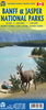
Banff & Mount Assiniboine Gem Trek

Banff - Mount Assiniboine area at 1:100, 000 on a light, waterproof and tear-resistant map from Gem Trek Publishing in their series of detailed hiking maps of the Canadian Rockies. On the reverse are descriptions of several day hikes and overnight trips, plus plenty of other tourist information.The map covers the most popular hiking and mountain biking terrain in the Banff National Park, from Lake Louise in the north to the southern boundary of the park, plus all of Mt. Assiniboine Provincial Park. Contours are at 50m intervals, with subtle relief shading and colouring for forested areas, rocky or alpine terrain and glaciers. The map has a 2km UTM grid and margin ticks at 5’ of latitude/longitude.On the reverse there are enlargements at 1:50 000 of the Mt. Assiniboine area (with
contours at 25m) and of the Sunshine Village and Sunshine Meadows. Also included is a street plan of Banff annotated with tourist facilities. Accompanying notes describe eight day hikes from Banff Townside, treks near Lake Minnewanka and Sunshire Meadows, four overnight trips, and a selection of mountain bike trails. Also provided are full details of backcountry accommodation, safety tips and other useful information.
RIP - This product is no longer available on our network. It was last seen on 25.09.2019

This page now acts as a permanent archive for this product. Add more information using the comments box below to ensure it can still be found by future generations.

Use our search facility to see if it is available from an alternative contributor.
  • Availability: Out Of Stock
  • Supplier: Stanfords
  • SKU: 9781895526844
Availability: In Stock
£14.99

Product Description

Banff
- Mount Assiniboine area at 1:100, 000 on a light, waterproof & tear-resistant map from Gem Trek Publishing in their series of detailed hiking maps of the Canadian Rockies. On the reverse are descriptions of several day hikes & overnight trips, plus plenty of other tourist information. The map covers the most popular hiking & mountain biking terrain in the Banff National Park, from Lake Louise in the north to the southern boundary of the park, plus all of Mt. Assiniboine Provincial Park. Contours are at 50m intervals, with subtle relief shading & colouring for forested areas, rocky or alpine terrain & glaciers. The map has a 2km UTM grid & margin ticks at 5’ of latitude/longitude. On the reverse there are enlargements at 1:50 000 of the Mt. Assiniboine area (with contours at 25m) & of the Sunshine Village & Sunshine Meadows. Also included is a street plan of Banff annotated with tourist facilities. Accompanying notes describe eight day hikes from Banff Townside, treks near Lake Minnewanka & Sunshire Meadows, four overnight trips, & a selection of mountain bike trails. Also provided are full details of backcountry accommodation, safety tips & other useful information.

Reviews/Comments

Add New

Intelligent Comparison

Oooops!
We couldn't find anything!
Perhaps this product's unique.... Or perhaps we are still looking for comparisons!
Click to bump this page and we'll hurry up.

Price History

Vouchers

No voucher codes found.
Do you know a voucher code for this product or supplier? Add it to Insights for others to use.

Facebook

Jargon Buster

Hiking - An outdoor activity envolving walking in nature
Waterproof - Resistant to water, usualy specified by depth in metres
Day - The time it takes a planet or other space objects to complete one rotation.
Safety - prevents damage being caused.
Resistant - Something that can repel against something.
Accommodation - A room in which someone can live in, for example in a hotel
Popular - Something that is admired and liked by many people.
Subtle - Something that is delicate and not to harsh, can be difficult to describe.

Supplier Information

Stanfords
Stanfords was established in 1853 and opened their iconic Covent Garden flagship store in 1901. They have become the top retailer of maps, travel books and accessories in the UK and arguably offer the largest selection of maps and travel books worldwide. Famous names such as Captain Robert Falcon Scott, Ranulph Fiennes and Michael Palin have purchased from Stanfords. They now have a shop in Bristol and both stores together with other venues operate a calendar of events including talks, book signings and exhibitions. As a specialist map retailer, the map selection is comprehensive and includes road maps, street maps and walking maps from worldwide destinations, as well as a selection of world atlases and wall maps. Books include travel guides and travel literature. Stanfords also stock globes, from miniatures made of blue marble to magnificent floor-standing globes. The website features a selection of interesting articles on travel topics.
Page Updated: 2023-11-12 20:15:36

Community Generated Product Tags

Oh No! The productWIKI community hasn't generated any tags for this product yet!
Menu