More From Contributor

£7.99
Joel, aka ` The Rink` (because his bald patch is shiny enough to skate on), the unpopular owner of the only bar in town has been murdered. There are so many suspects, it`s not so much a question of who did kill him as who didn`t. There`s Magalie, the temperamental teenager obsessed with Paris Hilton; her troublemaker boyfriend, Tani; Tani`s mother, Madame Levi; her unemployed, daytime-TV addicted husband; Yeznig, their younger son, who has learning difficulties but perfect memory recall; & newcomers Ali & Nadia, the Muslim twins struggling to fit in. As the tension mounts & we`re still none the wiser, the ending is as tragic as it is unexpected. ...
Archived Product
£12.99
Topographic survey of France at 1:25, 000 in IGN`s excellent TOP25 / Série Bleue series. All the maps are GPS compatible, with a 1km UTM grid plus latitude & longitude lines at 5’ intervals. Contours are at 5m intervals except for mountainous areas where the maps have contours at 10m intervals, vividly enhanced by hill shading & graphics for rocky terrain. Colouring with graphics indicates different types of vegetation or land use (deciduous or coniferous forests, moors, orchards, vineyards, etc). PLEASE NOTE: coverage of France at this scale is currently being revised – the format & the presentation of each title are indicated by the letters at the end of its Sheet Reference number (e.g. 0416ET, 3531ETR, 1923SB, etc.)MAPS WITH FULL TOURIST OVERPRINT & AN ENGLISH MAP LEGEND: all TOP25 maps & the SB editions of Série Bleue have an overprint highlighting waymarked walking trails including long-distance GR routes &, where appropriate, ski routes. Symbols indicate campsites, gîtes d’etape, refuges, equestrian centres & other recreational facilities or sites, tourist information centres, cultural heritage, etc. Towns & locations of particular interest are highlighted.- ET or OT = single-sided TOP25 map covering approx. 29x 21 km / 18x 13 miles.- ETR or OTR = waterproof & tear resistant TOP25 map covering the same area as the corresponding ET or OT number, but double-sided, printed on a smaller size sheet with a good overlap between the sides.- SB = Série Bleue map with full tourist overprint; these maps, first introduced in summer 2014, each cover approx. 29x 24km / 18x 15 miles.SÉRIE BLEUE maps with numbers ending in E (Est) or O (Ouest): most editions now indicate the GR routes, but do not show any other tourist information. Map legend is in French only. Each map covers approx. 14x 20km / 9x 12 miles. ...
Archived Product
£6.95
Topographic coverage of mainland Spain at 1:50, 000 in the MTN50 (Mapa Topográfico Nacional) series from the Centro Nacional de Información Geografica, the country’s civilian survey organization. The maps have contours at 20m intervals, enhanced by relief shading, plus colouring and/or graphics to show different types of terrain, vegetation or land use. Boundaries of national parks & other protected areas are marked. In addition to all the usual information featured on topographic mapping at this scale, detailed presentation of the road & rail networks, rural tracks & paths, etc, the maps also show campsites & mountain refuges. On more recent editions some GRs, the official long-distance hiking routes, are also marked (although not as clearly as on hiking maps from other publishers). Each map covers 29.5x 18.5 km (with adjustments in the border or coastal areas). The maps have a 1-km UTM grid, plus margin ticks for latitude & longitude at 1` intervals. Map legend is in Spanish only.HOW TO CHOOSE THE RIGHT 50K MAP: all the titles in CNIG’s 200K Provincial Road Maps series at 1:200, 000 are overprinted with the grid for the 1:50, 000 maps & can be used to see the area covered by each 50K title. TO SEE THE LIST OF TITLES IN THIS SERIES PLEASE CLICK ON THE SERIES LINK.PLEASE NOTE
- MAP TITLES: the grids shown on our website serve both the civilian & the military 1:50, 000 topographic series. Although the areas covered by maps in both series are identical (apart from some border or coastal sheets), occasionally map titles differ – only one title is shown on the grid, usually the military one. In Galicia, the Basque country & in the Catalan speaking areas the tendency now is to use local place names rather than the often better known Castilian ones. Where possible, both versions are included in our titles. Map titles listed on our website are based on information received by us at the time of publication, but sometimes maps arrive showing a completely different title! As long as the map number is as ordered, the correct map has been supplied.
...
Archived Product
£8.99
Barbados in the Landmark Visitor Guides series, exploring a range of places in Britain, Europe & the Caribbean, with a particular expertise in UK destinations. Each guide presents the reader with detailed, wide-ranging & accessible overview of the region or area, with a particular focus on history & culture, notable local attractions, the landscape, local events & family activities. A series of recommended walks & guided car tours exploring the region are also included in each title. The guides are arranged geographically by region & are ideal both for short & longer breaks, with practical guidance on recommended routes & tourist attractions, in addition to insightful inset boxes into local history, culture & traditions. Information on accommodation, restaurants & day-to-day information are more limited, though a compact Directory at the end of each guide provides basic listings of recommended accommodation & restaurants, as well as tourist information contacts & regional event calendars. International destinations also carry climate & country facts, basic phrases & other general travel practical guidance for travelling to the region. The British titles in the Landmark Visitor Guides series are highly recommended, covering titles that are rarely available from other publishers. ...
Archived Product
£8.99
Barbados offers the ideal Caribbean holiday. Whether you`re seeking some serious relaxation in the sun or rugged coastal walking, this island has something to offer everyone. This Footprint Handbook provides invaluable information on transport, accommodation, eating & entertainment to ensure that your trip

Includes::
the best of this sun-drenched isle.* Essentials section with useful advice on getting to & around the island of Barbados.* Comprehensive, up-to-date listings of where to eat, sleep & play.*

Includes::
information on tour operators & activities, from sipping rum on the plantations to golfing in the sunshine.* Detailed maps for Barbados & its key destinations.* Slim enough to fit in your pocket. With detailed information on all the main sights, plus many lesser-known attractions, the Footprint Barbados Handbook provides concise & comprehensive coverage of one the Caribbean`s most sought-after destinations.


...
Archived Product
£10.99
Fodor's correspondents highlight the best of Barbados & St. Lucia, including the Oistins fish fry, Harrison's Cave, & the scenic beauty of Marigot Bay. Our local experts vet every recommendation to ensure you make the most of your time, whether it's your first trip or your fifth. ...
Archived Product
£25.00
” Barbados: An Island Portrait” is an extraordinary exploration of the Caribbean island of Barbados by the combined talents of noted English photographer & long-time Barbadian resident Mike Toy & Barbadian writer Peter Laurie. Peter Laurie, playwright, author of children`s fiction & a former ambassador of Barbados, provides a fascinating insight into the cultural & historical forces that have made Barbados & its people unique. Together they provide a unique & beautiful guide to the island of Barbados. ...
Archived Product
£29.95
Barbados at 1:40, 000 indexed, clear road & tourist map from ITMB with a small enlargement of Bridgetown at 1:8, 000 showing the location of many places of interests. Road network

Includes::
motorway & highways with their respective codes, primary & secondary roads & tracks. Symbols clearly indicate petrol stations & the airport. Topography is represented by altitude colouring, contours at 25 metre intervals & spot heights; graphics indicate rivers, marshes, coral reef, etc. The map identifies many places of interest for the tourist such as nature reserves, caves, beaches, watersports & diving spots, marinas, ports, etc. Additional information

Includes::
the location of hotels & accommodation facilities, golf courses & embassies, restaurants & shopping areas. Furthermore, regional boundaries are marked & named. The small insert of central Bridgetown extends just short of the Kensington Oval in the north & the Bayshore complex in the south, the Bridgtown Inter-Island Ferry & Bridgetown Cruiseship terminals in the west & the Weymouth area in the east. It conveniently identifies parking, attractions & shopping areas as well as restaurants, markets & bus terminals. The map is indexed, & latitude & longitude lines are drawn at intervals of 5


...
Archived Product

Barðaströnd

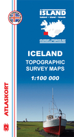
Barðaströnd, map no. 5, in the topographic survey of Iceland at 1:100, 000 published by Mál og menning, with excellent, vivid presentation of the terrain, footpaths and bridleways, campsites, etc. The maps have contours at 20m intervals, enhanced by bold relief shading plus colouring and/or graphics to show glaciers, lava fields, sands and mudflats, as well as to distinguish land with vegetation cover from the more sparsely covered terrain. The series provides a splendid presentation of the country’s topography, with large amount of detail and over 43, 000 place names.Road network indicates gravel roads and includes country tracks. Also marked are local footpaths, clear to see with their distinctive colouring, and bridleways. Symbols shows campsites, tourist huts or
shelters, emergency shelters, summer houses, river fords, golf courses and swimming pools, hydro-electric or thermal power stations, local airports, etc, and detail such as individual farms, abandoned farms or ruins, sheepfolds, etc. Each map covers an area of 84 x 67km (53 x 42 miles approx.) and has latitude and longitude lines drawn at intervals of 2’ and 5’ respectively. Map legend includes English, German and French.To see the other titles in this series please click on the series link.
RIP - This product is no longer available on our network. It was last seen on 25.09.2019

This page now acts as a permanent archive for this product. Add more information using the comments box below to ensure it can still be found by future generations.

Use our search facility to see if it is available from an alternative contributor.
  • Availability: Out Of Stock
  • Supplier: Stanfords
  • SKU: 9789979331216
Availability: In Stock
£14.99

Product Description

Barðaströnd, map no. 5, in the topographic survey of Iceland at 1:100, 000 published by Mál og menning, with excellent, vivid presentation of the terrain, footpaths & bridleways, campsites, etc. The maps have contours at 20m intervals, enhanced by bold relief shading plus colouring and/or graphics to show glaciers, lava fields, sands & mudflats, as well as to distinguish land with vegetation cover from the more sparsely covered terrain. The series provides a splendid presentation of the country’s topography, with large amount of detail & over 43, 000 place names. Road network indicates gravel roads &

Includes::
country tracks. Also marked are local footpaths, clear to see with their distinctive colouring, & bridleways. Symbols shows campsites, tourist huts or shelters, emergency shelters, summer houses, river fords, golf courses & swimming pools, hydro-electric or thermal power stations, local airports, etc, & detail such as individual farms, abandoned farms or ruins, sheepfolds, etc. Each map covers an area of 84 x 67km (53 x 42 miles approx.) & has latitude & longitude lines drawn at intervals of 2’ & 5’ respectively. Map legend

Includes::
English, German & French. To see the other titles in this series please click on the series link.

Reviews/Comments

Add New

Intelligent Comparison

Oooops!
We couldn't find anything!
Perhaps this product's unique.... Or perhaps we are still looking for comparisons!
Click to bump this page and we'll hurry up.

Price History

Vouchers

No voucher codes found.
Do you know a voucher code for this product or supplier? Add it to Insights for others to use.

Facebook

Jargon Buster

Electric - A general term for the flow of electric charge
Summer - The season between Spring and Autumn. Usually the hottest season of the year
Graphics - A general term for visual aspects of an item/display
Gravel - A size of rock between 2mm and 64mm
Network - A link and communication between things. Often computers or people.
Large - something that takes up more space than normal.
Road - a manmade lane or a path that is used to speed up travel.
Golf - A sport played on a large outside grass course, the aim to hit a small ball with a club into small holes.
Individual - A single separate item or person.

Supplier Information

Stanfords
Stanfords was established in 1853 and opened their iconic Covent Garden flagship store in 1901. They have become the top retailer of maps, travel books and accessories in the UK and arguably offer the largest selection of maps and travel books worldwide. Famous names such as Captain Robert Falcon Scott, Ranulph Fiennes and Michael Palin have purchased from Stanfords. They now have a shop in Bristol and both stores together with other venues operate a calendar of events including talks, book signings and exhibitions. As a specialist map retailer, the map selection is comprehensive and includes road maps, street maps and walking maps from worldwide destinations, as well as a selection of world atlases and wall maps. Books include travel guides and travel literature. Stanfords also stock globes, from miniatures made of blue marble to magnificent floor-standing globes. The website features a selection of interesting articles on travel topics.
Page Updated: 2023-11-12 20:15:36

Community Generated Product Tags

Oh No! The productWIKI community hasn't generated any tags for this product yet!
Menu