
 United Kingdom
 France
 Germany
 Netherlands
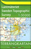
 Sweden
 USA
USA
 Italy
Italy
 Spain
Spain
More From Contributor


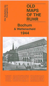
Bochum And Wattenscheid 1944 British War Office Survey Map
Bochum and Wattenscheid in 1944 in the Alan Godfrey series of reproductions of British War Office survey maps first published in 1945 prior to the Allied occupation of the area. The map is dominated by the major city of Bochum and by Wattenscheid, now part of Bochum but once a major mining town in its own right. Other locations covered by this title include Ückendorf, Wasserstrasse, Hamme, Weitmar, Kray, Kanarienberg, Sevinghausen. Industrial information includes the Bochumer Verein Höntrop Works and several mines: Präsident, Prinz Regent, Zentrum, Fröhliche Morgensonne, Holland Mine, Karolinenglück, etc.To see other titles in this series please click on the series link.This series of reproductions from Alan Godfrey covers the major industrial area east of the Rhine that
includes Bochum, Cologne, Dortmund, Duisburg, Düsseldorf, Essen, Gelsenkirchen, Oberhausen and other towns, with their great network of railways and industries. The maps are taken from the British War Office 1:12, 500 plans and reduced at approximately 1:19, 000. Published in 1945, prior to the Allied occupation of the area, the maps are especially good at showing industry, collieries and transport. They are not bombing maps - indeed, they make clear that allowance is not made for bomb damage - but show the areas with all their industrial sites and railways largely as they were before the bombing raids of 1943-44. The maps have additional information added by British intelligence. This is normally accurate but allowance must be made for the `fog of war` and occasional spelling
mistakes, etc. Each title has on the reverse a specially written introduction to the area in English, with a shorter text in German. Map legend is in English only.

Product Description
Reviews/Comments
Add New
Intelligent Comparison
Archived Product
Hohensyburg And Westhofen 1944 British War Office Survey Map Stanfords
£3.95
Archived Product
Dortmund North 1944 British War Office Survey Map Stanfords
£3.95
Archived Product
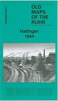
Hattingen 1944 British War Office Survey Map Stanfords
£3.95
Archived Product
Recklinghausen And Herten 1944 British War Office Survey Map Stanfords
£3.95
Archived Product
Hagen 1944 British War Office Survey Map Stanfords
£3.95
Archived Product
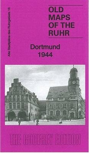
Dortmund 1944 British War Office Survey Map Stanfords
£3.95
Archived Product
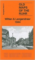
Witten And Langendreer 1944 British War Office Survey Map Stanfords
£4.50
Archived Product
Gladbeck And Buer 1944 British War Office Survey Map Stanfords
£3.95
Vouchers
No voucher codes found.
Do you know a voucher code for this product or supplier? Add it to Insights for others to use.
Do you know a voucher code for this product or supplier? Add it to Insights for others to use.
 Denmark