More From Contributor

£10.99
The Waterproof Body Wallet from Lifeventure is a thin pouch where you can keep your money, valuables & small documents safe & dry whilst travelling. made from waterproof fabric it will keep its content dry in bad weather. It is comfortable to wear thanks to its ultra-soft outer lining & adjustable elasticated belt. It features a main large pocket with rool-top entry & several internal small pockets. Ideal for your travels. ...
Archived Product
£13.99
The Waterproof Body Wallet -Waist is a discreet water resistant waist pouch for storing valuables such as a passport, documents & money. With a roll top closure & waterproof fabric that will keep your belongings safe in bad weather or by the pool, & a soft back lining which is comfortable against the skin. The Body Wallet is made from lightweight rip-stop fabric, with an adjustable, elasticated waist belt with slimline buckle. ...
Archived Product
£10.99
The Body Wallet from Lifeventure is a thin wallet you comfortably wear under your shirt, to keep your money, valuables & small documents safe whilst travelling. It is comfortable to wear thanks to its ultra-soft outer lining & adjustable elasticated belt. It features a main large pocket with zipped entry & several internal small pockets. Ideal for your travels. ...
Archived Product
£11.99
The Lifeventure RFi D body wallet chest is a low profile wallet for securing valuables underneath clothing. This RFi D wallet uses an RFi D blocking material. This unique fabric acts as a barrier against RFi D signals, dramatically reducing the risk of identity theft from cards or passports. ...
Archived Product
£13.99
The RFi D body wallet waist by Lifeventure ia a low profile wallet for securing valuables underneath clothing. This body wallet uses a RFi D blocking material. This unique fabric acts as a barrier against RFi D signals, dramatically reducing the risk of identity theft from cards or passports. ...
Archived Product
£29.99
Topographic survey of Denmark at 1:100, 000 from Kort & Matrikelstyrelsen, the country’s national survey organization. The maps have contours at 5 metre intervals, with colouring and/or graphics showing various types of terrain & land use: woodlands, orchards, heath, sand & dunes, tidal flats, meadows & marshl&, etc. The maps provide detailed presentation of the road & rail networks & other information expected of topographic mapping at this scale. No specifically tourist information such as waymarked cycling or hiking routes is shown. Standard size sheets cover an area of 56 x 45km / 35x 28 miles approx. Map legend

Includes::
English. To see other titles in this series please click on the series link.IMPORTANT – PLEASE NOTE BEFORE ORDERING:AVAILABILITY: all the maps are now printed on dem&. Delivery from Denmark can take over 4 weeks. Once an order has been placed we cannot accept any returns for credit.COORDINATES: although the maps are meant to have UTM coordinates for EUREF 89 (WGS 84) datum, sheets are sometimes delivered printed without any grid or margin ticks for UTM or latitude & longitude.

...
Archived Product
£8.99
A truly funny & stunningly well-told tale of murder in a small Irish village in Donegal, Bogmail is a classic of modern Irish literature. Set in a remote village, the action begins with a murder when Roarty, a publican & former priest, kills his bartender then buries his body in a bog. It`s not long before Roarty starts getting blackmail letters, & matters quickly spiral out of his control. Twisty, turny & enlivened with colour that echoes the landscape & surroundings, Bogmail was Patrick Mc Ginley`s first novel, yet it remains just as fresh today as the day it first appeared. ...
Archived Product
£3.50
Bognor in 1896 in a fascinating series of reproductions of old Ordnance Survey plans in the Alan Godfrey Editions, ideal for anyone interested in the history of their neighbourhood or family. In 1896 this pleasant seaside town was simply called Bognor, but in 1929 King George V came to Craigwell House (a mile west of the town & beyond this map) to recuperate after a life threatening illness & he subsequently gave Bognor UDC permission to rename the town Bognor Regis. The map captures most of this relatively small town (population 8, 142 in 1911) in detail. Coverage stretches from Rock Gardens & the Norfolk Hotel eastward to Felpham, & from the shoreline northward to Upper Bognor. Features include the railway terminus, Steyne, Waterloo Square, West Street, High Street, pier, Assembly Rooms, Bersted Lodge & Convalescent Homes. To the east is Felpham
- where William Blake lived for a while
- & features here include St Mary`s church, Black Windmill & Turret House. On the reverse is a list of private residents from a Bognor directory. About the Alan Godfrey Editions of the 25” OS Series Selected towns in Great Britain & Ireland are covered by maps showing the extent of urban development in the last decades of the 19th & early 20th century. The plans have been taken from the Ordnance Survey mapping & reprinted at about 15 inches to one mile (1:4, 340). On the reverse most maps have historical notes & many also include extracts from contemporary directories. Most maps cover about one mile (1.6kms) north/south, one & a half miles (2.4kms) across; adjoining sheets can be combined to provide wider coverage.FOR MORE INFORMATION & A COMPLETE LIST OF ALL AVAILABLE TITLES PLEASE CLICK ON THE SERIES LINK.

...
Archived Product
£12.99
` This new generation of Latin American writers has exchanged history for memory, dictators for narcos & political engagement for gender & class consciousness.` El Pais Ten years on from the first Bogota 39 selection, which brought writers such as Juan Gabriel Vasquez, Alejandro Zambra & Junot Diaz to fame, comes this story collection showcasing thirty-nine exceptional new talents. Chosen by some of the biggest names in Latin American literature, together with publishers, writers & literary critics & a panel of expert judges, this exciting anthology paves the way for a new generation of household names. These stories have been brought into English by some of the finest translators around, including familiar names such as Daniel Hahn, Christina Mac Sweeney & Megan Mc Dowell, as well as many new & exciting translators who are just launching their careers. With authors from fifteen different countries, this diverse collection of stories transports readers to a host of new worlds, & represents the very best writing coming out of Latin America today. ...
Archived Product
£7.99
Moon Spotlight Bogota is a 60-page compact guide covering Colombia`s cool & cosmopolitan capital. Author Andrew Dier offers his expert advice on must-see attractions, &

Includes::
maps with sightseeing highlights so you can make the most of your time. This lightweight guide is packed with recommendations on sights, entertainment, shopping, recreation, accommodations, food, & transportation, making navigating this bustling city & cultural center uncomplicated & enjoyable. This full-color Spotlight guidebook is excerpted from Moon Colombia.

...
Archived Product

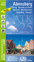
Bogen

Bogen in a series of GPS compatible recreational editions of the Bavarian topographic survey at 1:25, 000, with waymarked hiking trails and cycling routes, campsites and youth hostels, etc. Coverage includes Aiterhofen, Hunderdorf, Irlbach, Mitterfels, Sankt Englmar, Schwarzach.Contours used in this map vary between 5 to 20m according to the terrain, with 20m interval predominantly used for hilly areas. Varied colouring show different types of landscape: woods, vineyards, fields etc. Maps in this series feature extensive overprint highlighting local and long-distance footpaths and cycle routes, including King Ludwig Way or different variants of the Way of St James, indicating their waymarking. Symbols highlight different types of accommodation (campsites, youth hostels,
refuges, etc), sport and recreational facilities, various places of interest, etc. The maps have a 1-km UTM grid. Map legend and all the text are in German only.To see other titles in this series please click on the series link.
RIP - This product is no longer available on our network. It was last seen on 25.09.2019

This page now acts as a permanent archive for this product. Add more information using the comments box below to ensure it can still be found by future generations.

Use our search facility to see if it is available from an alternative contributor.
  • External links may include paid for promotion
  • Availability: Out Of Stock
  • Supplier: Stanfords
  • SKU: 9783899336207
Availability: In Stock
£11.50

Product Description

Bogen in a series of GPS compatible recreational editions of the Bavarian topographic survey at 1:25, 000, with waymarked hiking trails & cycling routes, campsites & youth hostels, etc. Coverage

Includes::
Aiterhofen, Hunderdorf, Irlbach, Mitterfels, Sankt Englmar, Schwarzach. Contours used in this map vary between 5 to 20m according to the terrain, with 20m interval predominantly used for hilly areas. Varied colouring show different types of landscape: woods, vineyards, fields etc. Maps in this series feature extensive overprint highlighting local & long-distance footpaths & cycle routes, including King Ludwig Way or different variants of the Way of St James, indicating their waymarking. Symbols highlight different types of accommodation (campsites, youth hostels, refuges, etc), sport & recreational facilities, various places of interest, etc. The maps have a 1-km UTM grid. Map legend & all the text are in German only. To see other titles in this series please click on the series link.

Reviews/Comments

Add New

Intelligent Comparison

Oooops!
We couldn't find anything!
Perhaps this product's unique.... Or perhaps we are still looking for comparisons!
Click to bump this page and we'll hurry up.

Price History

Vouchers

No voucher codes found.
Do you know a voucher code for this product or supplier? Add it to Insights for others to use.

Facebook

Jargon Buster

GPS - Global Positioning System - Global position using satellites
Hiking - An outdoor activity envolving walking in nature
King - The figure head of a monarch
Km - Kilometre. A unit of measurement equal to 1000 metres.
Accommodation - A room in which someone can live in, for example in a hotel
Feature - An attribute that makes something stand out.

Supplier Information

Stanfords
Stanfords was established in 1853 and opened their iconic Covent Garden flagship store in 1901. They have become the top retailer of maps, travel books and accessories in the UK and arguably offer the largest selection of maps and travel books worldwide. Famous names such as Captain Robert Falcon Scott, Ranulph Fiennes and Michael Palin have purchased from Stanfords. They now have a shop in Bristol and both stores together with other venues operate a calendar of events including talks, book signings and exhibitions. As a specialist map retailer, the map selection is comprehensive and includes road maps, street maps and walking maps from worldwide destinations, as well as a selection of world atlases and wall maps. Books include travel guides and travel literature. Stanfords also stock globes, from miniatures made of blue marble to magnificent floor-standing globes. The website features a selection of interesting articles on travel topics.
Page Updated: 2023-11-12 20:15:36

Community Generated Product Tags

Oh No! The productWIKI community hasn't generated any tags for this product yet!
Menu