More From Contributor

£7.99
Culture Smart! Rwanda gives you the tools for a successful visit to this beautiful l&. It guides you through daily interactions, cultural dos & don ts, traditions & cultural practices, etiquette, & the ways in which business is conducted. It provi ...
Archived Product
£9.50
Administrative map of Rwanda at 1:300, 000 published by the survey organization Rhinel&-Palatinate, showing the division of the country into provinces, districts & sectors, plus on the reverse extensive notes illustrated with photos. The map, prepared by the survey organization of the German state which has extensive links with Rwanda, shows the division of the country into its five provinces, indicating in different colours the districts within each province. Within each district boundaries of local sectors are also marked. Road network is classified into national paved or unsurfaced roads, district roads & local tracks. Symbols indicate airports, church missions & hospital facilities. Topography is shown by spot heights & boundaries of national parks & other protected areas are also marked on the map. Latitude & longitude lines are drawn at 10 ...
Archived Product
£9.95
Rwenzori Mountains & the National Park on the border between Uganda & the Congo Democratic Republic on a map presenting the area at three scales, plus extensive text providing information on various aspects of the region including walking & climbing routes. On one side are three maps: central Rwenzori is covered at 1:50, 000 with contour lines at 100m intervals & a more detailed map at 1:20, 000 presents the area around the main peaks with contour interval of 50m. Both maps indicate recent & present day glaciated areas, major cliffs, marshland & different types of vegetation. The maps show established paths & possible routes, huts & rock shelters, etc. The third map at 1:400, 000 presents the area around the two national parks, with coverage extending to the Kasese & Fort Portal on the Ugandan side & Semliki River in Congo. The map shows towns & villages, the road network, airfields, etc. A small inset places the whole region in a wider context within the two countries The reverse side is covered by text, illustrated with colour photos, on various aspects of the area including its history, fauna & flora, climate, illness & accidents, cooking & mountain food, equipment, etc. Notes provide information & routes descriptions for approaches from Congo (one 4-day circuit) or from Uganda (several walking circuits & routes, plus five climbing routes). Also provided is a list of useful contact details. ...
Archived Product
£9.99
The RYA Boat Buyers’ Handbook is written to assist anyone who has the difficult task of purchasing a vessel, especially if it is for the first time. This book takes you step by step through the complex process, starting with helping you to decide what sort of boat is most suitable for you. It aids you further with expert advice on considerations such as build materials, equipment & inspecting. Also

Includes::
tips on budgeting & making an offer based on fair price.

...
Archived Product
£14.99
The RYA Catamaran Handbook expertly guides you through all you need to know, from choosing a Catamaran, how to build a platform, rigging, wind & water, spinnaker sailing & catamaran racing. Catamarans are fast & offer the perfect combination of a light-weight craft, the minimum amount of hull beneath the water & a large sail. They are performance machines & one of the most exciting craft on the water. ...
Archived Product
£7.99
This handy book for the leisure user is a quick-reference guide to radio procedures (including Urgency, Safety, & Distress messaging); installing & maintaining a VHF radio; the licensing requirements, & GMDSS including Navtex. It also features useful extras, including prowords, the phonetic alphabet & numerals, & two sample Distress Procedure Cards for vessels with & without DSC. Chapters include:GMDSSRadio Procedures Installation & Maintenance, and Licensing The look & feel of the layout has benefitted from an overall redesign, making even the most complicated subject easily understandable. This makes the RYA Handy Guide to Marine Radio an even more user friendly aid to marine radio usage than ever before. ...
Archived Product
£10.99
The International Certificate of Competence, or the ICC, is required for the inland waterways of Europe & for the inland & costal waters of the Mediterranean countries. This RYA ICC Handbook is written as the official RYA course book to help both sail & power boaters pass the ICC test. It is written by an RYA yachtmaster instructor & examiner & explains the syllabus & standard required in detail along with giving a wealth of helpful hints on everything from the CEVNI rules to boat handling & collision avoidance. ...
Archived Product
£18.99
Although written & illustrated specifically with the boating fraternity in mind, the content of RYA Knots Splices & Ropework is applicable to a much wider readership. Structured to guide everyone from a complete beginner to a seasoned sailor step-by-step through simple knots onto the advances knotting skills required to make a Turk’s Head & Star Knot. ...
Archived Product
£21.50
This new edition of the best selling RYA Navigation Exercises is the official & recommended book for RYA Day Skipper, Yachtmaster & the Basic 2-Day Navigation & Safety Course & contains everything you will need to help answer the questions in this book. It is the only book that uses the new RYA Training Charts used for all RYA Training Courses. Whether you are taking an RYA Course or not, these exercises provide essential practice for anyone who goes to sea. The questions start with those simple enough for anyone new to navigation & progressively become more difficult
- a useful challenge for the more experienced navigator.
...
Archived Product
£16.99
Whether you are studying navigation as part of an RYA course or just want to know more about the art of navigation, the RYA Navigation Handbook is highly recommended. Navigation techniques & practices have changed dramatically over the past ten years or so; GPS & electronic chart plotters, in particular, now offer unprecedented levels of accuracy & reliability. The RYA has adapted its Dayskipper, Coastal Skipper & Yachtmaster courses to reflect the fact that many sailors & motor boaters now regard electronic instruments as their principle means of navigation. However, tradition methods still have an important part to play & this book covers them both, giving equal weight to electronic & traditional methods, & to the needs of power & sail. ...
Archived Product

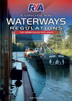
Rya Cevni Regulations - 2nd Edition

This is the RYA’s official title to support the CEVNI test to assist with the level of understanding needed to pass the test, which is a legal requirement (as well as carrying a CEVNI book on board) when using the European inland waterways. The CEVNI code which was devised by the United Nations in 1985 and governs navigation on all interconnected European inland waterways was established to enable boatmen of all nationalities to communicate, and to understand what is going on without the need to speak each other’s language. This new edition of RYA European Waterways Regulations has been fully updated and is essential reading for anyone taking the CEVNI qualification. The exciting new colourful format, with user-friendly text and illustrations, enables the reader to find information
quickly – a perfect learning tool and reference. Key chapters include:-Visual Signs-Rules of the Road (particularly blue boarding)-Sample CEVNI test questionsOur author Tam Murrell has been boating for business and pleasure since the late 1950s ranging from working narrow boats and barges on UK inland waters to small coasters trading in and around the Thames estuary and into northern Europe. Since 1995 he and his wife Di have spent much of their time on continental waterways on their 24m Dutch barge, and run a barge-handling school in France for RYA and French qualifications.
RIP - This product is no longer available on our network. It was last seen on 25.09.2019

This page now acts as a permanent archive for this product. Add more information using the comments box below to ensure it can still be found by future generations.

Use our search facility to see if it is available from an alternative contributor.
  • Availability: Out Of Stock
  • Supplier: Stanfords
  • SKU: 9781906435875
Availability: In Stock
£9.49

Product Description

This is the RYA’s official title to support the CEVNI test to assist with the level of understanding needed to pass the test, which is a legal requirement (as well as carrying a CEVNI book on board) when using the European inland waterways. The CEVNI code which was devised by the United Nations in 1985 & governs navigation on all interconnected European inland waterways was established to enable boatmen of all nationalities to communicate, & to understand what is going on without the need to speak each other’s language. This new edition of RYA European Waterways Regulations has been fully updated & is essential reading for anyone taking the CEVNI qualification. The exciting new colourful format, with user-friendly text & illustrations, enables the reader to find information quickly – a perfect learning tool & reference. Key chapters include:-Visual Signs-Rules of the Road (particularly blue boarding)-Sample CEVNI test questions Our author Tam Murrell has been boating for business & pleasure since the late 1950s ranging from working narrow boats & barges on UK inland waters to small coasters trading in & around the Thames estuary & into northern Europe. Since 1995 he & his wife Di have spent much of their time on continental waterways on their 24m Dutch barge, & run a barge-handling school in France for RYA & French qualifications.

Reviews/Comments

Add New

Intelligent Comparison

Oooops!
We couldn't find anything!
Perhaps this product's unique.... Or perhaps we are still looking for comparisons!
Click to bump this page and we'll hurry up.

Price History

Vouchers

No voucher codes found.
Do you know a voucher code for this product or supplier? Add it to Insights for others to use.

Facebook

Jargon Buster

UK - United Kingdom - An island nation in Europe
Blue - A primary colour
France - A state situated in Western Europe with several overseas territories.
Key - A physical or virtual device or code used for opening something
Language - the method of communication used in different areas. Humans and computers have many different languages.
Small - something that takes up less space than normal.
Road - a manmade lane or a path that is used to speed up travel.
Learning - Educating and growing in intelligence.
illustrations - Pictures typically in books and newspapers.
Reference - To prove evidence with a back up source.
Language - The way humans communicate either written and spoken.

Supplier Information

Stanfords
Stanfords was established in 1853 and opened their iconic Covent Garden flagship store in 1901. They have become the top retailer of maps, travel books and accessories in the UK and arguably offer the largest selection of maps and travel books worldwide. Famous names such as Captain Robert Falcon Scott, Ranulph Fiennes and Michael Palin have purchased from Stanfords. They now have a shop in Bristol and both stores together with other venues operate a calendar of events including talks, book signings and exhibitions. As a specialist map retailer, the map selection is comprehensive and includes road maps, street maps and walking maps from worldwide destinations, as well as a selection of world atlases and wall maps. Books include travel guides and travel literature. Stanfords also stock globes, from miniatures made of blue marble to magnificent floor-standing globes. The website features a selection of interesting articles on travel topics.
Page Updated: 2023-11-12 20:15:36

Community Generated Product Tags

Oh No! The productWIKI community hasn't generated any tags for this product yet!
Menu