More From Contributor

£6.95
Topographic coverage of mainland Spain at 1:50, 000 in the MTN50 (Mapa Topográfico Nacional) series from the Centro Nacional de Información Geografica, the country’s civilian survey organization. The maps have contours at 20m intervals, enhanced by relief shading, plus colouring and/or graphics to show different types of terrain, vegetation or land use. Boundaries of national parks & other protected areas are marked. In addition to all the usual information featured on topographic mapping at this scale, detailed presentation of the road & rail networks, rural tracks & paths, etc, the maps also show campsites & mountain refuges. On more recent editions some GRs, the official long-distance hiking routes, are also marked (although not as clearly as on hiking maps from other publishers). Each map covers 29.5x 18.5 km (with adjustments in the border or coastal areas). The maps have a 1-km UTM grid, plus margin ticks for latitude & longitude at 1` intervals. Map legend is in Spanish only.HOW TO CHOOSE THE RIGHT 50K MAP: all the titles in CNIG’s 200K Provincial Road Maps series at 1:200, 000 are overprinted with the grid for the 1:50, 000 maps & can be used to see the area covered by each 50K title. TO SEE THE LIST OF TITLES IN THIS SERIES PLEASE CLICK ON THE SERIES LINK.PLEASE NOTE
- MAP TITLES: the grids shown on our website serve both the civilian & the military 1:50, 000 topographic series. Although the areas covered by maps in both series are identical (apart from some border or coastal sheets), occasionally map titles differ – only one title is shown on the grid, usually the military one. In Galicia, the Basque country & in the Catalan speaking areas the tendency now is to use local place names rather than the often better known Castilian ones. Where possible, both versions are included in our titles. Map titles listed on our website are based on information received by us at the time of publication, but sometimes maps arrive showing a completely different title! As long as the map number is as ordered, the correct map has been supplied.
...
Archived Product
£6.50
Topographic coverage of mainland Spain at 1:25, 000 published by the Centro Nacional de Información Geograficá, the country’s civilian survey organization. The maps have contours at 10m intervals & colouring and/or graphics to show different types of vegetation or land use. Boundaries of national parks & other protected areas are marked. In addition to all the usual information shown on topographic maps at this scale, detailed presentation of the road & rail networks, rural tracks & paths, etc, the maps also show campsites. The maps have a 1-km UTM grid, with margin ticks for latitude & longitude at 1` intervals. Map legend is in Spanish only.PLEASE NOTE: our grid for the whole of Spain is in preparation
- in the meantime, for areas other than those shown on the attached grid please use CNIG’s topographic survey at 1:50, 000 by searching for ‘SI00000832’. Each 25K map covers one quarter of the corresponding 50K map, with the numbering system: I = NW quarter, II = NE quarter, III = SW quarter & IV = SE quarter. CNIG maps in the Provincial Road Maps series at 1:200, 000 are overprinted with the grid for the 1:50, 000 survey & can be used to see the area covered by each 50K or 25K title in more detail. To see the list of titles in this series please click on the series grid
- for map numbers not yet listed on our website please contact us by email.

...
Archived Product
£12.99
Camping
- Our favourite sites in Britain showcases Time Out’s choice of the top 100 campsites throughout the length & breadth of
...
Archived Product
£11.99
Camping & Tramping in Malaya: Fifteen Years' in the Native States of the Malay Peninsula, first published in 1898, is a lively & entertaining account of the author's travels around the Peninsula, with fascinating insights into the colonial personalities & working conditions of the day. ...
Archived Product
£9.99
Ambrose Rathborne was an Australian mining engineer who moved first to Ceylon (present-day Sri Lanka) as a coffee planter, & then in the 1880s to the Malay States, where he worked as a planter & entrepreneur. Camping & Tramping in Malaya: Fifteen Years in the Native States of the Malay Peninsula was first published in 1898, & is a lively & entertaining account of the author`s travels, with fascinating insights into the colonial personalities & working conditions of the day. An urge to find his own nirvana in the hills for planting Arabica coffee evidently drove Rathborne`s initial years in Malaya, & his chief legacy is his role in surveying for the alignments of the first long-distance roads in Malaysia. As Malaysia develops & matures as a nation state, interest will surely grow in its early formative years. Rathborne`s Camping & Tramping is an excellent place to start, & as easy to read as a good novel. About this series: Stanfords Travel Classics feature some of the finest historical travel writing in the English language, with authors hailing from both sides of the Atlantic. Every title has been reset in a contemporary typeface to create a series that every lover of fine travel literature will want to collect & keep. ...
Archived Product
£20.95
A guide to over 100 campgrounds within the parks, reserves & state forests of Western Australia, providing details of fees, facilities & activities, plus other useful advice for visitors. There are many other private campgrounds & local authority camping areas that are not an integral part of these parks, reserves & forests. A selection of these are also listed, giving their telephone numbers & a summary of faciliies. All sites are cross-referenced to the road atlas section included in the book. ...
Archived Product
£12.99
This stylish & inspiring book contains all the information campers need to make the most of the wonderful waterside locations throughout the UK & Irel&. Covering all kinds of camping (caravan, campsite & wild), the book starts by showing how to plan your trip, what gear to take & how to get stuck into all the fantastic water-based activities on offer, such as sailing, kayaking, angling, surfing & wild swimming. Tip boxes, top 10 features & gorgeous photos combine to give readers all the knowledge & inspiration they need to get out there, whether they`re on their own, part of a family or with a group of friends. The main part of the guide is organised by region, but also searchable by activity. Each region has an overview, & within it the best sites to visit, with useful information (best times of year to go, activities on offer, facilities, cost), advice on most attractive pitches, contact details & photos. There is a huge variety of sites here, all with something unique to offer, & helpful maps plot each one clearly. With a Foreword by One Man & his Campervan`s Martin Dorey, this is the essential guidebook for all campers, showing how it really is possible to pitch up in paradise. ...
Archived Product
£14.99
This stylish & inspiring book contains all the information campers need to make the most of the wonderful waterside locations throughout the UK & Irel&. Covering all kinds of camping (caravan, campsite & wild), the book starts by showing how to plan your trip, what gear to take & how to get stuck into all the fantastic water-based activities on offer, such as sailing, kayaking, angling, surfing & wild swimming. Tip boxes, top 10 features & gorgeous photos combine to give readers all the knowledge & inspiration they need to get out there, whether they`re on their own, part of a family or with a group of friends. The main part of the guide is organised by region, but also searchable by activity. Each region has an overview, & within it the best sites to visit, with useful information (best times of year to go, activities on offer, facilities, cost), advice on most attractive pitches, contact details & photos. There is a huge variety of sites here, all with something unique to offer, & helpful maps plot each one clearly. With a Foreword by One Man & his Campervan`s Martin Dorey, this is the essential guidebook for all campers, showing how it really is possible to pitch up in paradise. This 2nd edition is thoroughly updated throughout, featuring new campsites & photography. ...
Archived Product
£13.99
Michelin’s Camping Car Europe 2015 (French text) describes 75 routes for those exploring the continent by camper-van. There is extensive practical information on places to stay, eat & visit in addition to recommendations for must-see attractions & up-to-date information for each destination. Routes include the North Cape of Norway, the villages of Andalucia, the Hungarian countryside, Greek ports, Polish forests, Belgian beaches, Austrian museums, the German Alps, Croatian waterfalls, the Danish isles, Tuscan churches, English castles & festivals in Latvia. It features QR codes for connecting to website of selected destinations. Please note the text is in French only but symbols are also explained in English. ...
Archived Product
£15.99
The Camping Car Europe will help you find all the best spots for your camping car holiday in 25 European countries. Camping Car Europe is your perfect travel companion to explore Europe in Camping-Car &

Includes::
75 suggested itineraries & is packed with practical information on where to stay, what to do as well as information on road regulations in each countries. Camping Car Europe features for each itinerary a presentation of the the country, tourist & leisure activities as well as practical mapping & addresses with service areas, camping & leisure facilitities. Please note that the introductions are in English but the main body of the guide is in French.

...
Archived Product

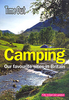
Camping Around Astralia

This brand-new publication is Australia's most comprehensive camping guide. No matter where in Australia you plan to travel, Camping Around Australia has listings for over 2600 campsites in every state and territory. There are also 54 detailed maps locating campsites, practical tips to prepare for a camping trip, 62 atlas pages locating all of the campsites and a complete index. With a modern and easy-to-follow design, it's the perfect guide for campers of all ages.
RIP - This product is no longer available on our network. It was last seen on 25.09.2019

This page now acts as a permanent archive for this product. Add more information using the comments box below to ensure it can still be found by future generations.

Use our search facility to see if it is available from an alternative contributor.
  • Availability: Out Of Stock
  • Supplier: Stanfords
  • SKU: 9781741173314
Availability: In Stock
£14.99

Product Description

This br&-new publication is Australia's most comprehensive camping guide. No matter where in Australia you plan to travel, Camping Around Australia has listings for over 2600 campsites in every state & territory. There are also 54 detailed maps locating campsites, practical tips to prepare for a camping trip, 62 atlas pages locating all of the campsites & a complete index. With a modern & easy-to-follow design, it's the perfect guide for campers of all ages.

Reviews/Comments

Add New

Intelligent Comparison

Oooops!
We couldn't find anything!
Perhaps this product's unique.... Or perhaps we are still looking for comparisons!
Click to bump this page and we'll hurry up.

Price History

Vouchers

No voucher codes found.
Do you know a voucher code for this product or supplier? Add it to Insights for others to use.

Facebook

Jargon Buster

Practical - Weather a task is easy to carry out and realistically succeed.
Design - A drawing or styles that shows the look and functionality of something before its made.

Supplier Information

Stanfords
Stanfords was established in 1853 and opened their iconic Covent Garden flagship store in 1901. They have become the top retailer of maps, travel books and accessories in the UK and arguably offer the largest selection of maps and travel books worldwide. Famous names such as Captain Robert Falcon Scott, Ranulph Fiennes and Michael Palin have purchased from Stanfords. They now have a shop in Bristol and both stores together with other venues operate a calendar of events including talks, book signings and exhibitions. As a specialist map retailer, the map selection is comprehensive and includes road maps, street maps and walking maps from worldwide destinations, as well as a selection of world atlases and wall maps. Books include travel guides and travel literature. Stanfords also stock globes, from miniatures made of blue marble to magnificent floor-standing globes. The website features a selection of interesting articles on travel topics.
Page Updated: 2023-11-12 20:15:36

Community Generated Product Tags

Oh No! The productWIKI community hasn't generated any tags for this product yet!
Menu