
 United Kingdom
 France
 Germany
 Netherlands
 Sweden
 USA
USA
 Italy
Italy
 Spain
Spain
More From Contributor


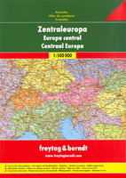
Central Europe F&B Road Atlas
Central Europe Road Atlas from Freytag & Berndt at 1:500, 000, in an A4, hardback format, with indexed street plans of city centres in 42 main towns across the whole of the continent. The whole of Europe is also covered at 1:3, 500, 000.Coverage extends from Paris to the eastern borders of Poland, Hungary, and Serbia, and north/south from Benelux, Germany and Poland to the whole of Italy and Albania. Austria, Czech Republic, central and eastern France, Germany, Hungary, Italy, Poland, Slovak Republic and Switzerland are all presented in separate sections followed by an index of localities with their postcodes, with three further sections covering the Benelux, Slovenia - Croatia-Bosnia - Herzegovina, and Serbia - Montenegro - Macedonia - Albania. The maps show road network
including secondary roads, indicating seasonal closures, routes closed to or not recommended for caravans, steep gradients, scenic routes, etc. Railways and main ferry routes are also marked. Symbols indicate various monuments and sights, selected campsites, etc., with places of particular interest highlighted. The maps have no geographical coordinates. Centres of 42 capital cities, including those outside the area covered by the main section of the atlas, are presented on street plans at 1:15, 000. Each plan has a separate street index. The whole of Europe, including most of Western Russia and the western half of Turkey is shown in an overview section at 1:3, 500, 000, also with an index. All map legends include English.
including secondary roads, indicating seasonal closures, routes closed to or not recommended for caravans, steep gradients, scenic routes, etc. Railways and main ferry routes are also marked. Symbols indicate various monuments and sights, selected campsites, etc., with places of particular interest highlighted. The maps have no geographical coordinates. Centres of 42 capital cities, including those outside the area covered by the main section of the atlas, are presented on street plans at 1:15, 000. Each plan has a separate street index. The whole of Europe, including most of Western Russia and the western half of Turkey is shown in an overview section at 1:3, 500, 000, also with an index. All map legends include English.

Product Description
Reviews/Comments
Add New
Intelligent Comparison
Archived Product
Central Europe F&B Compact Road Atlas PAPERBACK Stanfords
£13.99
Archived Product

Europe F&B Compact Road Atlas Stanfords
£9.99
Archived Product
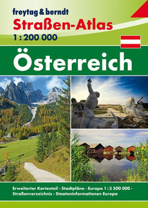
Austria F&B Road Atlas Stanfords
£13.99
Vouchers
No voucher codes found.
Do you know a voucher code for this product or supplier? Add it to Insights for others to use.
Do you know a voucher code for this product or supplier? Add it to Insights for others to use.
 Denmark