
 United Kingdom
 France
 Germany
 Netherlands
 Sweden
 USA
USA
 Italy
Italy
 Spain
Spain
More From Contributor


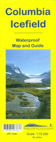
Columbia Icefield Gem Trek Map
Columbia Icefield spanning the border between the Banff and the Jasper National Parks in the Canadian Rockies on a contoured and GPS-compatible, waterproof and tear-resistant map at 1:75, 000 from Gem Trek, with extensive tourist information including recommended hikes, geology, etc. Coverage extends along both sides of the Icefields Parkway from approx 102km/63 miles north of Lake Louise to 83km/52 miles south of the Jasper townsite.Contours at 200 feet intervals, vividly enhanced by relief shading, colouring and spot heights (given in metres and feet). An overprint highlights hiking and/or horse riding trails, indicating less well maintained routes, several types of tourist accommodation, etc. The map has a 1km UTM grid. Next to the map and on the reverse is extensive tourist
information: recommendations for both short and longer, more difficult day hikes, notes about Columbia Icefield and the Athabasca Glacier, local wildlife, geology and history of the area, etc. Also provided is information a table showing facilities in the campgrounds along the Icefields Parkway, a plan of the facilities at the Icefield Centre, useful contact numbers, etc.To see the full list of all the titles in this series please click on the series link.
information: recommendations for both short and longer, more difficult day hikes, notes about Columbia Icefield and the Athabasca Glacier, local wildlife, geology and history of the area, etc. Also provided is information a table showing facilities in the campgrounds along the Icefields Parkway, a plan of the facilities at the Icefield Centre, useful contact numbers, etc.To see the full list of all the titles in this series please click on the series link.

Product Description
Reviews/Comments
Add New
Vouchers
No voucher codes found.
Do you know a voucher code for this product or supplier? Add it to Insights for others to use.
Do you know a voucher code for this product or supplier? Add it to Insights for others to use.
 Denmark