
 United Kingdom
 France
 Germany
 Netherlands
 Sweden
 USA
USA
 Italy
Italy
 Spain
Spain
More From Contributor


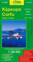
Corfu Orama Editions 302
Corfu with Paxos at 1:100, 000 on a road map from the Greek publishers Orama with a street plan of Corfu/Kerkyra Town, notes on the island’s resorts, beaches and other places of interest, an extensive list of tourist accommodation, etc.On one side is a map of Corfu, Paxos and Antipaxos, with the nearby islands of Mathraki, Othoni and Erikoussa on an inset. All place names are shown in both Greek and Latin alphabet. The map shows the islands’ road network, indicating dirt roads and distances on main routes. Topography is presented by altitude colouring. Numerous places of interest are highlighted, including campsites, archaeological sites, natural features, etc. The map shows which beaches have the Blue Flag rating and provides brief descriptions of several others. Also
marked are ferry connections and on the mainland around Igoumenitsa campsites, beaches and various places of interest. The map has a UTM grid, plus latitude and longitude crosshairs at 5’ intervals. On the reverse is an indexed street plan of Corfu Town indicating main traffic routes plus various facilities and places of interest. Names of smaller streets are in the Greek alphabet only.The map also includes an extensive list of hotels and family accommodation with phone numbers, plus bilingual notes on the sights and recommended walks in Corfu Town, the island’s beaches and resorts, etc.Map legend and the text include English.PLEASE NOTE: although on the map and the street plan the sea has bathymetric tints, soundings, markings for underwater cables, lighthouses, etc, plus 16
additional insets showing various bays on Corfu and Paxos in more detail, this title is not sold by Stanfords as a nautical chart.

Product Description
Reviews/Comments
Add New
Vouchers
No voucher codes found.
Do you know a voucher code for this product or supplier? Add it to Insights for others to use.
Do you know a voucher code for this product or supplier? Add it to Insights for others to use.
 Denmark