
 United Kingdom
 France
 Germany
 Netherlands
 Sweden
 USA
USA
 Italy
Italy
 Spain
Spain
More From Contributor

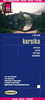
Corsica South 3-Map Set Kompass 2251
The southern half of Corsica at 1:50, 000 on a set of three double-sided, contoured and GPS compatible maps from Kompass with highlighting for walking / hiking trails including the GR20, cycle routes, campsites and mountain shelters, recreational facilities, etc, plus a road map of the whole island and town centre street plans of several locations.Coverage extends southwards from Sagone on the west coast and Aléria in the east, presenting the southern half of Corsica in five 1:50, 000 sections. The remaining sixth side has a very clear road map of the whole island at 1:300, 000, highlighting scenic routes plus interesting towns or villages and natural locations. Panels with street plans show Ajaccio, Bastia, Bonifacio, Calvi, Corte, and Porto-Vecchio. Mapping at 1:50, 000 has
contours at 40m intervals, enhanced by relief shading and graphic relief, with additional colouring and/or graphics for different types of vegetation. The overprint highlighting hiking trails distinguishes between cart tracks, footpaths, and steep narrow paths. Named trails such as Mare è Monti or Mare a Mare are indicated, with special more prominent overprint for the GR20. Also marked are bicycle routes, plus a selection of mountain bike trails and horse riding paths. A very wide range of symbols indicate various accommodation options including campsites and youth hostels, recreational facilities and places of interest. The map has a 1-km UTM grid. Map legend includes English.The set also contains a 62-page bilingual French/German guide (no English edition is available) with
general notes and hiking recommendations. Kompass Verlag are Europe’s largest publishers of walking maps, with wide coverage of central Europe, Italy, etc, all listed on our website.A similar set covers the northern half of Corsica.
Product Description
Reviews/Comments
Add New
Vouchers
No voucher codes found.
Do you know a voucher code for this product or supplier? Add it to Insights for others to use.
Do you know a voucher code for this product or supplier? Add it to Insights for others to use.
 Denmark