More From Contributor

£9.99
Cracking the Egyptian Code is the first biography in English of Jean-François Champollion, the impoverished, arrogant & brilliant child of the French Revolution who made the vital breakthrough in deciphering the Egyptian hieroglyphs. This finely illustrated account charts Champollion’s dramatic life & achievements: by turns a teenage professor, a supporter of Napoleon, an exile, a fanatical decipherer & a curator at the Louvre, he lived life to the full but drove himself into an early grave. Andrew Robinson’s full-blooded account brings the man, his setbacks & his ultimate triumphs vividly to life. ...
Archived Product
£8.99
Cracking the Wine Code is a starting point for any curious but frustrated wine drinker; offering solutions to the questions you have always felt a little too abashed to admit you wanted to ask. Lavinia Brown makes a point of empowering wine lovers to stand on their own to vinous feet & ending the days of the floundering saying ‘I don’t know much about wine but I know what I like!’. ...
Archived Product
£6.99
From Tintagel Castle in Cornwall to Skibo Castle in the Scottish highlands, Horrible Histories: Crackin` Castles covers the history of Britain from the time of the Romans to the London Blitz. Filled with adventure, danger, magic, sieges, treachery, spies, revenge & much more besides
- all in the classic Horrible Histories style! It`s a seriously horrible read.
...
Archived Product
£8.99
Crakow in the Landmark Visitor Guides series, exploring a range of places in Britain, Europe & the Caribbean, with a particular expertise in UK destinations. Each guide presents the reader with detailed, wide-ranging & accessible overview of the region or area, with a particular focus on history & culture, notable local attractions, the landscape, local events & family activities. A series of recommended walks & guided car tours exploring the region are also included in each title. The guides are arranged geographically by region & are ideal both for short & longer breaks, with practical guidance on recommended routes & tourist attractions, in addition to insightful inset boxes into local history, culture & traditions. Information on accommodation, restaurants & day-to-day information are more limited, though a compact Directory at the end of each guide provides basic listings of recommended accommodation & restaurants, as well as tourist information contacts & regional event calendars. International destinations also carry climate & country facts, basic phrases & other general travel practical guidance for travelling to the region. The British titles in the Landmark Visitor Guides series are highly recommended, covering titles that are rarely available from other publishers. ...
Archived Product
£15.95
The Cracow & Wieliczka Tourist Navigator combines practical information & guidance for tourists visiting the cities with overview mapping to help visitors make the most of their trip. There are more than 300 descriptions of principal tourist attractions & almost 1000 addresses of hotels, restaurants, museums & other attractions, in addition to 150 photographs of all of Cracow & Wieliczka`s nooks & crannies. There are also 1:20, 000 scale maps of the cities & a more detailed 1:20, 000 scale map of the centre of Cracow. ...
Archived Product
£12.99
Cracow Eyewitness travel guide from Dorling Kindersley is a lavishly illustrated book concerned with providing the visitor with detailed background information to sightseeing in the country & a broad cultural introduction. Popular historical buildings & museums are often described with cutaway diagrams allowing you to view ...
Archived Product
£5.95
The Cracow with Kazimierz Mini Tour Guide provides as a descriptive tour through this beautiful & historically rich city. The highly informative text

Includes::
a historical overview for the selected sites accompanied by full-colour photographs. A street map of the city centre that clearly marks the attractions described in the text is included. Also marked are a series of suggested walking routes through the city. Practical information on Cracow’s museums is listed at the back of the guide book.

...
Archived Product
£3.50
Cradley Heath & Old Hill in 1901 in a fascinating series of reproductions of old Ordnance Survey plans in the Alan Godfrey Editions, ideal for anyone interested in the history of their neighbourhood or family. The map covers Old Hill & the northern part of Cradley Heath; it also

Includes::
a portion of Worcestershire (sheet 4.08) around Dudley Wood. Coverage stretches from Whitehall Road eastward to Waterfall Lane, & from Saltwells Road & Primrose Bridge southward to Grainger`s Lane. Features include Cradley Heath town centre with High Street, Lomey Town, St Luke`s church, Newtown area; Old Hill with Holy Trinity church, Reddal Hill area, Trinity Hall, Riddings Colliery (disused), Bearmore Colliery (disused), Black Waggon Colliery (disused), Providence Chain Works, Cherry Orchard area; also Hadenhill Colliery (disused), GWR Stourbridge Extension with Old Hill station, GWR Netherton & Halesowen Branch, Waterfall Lane Colliery (disused), Pearson`s Colliery, Powkelane Sawmills, Oldhill Colliery, Oldhill Iron Works, Eagle Colliery, Dudley Canal, Fly Colliery, Mouse Street area, gas works, Tiger Works, Bowling Green, Dudley Wood area, Saltwells Colliery, Netherton Foundry, tramways, Spring Hill House, Saltwells Basin, etc. On the reverse is a directory of Cradley Heath. About the Alan Godfrey Editions of the 25” OS Series: Selected towns in Great Britain & Ireland are covered by maps showing the extent of urban development in the last decades of the 19th & early 20th century. The plans have been taken from the Ordnance Survey mapping & reprinted at about 15 inches to one mile (1:4, 340). On the reverse most maps have historical notes & many also include extracts from contemporary directories. Most maps cover about one mile (1.6kms) north/south, one & a half miles (2.4kms) across; adjoining sheets can be combined to provide wider coverage.FOR MORE INFORMATION & A COMPLETE LIST OF ALL AVAILABLE TITLES PLEASE CLICK ON THE SERIES LINK.

...
Archived Product
£3.50
Cradley South in 1901 in a fascinating series of reproductions of old Ordnance Survey plans in the Alan Godfrey Editions, ideal for anyone interested in the history of their neighbourhood or family. The map covers the eastern part of Cradley, southern part of Cradley Heath, the Haden Hill & Haden Cross area, & a rural portion of Hawne parish. Features include Corngreaves Works, Hightown & Overend areas of Cradley, Toy`s Green, Colonial Works, Colley Orchard, New Hawne Colliery with mineral railway, Colmanhill House, Timbertree Colliery with tramway, Corngreaves Hall, Surfeit Hill, St Peter`s church (split by margin), disused Codsall Colliery, Haden Hill, Haden Cross, Old Hawne Colliery (disused), Gunbarrel Mill, Tadpole Hole, Granville & Gorstyhill Colliery (disused), stretch of GWR Netherton & Halesowen branch, River Stour, etc. On the reverse is an 1896 Cradley directory. About the Alan Godfrey Editions of the 25” OS Series: Selected towns in Great Britain & Ireland are covered by maps showing the extent of urban development in the last decades of the 19th & early 20th century. The plans have been taken from the Ordnance Survey mapping & reprinted at about 15 inches to one mile (1:4, 340). On the reverse most maps have historical notes & many also include extracts from contemporary directories. Most maps cover about one mile (1.6kms) north/south, one & a half miles (2.4kms) across; adjoining sheets can be combined to provide wider coverage.FOR MORE INFORMATION & A COMPLETE LIST OF ALL AVAILABLE TITLES PLEASE CLICK ON THE SERIES LINK. ...
Archived Product

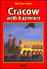
Cracow 3 In 1 Explore!Guide - Guidebook, Street Atlas And Map

The Cracow Explore! Guide by ExpressMap is a fully illustrated guide to the city, with itinerary suggestions, extensive information on what to do and see, and street atlas pages and detachable laminated pocket map.The book explores the city in 11 itinerary suggestions and includes one for the surrounding area. Each route is explained in a separate colour-coded chapter featuring a general introduction to the history and character of the particular part of the town and is accompanied by a street map extract showing the suggested tour with colour coded numbers to indicate the locations of all the sights described in the following pages. The numbers are also reproduced in the atlas pages and the pocket map for easy referencing. The section covering the area outside Cracow is accompanied by
a road map extract rather than a street map. The sights are presented with detailed information and practical advice on opening hours, contacts, prices and transport links are highlighted on the side of the text. Following, the listing pages feature 59 restaurants bars and coffee shops for different budgets and tastes; and 29 best shopping places from fashion and jewellery to flea market and second hand. The culture and entertainment section provides 42 suggestions for theatres, museums and gallery as well as jazz bars, clubs and themed parks. For more ideas on what to do and see in the city a Festival and Events Calendar lists concerts, shows, exhibitions and fairs that take place throughout the year.The last part of the guide is dedicated to an indexed street atlas of Cracow at
1:22, 000 and the city centre at 1:11, 000 showing tram, bus and railway routes with stops and line numbers. Places of interests featured in the book are numbered and colour-coded. Street names, various monuments and historical buildings are in Polish only. Map legend includes English. The detachable map provides the same information but in foldable version.
RIP - This product is no longer available on our network. It was last seen on 25.09.2019

This page now acts as a permanent archive for this product. Add more information using the comments box below to ensure it can still be found by future generations.

Use our search facility to see if it is available from an alternative contributor.
  • Availability: Out Of Stock
  • Supplier: Stanfords
  • SKU: 9788375464894
Availability: In Stock
£18.95

Product Description

The Cracow Explore! Guide by Express Map is a fully illustrated guide to the city, with itinerary suggestions, extensive information on what to do & see, & street atlas pages & detachable laminated pocket map. The book explores the city in 11 itinerary suggestions &

Includes::
one for the surrounding area. Each route is explained in a separate colour-coded chapter featuring a general introduction to the history & character of the particular part of the town & is accompanied by a street map extract showing the suggested tour with colour coded numbers to indicate the locations of all the sights described in the following pages. The numbers are also reproduced in the atlas pages & the pocket map for easy referencing. The section covering the area outside Cracow is accompanied by a road map extract rather than a street map. The sights are presented with detailed information & practical advice on opening hours, contacts, prices & transport links are highlighted on the side of the text. Following, the listing pages feature 59 restaurants bars & coffee shops for different budgets & tastes; & 29 best shopping places from fashion & jewellery to flea market & second h&. The culture & entertainment section provides 42 suggestions for theatres, museums & gallery as well as jazz bars, clubs & themed parks. For more ideas on what to do & see in the city a Festival & Events Calendar lists concerts, shows, exhibitions & fairs that take place throughout the year. The last part of the guide is dedicated to an indexed street atlas of Cracow at 1:22, 000 & the city centre at 1:11, 000 showing tram, bus & railway routes with stops & line numbers. Places of interests featured in the book are numbered & colour-coded. Street names, various monuments & historical buildings are in Polish only. Map legend

Includes::
English. The detachable map provides the same information but in foldable version.

Reviews/Comments

Add New

Intelligent Comparison

Oooops!
We couldn't find anything!
Perhaps this product's unique.... Or perhaps we are still looking for comparisons!
Click to bump this page and we'll hurry up.

Price History

Vouchers

No voucher codes found.
Do you know a voucher code for this product or supplier? Add it to Insights for others to use.

Facebook

Jargon Buster

Jazz - A music genre from the begining of the 20th century
Calendar - A system for organising dates
Hand - A part of the body at the end of the arm
Hand - A pointer which indicates time on a clock face
Jewellery - A decorative item which is worn on the body
Coffee - A popular brewed drink using roasted coffee beans
History - Anything that happens in the past. An acedemic subject.
Entertainment - Something that provides amusement
Colour - The categorised spectrum of light visable to humans
Year - The time it takes the planet earth to orbit the sun. This takes around 365.25 days.
Road - a manmade lane or a path that is used to speed up travel.
Tram - A large vehicle common in cities for public transport, also known as a cable car.
Festival - A period usually occurring once a year for celebration, typically for religious reasons.
Practical - Weather a task is easy to carry out and realistically succeed.
Year - 365 days (366 days in a leap year), the time taken for planet earth to make one full revolution around the sun.
Detachable - Something that can be removed from the main object via a fastening.
Pocket - A bag shaped insert in clothing used to carry items
Jazz - A genre of music that regularly involves saxophones and clarinets
Laminated - A thin layer of plastic that gives a coating and shine to a material.
Feature - An attribute that makes something stand out.
Transport - Something that carries people or goods.

Supplier Information

Stanfords
Stanfords was established in 1853 and opened their iconic Covent Garden flagship store in 1901. They have become the top retailer of maps, travel books and accessories in the UK and arguably offer the largest selection of maps and travel books worldwide. Famous names such as Captain Robert Falcon Scott, Ranulph Fiennes and Michael Palin have purchased from Stanfords. They now have a shop in Bristol and both stores together with other venues operate a calendar of events including talks, book signings and exhibitions. As a specialist map retailer, the map selection is comprehensive and includes road maps, street maps and walking maps from worldwide destinations, as well as a selection of world atlases and wall maps. Books include travel guides and travel literature. Stanfords also stock globes, from miniatures made of blue marble to magnificent floor-standing globes. The website features a selection of interesting articles on travel topics.
Page Updated: 2023-11-12 20:15:36

Community Generated Product Tags

Oh No! The productWIKI community hasn't generated any tags for this product yet!
Menu