
 United Kingdom
 France
 Germany
 Netherlands
 Sweden
 USA
USA
 Italy
Italy
 Spain
Spain
More From Contributor


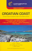
Croatia: Freytag & Berndt Maps Of The Croatian Coast
The coast of Croatia on detailed tourist maps from Freytag & Berndt prominently highlighting campsites and other facilities, as well as numerous places of interest. The whole coast with the islands, from Trieste in Italy to Herceg-Novi in Montenegro, is covered on six maps at 1:100, 000. A separate map at 1:150, 000 covers the Dalmatian coast without Istria.The maps show the region’s road and rail networks, indicating scenic routes, and include ferry connections to the islands. Symbols highlight various places of interest and facilities such as campsites, marinas, etc. All the maps are GPS compatible, showing latitude and longitude lines. Map legends include English.The “Top 10 Tips” titles provide additional street plans and descriptions of best sights. The region’s most
popular destinations are also covered by handy waterproof and tear-resistant pocket maps with street plans and publishers’ recommendations of five best choices in five categories: adventure, culture, food, nature and sights.For more information please see the individual description of each title.
popular destinations are also covered by handy waterproof and tear-resistant pocket maps with street plans and publishers’ recommendations of five best choices in five categories: adventure, culture, food, nature and sights.For more information please see the individual description of each title.
Product Description
Reviews/Comments
Add New
Vouchers
No voucher codes found.
Do you know a voucher code for this product or supplier? Add it to Insights for others to use.
Do you know a voucher code for this product or supplier? Add it to Insights for others to use.
 Denmark