More From Contributor

£3.99
Croatian Phraseguide is designed to help travellers get the very best out of their trip. This punchy full colour language guide,

Includes::
only the essential phrases to ensure the maximum of fun & to help out if things go wrong. In depth sections on shopping, eating & drinking are supplemented by essential phrases to allow you to interact with your hosts & get around your chosen destination. Sections include: Greetings; At the restaurant; Menu Decoder; Shopping; Getting around; Accommodation; On the phone; &, Emergencies. Phraseguides are designed to make the languages of major holiday destinations accessible in a practical & user-friendly style. Phrases & vocabulary are presented in visual ways to ease learning. Only the phrases & words that are commonly used have been included ensuring ease of use for the traveller.

...
Archived Product
£8.99
The Adriatic Coast of Croatia & Montenegro, from Trieste & Istria to the Albanian border at 1:160, 000 on a set of two separate maps with numerous street plans of central areas in its towns & holiday resorts, plus a separate booklet. The whole coastline is presented on two double-sided maps with, where appropriate, some of the outlying islands shown as insets. The southernmost part is shown on two panels, covering separately the coastlines of Croatia & Montenegro. Clear presentation of the region’s road network

Includes::
selected local roads & cart tracks. Driving distances are shown on main & some secondary routes & locations of petrol stations are marked. The map indicates ferry connections to the island & on the mainland railway lines are shown (although not identified in the legend). A range of symbols mark various places of interest. The maps have latitude & longitude lines at intervals of 10’. The index is in a separate booklet. Map legend

Includes::
English. The maps

Includes::
23 insets with street plans of central areas in the region’s towns & holiday resorts, annotated with places of interest & main facilities. Disapprovingly, but inevitably given the region’s geography, not all the street plans appear on the same side of the map as the town itself.* Please note: the map cover indicates a scale of 1:200, 000, but the maps themselves show 1:160, 000 both as a ratio & as a linear representation of the scale.*


...
Archived Product
£13.50
Croatia’s Adriatic Coast on a waterproof & tear-resistant, large & double-sided map at 1:200, 000 from the Swiss Hallwag/Kümmerly + Frey cartographic house, highlighting the region’s 77 best sights, each with a brief description, plus street plans of central Rijeka, Pula, Zadar, Split & Dubrovnik. Coverage starts at Trieste, extending inland to include access from the A1 motorway, but around Dubrovnik is limited only to the coastal strip. Road network, including small local roads & selected country tracks, is clearly laid out on a base showing the region’s topography by relief shading with names of mountain ranges, peaks, valleys, etc. Scenic routes are highlighted. The map also prominently shows ferry routes to & between the islands. 77 best sights are cross-referenced to the surrounding panels of brief descriptions, many illustrated with photos. The map has no geographical coordinates. The index lists main towns of the region. Also included are small street plans of central Rijeka, Pula, Zadar, Split & Dubrovnik annotated with main sights & recommendations for hotels, restaurants, shopping, etc. Map legend & all the text include English. ...
Archived Product
£12.99
Croatian coast on an indexed road map with small plans of central Pula, Rijeka, Zadar, Split & Dubrovnik from the Swiss cartographic group Hallwag Kümmerly + Frey. Coverage, presented in two panels, extends from Trieste & Ljubljana to the border with Montenegro. The base map has subtle relief shading, names of mountain ranges in the hinterland & spot heights. Boundaries of national parks & other protected areas are indicated. Road network

Includes::
selected country tracks & gives locations of petrol stations & driving distances on main routes. Railway lines are shown with stations. Ferry routes & marinas or anchorage are marked. Places of interest, including campsites, viewpoints, archaeological sites, churches & monasteries, etc., are highlighted. The map has latitude & longitude grid at intervals of 15’. The index is in a separate booklet attached to the map cover. Map legend

Includes::
English. Also included are plans of central Pula, Rijeka, Zadar & Split, plus the historic centre of Dubrovnik, annotated with places of interest.


...
Archived Product
£9.99
The northern part of the Croatian coast, from Istria to beyond Zadar, at 1:200, 000 on a light, waterproof at tear-resistant map published by Freytag & Berndt in their “ World Compact” series which combines a road map with street plans & additional tourist information. The map is double-sided & provides detailed presentation of the region’s road network, including scenic roads & special tourist routes, seasonal closures, roads closed to motorized traffic or not recommended for caravans, etc. Railway lines are shown with stations & ferry connections are marked. Icons highlight various places of interest. The map is indexed & has latitude & longitude lines drawn at 10’ intervals. A special feature of Freytag & Berndt’s World Compact series are additional street plans, here showing central Pula, Rijeka & Zadar, plus information panels with descriptions of main tourist destinations & general information about travelling in Croatia, & a “ Smalltalk” phrasebook. Map legend & all the text in the information panels is in German & English. ...
Archived Product
£9.99
The southern part of the Croatian coast, from Zadar to Dubrovnik, at 1:200, 000 on a light, waterproof at tear-resistant map published by Freytag & Berndt in their “ World Compact” series which combines a road map with street plans & additional tourist information. The map is double-sided & provides detailed presentation of the region’s road network, including scenic roads & special tourist routes, seasonal closures, roads closed to motorized traffic or not recommended for caravans, etc. Railway lines are shown with stations & ferry connections are marked. Icons highlight various places of interest. The map is indexed & has latitude & longitude lines drawn at 10’ intervals. A special feature of Freytag & Berndt’s World Compact series are additional street plans, here showing central Zadar, Split, Sibenik & Dubrovnik’s Old Town, plus information panels with descriptions of main tourist destinations & general information about travelling in Croatia, & a “ Smalltalk” phrasebook. Map legend & all the text in the information panels is in German & English. ...
Archived Product
£6.98
Being able to speak a little of the local language enhances any trip abroad, & this beginner-level Croatian audio course contains all the key travel phrases you need to communicate with complete confidence. The 60-minute audio CD features native Croatian speakers using phrases you`re likely to encounter in typical travel situations. In no time, you will be able to meet & greet people, be familiar with numbers, time & days of the week, find your way around transport, shops, & restaurants, & make new friends. The pack

Includes::
a sturdy booklet with a phonetic transcription of the phrases on the CD, plus handy tips & key word reminders. The contents of the CD can be easily downloaded to your iPod or MP3 player.

...
Archived Product
£4.99
Croatian in 60 Minutes in a selection of language titles from Berlitz, to aid you before & during your travels. Berlitz have been producing language titles & promoting language learning for more than 125years. Catalogue selection comprising the following Berlitz series: Phrase books & Dictionaries, Phrase books & CDs, Shortcuts to ...
Archived Product
£4.99
Croatian Phrase Book in a selection of language titles from Berlitz, to aid you before & during your travels. Berlitz have been producing language titles & promoting language learning for more than 125years. Catalogue selection comprising the following Berlitz series: Phrase books & Dictionaries, Phrase books & CDs, Shortcuts to ...
Archived Product
£6.99
Croatian Phrase Book & CD in a selection of language titles from Berlitz, to aid you before & during your travels. Berlitz have been producing language titles & promoting language learning for more than 125years. Catalogue selection comprising the following Berlitz series: Phrase books & Dictionaries, Phrase books & CDs, Shortcuts to ...
Archived Product

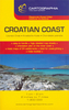
Croatian Coast Road Atlas

The Croatian Coast at 1:160, 000 in a spiral-bound road atlas from Cartographia, with regional maps of Slovenia, Croatia, Serbia, Montenegro and Norrthern Albania, and 49 street plans. Main mapping extends from Trieste in the north to the Albanian border in the south.Road classification has six different classes of roads, and locations of filling stations and driving distances on most local roads displayed; railways and car ferries are also shown. Towns, villages and places of interest, including national parks and protected areas, are highlighted. Points of interests such as beaches, swimming pools, waterfalls, campsites, selected hotels, castles, are all marked. The maps have no geographical coordinates. Subtle shading and spot heights indicate topographical
information.Regional maps at 1:820, 000 show motorways and junctions, with minor roads displayed. International and administrative boundaries are clearly marked, with railways, airports and ferries also shown. There are 49 street plans showing points of interest, local facilities and car-parking spots; the atlas also has 48 pages of tourist information (in English and Croatian) detailing 38 towns, sights, and resorts along the coastline, as well as destinations such as Zagreb and Sarajevo.Extensive index lists all the localities with their postcodes and gives population details. Multi-lingual map legend includes English.
RIP - This product is no longer available on our network. It was last seen on 25.09.2019

This page now acts as a permanent archive for this product. Add more information using the comments box below to ensure it can still be found by future generations.

Use our search facility to see if it is available from an alternative contributor.
  • Availability: Out Of Stock
  • Supplier: Stanfords
  • SKU: 9789633525630
Availability: In Stock
£19.95

Product Description

The Croatian Coast at 1:160, 000 in a spiral-bound road atlas from Cartographia, with regional maps of Slovenia, Croatia, Serbia, Montenegro & Norrthern Albania, & 49 street plans. Main mapping extends from Trieste in the north to the Albanian border in the south. Road classification has six different classes of roads, & locations of filling stations & driving distances on most local roads displayed; railways & car ferries are also shown. Towns, villages & places of interest, including national parks & protected areas, are highlighted. Points of interests such as beaches, swimming pools, waterfalls, campsites, selected hotels, castles, are all marked. The maps have no geographical coordinates. Subtle shading & spot heights indicate topographical information. Regional maps at 1:820, 000 show motorways & junctions, with minor roads displayed. International & administrative boundaries are clearly marked, with railways, airports & ferries also shown. There are 49 street plans showing points of interest, local facilities & car-parking spots; the atlas also has 48 pages of tourist information (in English & Croatian) detailing 38 towns, sights, & resorts along the coastline, as well as destinations such as Zagreb & Sarajevo. Extensive index lists all the localities with their postcodes & gives population details. Multi-lingual map legend

Includes::
English.

Reviews/Comments

Add New

Price History

Vouchers

No voucher codes found.
Do you know a voucher code for this product or supplier? Add it to Insights for others to use.

Facebook

Jargon Buster

Railways - A set of tracks that have been laid for the purpose of trains to travel up and down them
Car - A machine used for transport which runs on roads
Road - a manmade lane or a path that is used to speed up travel.
Regional - An adjective to describe a set geographic area.
Subtle - Something that is delicate and not to harsh, can be difficult to describe.

Supplier Information

Stanfords
Stanfords was established in 1853 and opened their iconic Covent Garden flagship store in 1901. They have become the top retailer of maps, travel books and accessories in the UK and arguably offer the largest selection of maps and travel books worldwide. Famous names such as Captain Robert Falcon Scott, Ranulph Fiennes and Michael Palin have purchased from Stanfords. They now have a shop in Bristol and both stores together with other venues operate a calendar of events including talks, book signings and exhibitions. As a specialist map retailer, the map selection is comprehensive and includes road maps, street maps and walking maps from worldwide destinations, as well as a selection of world atlases and wall maps. Books include travel guides and travel literature. Stanfords also stock globes, from miniatures made of blue marble to magnificent floor-standing globes. The website features a selection of interesting articles on travel topics.
Page Updated: 2023-11-12 20:15:36

Community Generated Product Tags

Oh No! The productWIKI community hasn't generated any tags for this product yet!
Menu