More From Contributor
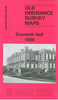
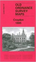
£7.99
A compulsively readable thriller that skillfully weaves together past & present to uncover the sinister secrets buried in the ancient stone quarries under Bath. Kit Parry is reluctant to take the job shoring up the ancient quarries beneath her hometown of Bath -- a place as riddled with memories she`d rather forget as it is with Roman ruins. The miners certainly don`t want her there, & her burgeoning romance with lanky foreman Gary looks likely to complicate matters even further. But when dark developments threaten the spa town`s placid facade, Kit must face up to the past she`s tried so desperately to bury. Someone wants her out of Bath -- that much is clear -- but who was it that brought her childhood to an abrupt end in the summer of her fourteenth year? Why has she never been back to Bath, & how did she escape her violent father? When Kit stumbles across evidence of a lost Mithraic temple, the mysteries in her own past become entangled with a search for what could be the archaeological discovery of the decade -- & what turns into a dangerous obsession! ...
Archived Product
£11.99
CROWDIE & CREAM: Peopled with characters like Great Aunt Rachel, `built like a Churchill tank & with a personality to match`, these are the stories of a childhood, of the hard years of the Depression, & then the departure of the island`s young men to fight in the Second World War. Together they bring alive the warmth & closeness of a unique Hebridean community. CROTAL & WHITE: Finlay J Macdonald continues his story with a witty account of his adolescent years during the depression. Hard days for the villagers, but their sense of humour never deserted them. & when young Finlay won the bursary to secondary school in the Northlands it was with a mixture of joy & sadness that he prepared to leave behind him a community that would soon be changed forever...THE CORNCRAKE & THE LYSANDER: As Finlay Macdonald set out for high school in Tarbert, Hitler`s growing military strength had begun to menace the people of Europe. But to Finlay this was just one more exciting prospect along with living in Big Grandfather`s house, making new friends & meeting the girls of his adolescent dreams. ...
Archived Product
£2.95
Croxteth Hall in 1906 in a fascinating series of reproductions of old Ordnance Survey plans in the Alan Godfrey Editions, ideal for anyone interested in the history of their neighbourhood or family. Selected towns in Great Britain & Ireland are covered by maps showing the extent of urban development in the last decades of the 19th & early 20th century. About the Alan Godfrey Editions of the 25 ...
Archived Product
£3.50
Croxteth Hall in 1906 in a fascinating series of reproductions of old Ordnance Survey plans in the Alan Godfrey Editions, ideal for anyone interested in the history of their neighbourhood or family. About the Alan Godfrey Editions of the 25” OS Series: Selected towns in Great Britain & Ireland are covered by maps showing the extent of urban development in the last decades of the 19th & early 20th century. The plans have been taken from the Ordnance Survey mapping & reprinted at about 15 inches to one mile (1:4, 340). On the reverse most maps have historical notes & many also include extracts from contemporary directories. Most maps cover about one mile (1.6kms) north/south, one & a half miles (2.4kms) across; adjoining sheets can be combined to provide wider coverage.FOR MORE INFORMATION & A COMPLETE LIST OF ALL AVAILABLE TITLES PLEASE CLICK ON THE SERIES LINK. ...
Archived Product
£2.99
Croyde area of northern Devon on a very detailed, GPS compatible hiking, cycling & horse riding map from Croydecycle at 1:12, 500, printed on light, waterproof & tear-resistant synthetic paper. The map is part of publishers’ series covering the western coast of Somerset, both coastlines of Devon, & the adjoining areas of Dorset. Each handy size, 50 x 35cm, map is double-sided to cover a wider area. Topography is indicated by contours at 10m intervals with graphics and/or colouring for different type of terrain (s&, shingle, mud, high or low cliffs, etc) & vegetation (woodlands, gorse, scrub, etc). An overprint highlights footpaths, permissive paths & small permissive paths, Bridleways, cycle tracks & country roads which are byways for all traffic. On other roads markings indicate routes which are part of the National Cycle Network. Symbols show locations of campsites & caravan sites, riding stables, pubs/cafes/restaurants, shops & other local facilities, etc. For GPS users each map has in the margins National Grid coordinates. Most 1:12, 500 maps include enlargements of main town (s), an inset providing geological information, & details of transport options. To see other titles in this series, including cycle maps, please click on the series link. The 1:12, 500 maps are numbered on our website westwards along the Somerset & north Devon coast, & then eastwards along the southern coast of Devon & into Dorset. ...
Archived Product
£3.50
Croydon East: Coombe Park & Addiscombe Road area in 1895 in a fascinating series of reproductions of old Ordnance Survey plans in the Alan Godfrey Editions, ideal for anyone interested in the history of their neighbourhood or family. The map covers the eastern part of Croydon, from the Addiscombe Road southward to Coombe Park. Features include Shirley House, Addiscombe Farm, Coombe Lane station, Parkhill House, Brickwood House, St Mary Magdalene church, Addiscombe Road etc. Extracts from a 1934 street directory are on the reverse. About the Alan Godfrey Editions of the 25” OS Series: Selected towns in Great Britain & Ireland are covered by maps showing the extent of urban development in the last decades of the 19th & early 20th century. The plans have been taken from the Ordnance Survey mapping & reprinted at about 15 inches to one mile (1:4, 340). On the reverse most maps have historical notes & many also include extracts from contemporary directories. Most maps cover about one mile (1.6kms) north/south, one & a half miles (2.4kms) across; adjoining sheets can be combined to provide wider coverage.FOR MORE INFORMATION & A COMPLETE LIST OF ALL AVAILABLE TITLES PLEASE CLICK ON THE SERIES LINK. ...
Archived Product
£3.50
Croydon Mitcham Road in 1911 in a fascinating series of reproductions of old Ordnance Survey plans in the Alan Godfrey Editions, ideal for anyone interested in the history of their neighbourhood or family. The map covers the north-western area of Croydon around the Mitcham Road which runs north-west/south-east across the map. East of this is suburban development to the London Road, including Canterbury Road, Sutherland Road, Thornton Road & adjacent streets, together with Mitcham Road Cemetery. To the west is a more rural scene, with the Croydon-Wimbledon railway including Beddington Lane station, Croydon fever hospital, a dog sanatorium, & Beddington Lane. Beddington Sewage Farm is at the west of the map. Other features include a tram depot & a peppermint & lavender distillery. About the Alan Godfrey Editions of the 25” OS Series: Selected towns in Great Britain & Ireland are covered by maps showing the extent of urban development in the last decades of the 19th & early 20th century. The plans have been taken from the Ordnance Survey mapping & reprinted at about 15 inches to one mile (1:4, 340). On the reverse most maps have historical notes & many also include extracts from contemporary directories. Most maps cover about one mile (1.6kms) north/south, one & a half miles (2.4kms) across; adjoining sheets can be combined to provide wider coverage.FOR MORE INFORMATION & A COMPLETE LIST OF ALL AVAILABLE TITLES PLEASE CLICK ON THE SERIES LINK. ...
Archived Product
£3.50
Croydon North-East in 1895 in a fascinating series of reproductions of old Ordnance Survey plans in the Alan Godfrey Editions, ideal for anyone interested in the history of their neighbourhood or family. The map covers the north-eastern part of Croydon & extends to Woodside. Features include complicated railway junctions between Norwood Fork Junction, Selhurst Junction & Windmill Bridge Junction, also Mid- Kent line with Woodside & Addiscombe Road stations, Beckenham Golf Course, Shirley Lodge, Woodside Green, St Luke`s church, a convent, Crystal Palace fireworks manufactory, Holy Trinity church, nurseries, steam joinery works, Royal Masonic Benevolent Institution, etc. Extracts from a 1934 street directory are on the reverse. About the Alan Godfrey Editions of the 25” OS Series: Selected towns in Great Britain & Ireland are covered by maps showing the extent of urban development in the last decades of the 19th & early 20th century. The plans have been taken from the Ordnance Survey mapping & reprinted at about 15 inches to one mile (1:4, 340). On the reverse most maps have historical notes & many also include extracts from contemporary directories. Most maps cover about one mile (1.6kms) north/south, one & a half miles (2.4kms) across; adjoining sheets can be combined to provide wider coverage.FOR MORE INFORMATION & A COMPLETE LIST OF ALL AVAILABLE TITLES PLEASE CLICK ON THE SERIES LINK. ...
Archived Product
£3.50
Croydon North-West in 1895 in a fascinating series of reproductions of old Ordnance Survey plans in the Alan Godfrey Editions, ideal for anyone interested in the history of their neighbourhood or family. The map extends from West Croydon station northward to Pawsons Road. Features include Croydon Workhouse, St James church, organ building works, tramways, London Road area, St George`s church, St Michael & All Angels church, Christ Church, St Mary`s RC church, St Saviour`s church, General Hospital, Waddon Marsh Farm, Croydon Union Infirmary, smallpox hospital, etc. Entries from a 1934 street directory are on the reverse. About the Alan Godfrey Editions of the 25” OS Series: Selected towns in Great Britain & Ireland are covered by maps showing the extent of urban development in the last decades of the 19th & early 20th century. The plans have been taken from the Ordnance Survey mapping & reprinted at about 15 inches to one mile (1:4, 340). On the reverse most maps have historical notes & many also include extracts from contemporary directories. Most maps cover about one mile (1.6kms) north/south, one & a half miles (2.4kms) across; adjoining sheets can be combined to provide wider coverage.FOR MORE INFORMATION & A COMPLETE LIST OF ALL AVAILABLE TITLES PLEASE CLICK ON THE SERIES LINK. ...
Archived Product
£3.99
This is a new edition in the AA's ground-breaking series of street atlases. It is fully revised & updated for 2007. Street by Street Croydon Midi has been fully updated with a stylish new cover design, in a handy glovebox size. The maps clearly show AA recommended restaurants, pubs, hotels, one-way streets & car parks. 24-hour petrol stations & garden centres are highlighted & the mapping uses National Grid referencing
- used by the emergency services. Featuring a clever use of colour to ensure they can be read under street lighting, these maps are all you need to find your way in Croydon.
...
Archived Product

Croydon 1895

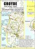
Brixton and Herne Hill in 1894 in a fascinating series of reproductions of old Ordnance Survey plans in the Alan Godfrey Editions, ideal for anyone interested in the history of their neighbourhood or family. Three versions for this area have been published, stretching from Branksome Road and Strathleven Road eastward to Beckwith Road, and from Pulross Road and Brixton station southward to Brixton prison. The left half of the map covers Brixton, with Brixton Hill running north-south; further east is Herne Hill, and Herne Hill itself runs northward through the map, lined with villas. Also crossing the map are railways, with Herne Hill station near the foot. Other features include Helix Gardens, Effra Road, Atlantic Road, Mayall Road, Railton Road, Coldharbour Lane, Loughborough
Park, St Matthew`s church, Brixton Hall, Lambeth Water Works, beer bottling works, Lowden Road, Brockwell Hall, north part of Brockwell Park, St Jude`s church, Casino House, and Loughborough Park station. The prison is blank on 1894 map but shown on 1870 version. The maps have directory extracts on the reverse; 1894 map has street entries for Atlantic Road, The Avenue, Brixton Hill, Railton Road; 1913 version has street directory entries for Acre Lane, Coldharbour Lane, Effra Road, Fawnbrake Avenue, Railton Road. About the Alan Godfrey Editions of the 25” OS Series:Selected towns in Great Britain and Ireland are covered by maps showing the extent of urban development in the last decades of the 19th and early 20th century. The plans have been taken from the Ordnance
Survey mapping and reprinted at about 15 inches to one mile (1:4, 340). On the reverse most maps have historical notes and many also include extracts from contemporary directories. Most maps cover about one mile (1.6kms) north/south, one and a half miles (2.4kms) across; adjoining sheets can be combined to provide wider coverage.FOR MORE INFORMATION AND A COMPLETE LIST OF ALL AVAILABLE TITLES PLEASE CLICK ON THE SERIES LINK.
RIP - This product is no longer available on our network. It was last seen on 25.09.2019

This page now acts as a permanent archive for this product. Add more information using the comments box below to ensure it can still be found by future generations.

Use our search facility to see if it is available from an alternative contributor.
  • Availability: Out Of Stock
  • Supplier: Stanfords
  • SKU: 9781847847980
Availability: In Stock
£3.50

Product Description

Brixton & Herne Hill in 1894 in a fascinating series of reproductions of old Ordnance Survey plans in the Alan Godfrey Editions, ideal for anyone interested in the history of their neighbourhood or family. Three versions for this area have been published, stretching from Branksome Road & Strathleven Road eastward to Beckwith Road, & from Pulross Road & Brixton station southward to Brixton prison. The left half of the map covers Brixton, with Brixton Hill running north-south; further east is Herne Hill, & Herne Hill itself runs northward through the map, lined with villas. Also crossing the map are railways, with Herne Hill station near the foot. Other features include Helix Gardens, Effra Road, Atlantic Road, Mayall Road, Railton Road, Coldharbour Lane, Loughborough Park, St Matthew`s church, Brixton Hall, Lambeth Water Works, beer bottling works, Lowden Road, Brockwell Hall, north part of Brockwell Park, St Jude`s church, Casino House, & Loughborough Park station. The prison is blank on 1894 map but shown on 1870 version. The maps have directory extracts on the reverse; 1894 map has street entries for Atlantic Road, The Avenue, Brixton Hill, Railton Road; 1913 version has street directory entries for Acre Lane, Coldharbour Lane, Effra Road, Fawnbrake Avenue, Railton Road. About the Alan Godfrey Editions of the 25” OS Series: Selected towns in Great Britain & Ireland are covered by maps showing the extent of urban development in the last decades of the 19th & early 20th century. The plans have been taken from the Ordnance Survey mapping & reprinted at about 15 inches to one mile (1:4, 340). On the reverse most maps have historical notes & many also include extracts from contemporary directories. Most maps cover about one mile (1.6kms) north/south, one & a half miles (2.4kms) across; adjoining sheets can be combined to provide wider coverage.FOR MORE INFORMATION & A COMPLETE LIST OF ALL AVAILABLE TITLES PLEASE CLICK ON THE SERIES LINK.

Reviews/Comments

Add New

Intelligent Comparison

Oooops!
We couldn't find anything!
Perhaps this product's unique.... Or perhaps we are still looking for comparisons!
Click to bump this page and we'll hurry up.

Price History

Vouchers

No voucher codes found.
Do you know a voucher code for this product or supplier? Add it to Insights for others to use.

Facebook

Jargon Buster

Contemporary - Modern era design
Contemporary - A design reference to indicate post war modern design
Foot - A part of the body at the bottom end of the leg
Foot - or Feet - a measurement equivilent to 30cm
water - A chemical substance. Chemical formula H2O.
History - Anything that happens in the past. An acedemic subject.
Railways - A set of tracks that have been laid for the purpose of trains to travel up and down them
running - A sport or hobbie of moving rapidly on foot. Can also refer to the running of equipment or run time refering to the length of time an applicance can run or the quiet running of an applicance.
Road - a manmade lane or a path that is used to speed up travel.
Contemporary - An object that is living in the same time.
Hall - A room at the inside of an entrance of a house.
Ideal - Something that satisfies a perfect criteria.
Family - A group of people that live together made up from parents and children.

Supplier Information

Stanfords
Stanfords was established in 1853 and opened their iconic Covent Garden flagship store in 1901. They have become the top retailer of maps, travel books and accessories in the UK and arguably offer the largest selection of maps and travel books worldwide. Famous names such as Captain Robert Falcon Scott, Ranulph Fiennes and Michael Palin have purchased from Stanfords. They now have a shop in Bristol and both stores together with other venues operate a calendar of events including talks, book signings and exhibitions. As a specialist map retailer, the map selection is comprehensive and includes road maps, street maps and walking maps from worldwide destinations, as well as a selection of world atlases and wall maps. Books include travel guides and travel literature. Stanfords also stock globes, from miniatures made of blue marble to magnificent floor-standing globes. The website features a selection of interesting articles on travel topics.
Page Updated: 2023-11-12 20:15:36

Community Generated Product Tags

Oh No! The productWIKI community hasn't generated any tags for this product yet!
Menu