More From Contributor
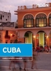
£4.79
Cuba at 1:850, 000 on an indexed road map with topographic & tourist information, printed on light, waterproof & tear-resistant plastic paper. The map, published by Rough Guides with cartography from the highly acclaimed World Mapping Project by the German publishers Reise Know-How, is double-sided to provide the best balance between a good scale & a convenient size sheet. The map divides Cuba east/west with a very generous overlap between the sides. Altitude colouring with contours & peak heights presents the country ...
Archived Product
£11.99
Cuba in the Countries, Regions & Cities series from Rough Guides; comprehensively detailed guidebooks specifically designed for independent travellers & serving a range of worldwide destinations. Widely recognised for their free editorial style, Rough Guide authors are allowed to express their personal opinions on a range of subjects. Although sometimes controversial, this editorial stance allows readers to experience more detailed & personal takes on each destination, a feature often more limited in other guidebooks. Cultural & historical nuances are explored in significant depth throughout the text & descriptions on the ambience of individual settings alongside personal recommendations, particularly in cities, are notably prevalent. Each Rough Guide in the Countries, Regions & Cities series has a similar layout. A ...
Archived Product
£15.95
A detailed, colour survey map from the Portuguese Military Survey's M782 series. Each map in this series has contours at 20m intervals with supplementary contours at 10m intervals. One major advantage the military mapping has over the civilian equivalent is that the legend is in English as well as Portuguese. This legend

Includes::
roads, railways, buildings, spot heights, vegetation type, fluvial information, scree, dunes, churches, ruins, etc. Latitude & longitude ticks are show at 10' intervals. Recently revised sheets also have a UTM grid at 100m intervals. Vertical Datum: Mean Sea Level at Cascais Harbour Projection: Transverse Mercator

...
Archived Product
£5.99
Cuba on an indexed road map from Michelin with on the reverse three street plans of Havana: the city centre & Old Havana with an additional enlargement for its central part, plus street plans of central Santiago de Cuba & Trinidad. The map shows the whole island on one side at a good scale of 1:800, 000 with very clear presentation of its road network which

Includes::
selected unsurfaced local tracks. Driving distances are marked on main routes & selected smaller roads. Topography is indicated by subtle relief shading & colouring and/or graphics for woodlands, swamps & mangrove, & names of mountain ranges, peaks, etc. National parks & other protected areas are highlighted. Symbols indicate various places of interest including campsites, UNESCO World Heritage sites, beaches, diving & snorkelling spots, etc. The map has latitude & longitude lines at 30

...
Archived Product
£14.99
Trapped in a time-warp, Cuba is like a prince in a poor man s coat. Behind the sometimes shabby facades, gold dust still lingers. Brendan Sainsbury, Lonely Planet Writer Getting you to the heart of a place. Amazing experiences Inspirational images, 3D illustrations, city walks & the best of local knowledge. Plan the perfect trip. Planning features & top itineraries give you the freedom to create your ideal trip. Find hidden travel gems. Our authors uncover local secrets that will make your trip unique. Special Features Color Havana walking tour Architecture photo essay Outdoor adventure guide Essays on the arts & music. We tell it like it is. Our job is to make amazing travel experiences happen. We visit the places we write about each & every edition. We never take freebies for positive coverage, so you can always rely on us to tell it like it is. ...
Archived Product
£17.99
Topographic survey of Portugal at 1:50, 000 from the Instituto Geográfico do Exército, the country’s military survey organisation. The maps have contours at 20m intervals & in addition to the standard features shown on topographic mapping at this scale also indicate various types of terrain or vegetation (s&, terraces, rocks, woodlands, vineyards, etc). Each sheet covers an area of 32 x 20km (20 x 12.5 miles approx). The maps have a 1-km UTM grid plus latitude & longitude coordinates for the map corners. Map legend & a glossary of terms used on the maps include English.EDITION DATES: most titles in this series date from 1990s or later. To see all the titles in this series please click on the series link. ...
Archived Product
£19.95
Cuba is a photographic collection of images in visual celebration of the sights, sounds, flavours & faces of the isl&. Images are produced by Pierre Hausherr & supporting text by Francois Missen. Cuba’s scenery, landscapes, cityscapes & seascapes, as well as its people in the bustling streets of Havana, the verdant inland countryside & the fishing communities which dot the coastline, are showcased on every page. ...
Archived Product
£16.99
In 2014, the United States began re-establishing diplomatic relations with Cuba. For the first time in decades, every U.S. citizen can now travel to this eccentric, enigmatic isl&. In this book, renowned Cuba expert Christopher P. Baker tells you everything you need to know to make this trip possible. Choose the best guides, tours, & means of transportation Join in the cultural feast in Havana, a city like no other Experience the best beaches, natural wonders, & scenic drives Appreciate the island`s history, from its indigenous origins through the revolution Find the ultimate mementos--authentic Cuban cigars & rum ...
Archived Product
£17.99
Topographic survey of Portugal at 1:50, 000 from the Instituto Geográfico Português, the country’s civilian survey organisation. The maps have contours at 25m intervals & in addition to the standard features shown on topographic mapping at this scale also indicate various types of vegetation (vineyards, olive groves, etc). Each sheet covers an area of 32 x 20km (20 x 12.5miles approx). The maps have latitude & longitude margin ticks at 1’ intervals & UTM coordinates for the map corners – each sheet also shows conversion details from BBLx (Bessel-Bonnie system, Datum Lisbon) to UTM. Map legend is in Portuguese only.EDITION DATES: most titles in this series have now been updated in the 1990s or later. To see all the titles in this series please click on the series link. ...
Archived Product
£12.99
Special features include rhythm & booze
- the best Casa de la Trova to pickup the latest sounds; cycling trips; Havana
- cadilacs

...
Archived Product

Cuba

This superb full-colour, illustrated guide features 3D laminated cut-outs to show you the key sights in perspective and a large, fully-indexed, pull-out map. Additional detailed maps and plans can also be found throughout the guide, clearly pin-pointing the best places to stay and the top places to eat and drink. At the heart of the guide is a wealth of comprehensive information written by experts on the sights and top attractions, in an easy-to-read A-Z format. Also included are great, practical travel tips covering accommodation and food and drink for all budgets, entertainment, sport, transport and health; not to mention some insider tips for saving money or having a unique travel experience. There is also a variety of recommended tours covering the best routes available, to
ensure you get the most from your destination. The plastic wallet allows you to keep the guide and map together and ensures that both will survive in all weather. Baedeker - setting a new standard in 21st century, travel guide publishing.
RIP - This product is no longer available on our network. It was last seen on 25.09.2019

This page now acts as a permanent archive for this product. Add more information using the comments box below to ensure it can still be found by future generations.

Use our search facility to see if it is available from an alternative contributor.
  • Availability: Out Of Stock
  • Supplier: Stanfords
  • SKU: 9783829766210
Availability: In Stock
£14.99

Product Description

This superb full-colour, illustrated guide features 3D laminated cut-outs to show you the key sights in perspective & a large, fully-indexed, pull-out map. Additional detailed maps & plans can also be found throughout the guide, clearly pin-pointing the best places to stay & the top places to eat & drink. At the heart of the guide is a wealth of comprehensive information written by experts on the sights & top attractions, in an easy-to-read A-Z format. Also included are great, practical travel tips covering accommodation & food & drink for all budgets, entertainment, sport, transport & health; not to mention some insider tips for saving money or having a unique travel experience. There is also a variety of recommended tours covering the best routes available, to ensure you get the most from your destination. The plastic wallet means that you can keep the guide & map together & ensures that both will survive in all weather. Baedeker
- setting a new standard in 21st century, travel guide publishing.

Reviews/Comments

Add New

Intelligent Comparison

Oooops!
We couldn't find anything!
Perhaps this product's unique.... Or perhaps we are still looking for comparisons!
Click to bump this page and we'll hurry up.

Price History

Vouchers

No voucher codes found.
Do you know a voucher code for this product or supplier? Add it to Insights for others to use.

Facebook

Jargon Buster

Plastic - A generic term for a synthetic product used in the manufacture of products
Key - A physical or virtual device or code used for opening something
Entertainment - Something that provides amusement
Colour - The categorised spectrum of light visable to humans
Weather - is the change of an atmospheres conditions.
Heart - An organ that pumps blood around the body. Usually related to love.
Large - something that takes up more space than normal.
Accommodation - A room in which someone can live in, for example in a hotel
Practical - Weather a task is easy to carry out and realistically succeed.
Experience - To gain further knowledge by practising.
Laminated - A thin layer of plastic that gives a coating and shine to a material.
Transport - Something that carries people or goods.

Supplier Information

Stanfords
Stanfords was established in 1853 and opened their iconic Covent Garden flagship store in 1901. They have become the top retailer of maps, travel books and accessories in the UK and arguably offer the largest selection of maps and travel books worldwide. Famous names such as Captain Robert Falcon Scott, Ranulph Fiennes and Michael Palin have purchased from Stanfords. They now have a shop in Bristol and both stores together with other venues operate a calendar of events including talks, book signings and exhibitions. As a specialist map retailer, the map selection is comprehensive and includes road maps, street maps and walking maps from worldwide destinations, as well as a selection of world atlases and wall maps. Books include travel guides and travel literature. Stanfords also stock globes, from miniatures made of blue marble to magnificent floor-standing globes. The website features a selection of interesting articles on travel topics.
Page Updated: 2023-11-12 20:15:36

Community Generated Product Tags

Oh No! The productWIKI community hasn't generated any tags for this product yet!
Menu