More From Contributor
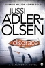
£29.00
In the seventeenth century, a map of the plague suggested a radical idea-that the disease was carried & spread by humans. In the nineteenth century, maps of cholera cases were used to prove its waterborne nature. More recently, maps charting the swine flu pandemic caused worldwide panic & sent shockwaves through the medical community. In ” Disease Maps”, Tom Koch contends that to understand epidemics & their history we need to think about maps of varying scale, from the individual body to shared symptoms evidenced across cities, nations, & the world. ” Disease Maps” begins with a brief review of epidemic mapping today & a detailed example of its power. Koch then traces the early history of medical cartography, including pandemics such as European plague & yellow fever, & the advancements in anatomy, printing, & world atlases that paved the way for their mapping. Moving on to the scourge of the nineteenth century-cholera-Koch considers the many choleras argued into existence by the maps of the day, including a new perspective on John Snow`s science & legacy. Finally, Koch addresses contemporary outbreaks such as AIDS, cancer, & H1N1, & reaches into the future, toward the coming epidemics. Ultimately, ” Disease Maps” redefines conventional medical history with new surgical precision, revealing that only in maps do patterns emerge that allow disease theories to be proposed, hypotheses tested, & treatments advanced. ...
Archived Product
£12.99
Disentis/ Mustér, map No. 256, in the standard topographic survey of Switzerland at 1:50, 000 from Swisstopo, i.e. without the special overprint highlighting walking trails, local bus stops, etc, presented in Swisstopo’s hiking editions of the 50K survey. Highly regarded for their superb use of graphic relief & hill shading, the maps give an almost 3-D picture of Switzerland`s mountainous terrain. Contours are at 20m intervals. All the maps have a 1-km grid with the Swiss national coordinates. This standard version of the 50K survey covers the whole country on 78 small format sheets, with special larger format maps published for several popular tourist destinations. Small format sheets cover an area of 35 x 24 km (21 x 15 miles approx) & have map legend in the language of the area covered by the map. The special larger sheets cover 50 x 35 km (31 x 22 miles approx) & have no map legend, but a separate leaflet can be provided instead.PLEASE NOTE: the hiking editions of the 1:50, 000 Swisstopo survey are listed on our website in a separate series. ...
Archived Product
£18.99
Disentis/ Mustér area, map No. 256T, at 1:50, 000 in a special hiking edition of the country’s topographic survey, published by Swisstopo in cooperation with the Swiss Hiking Federation. Cartography, identical to the standard version of the survey, is highly regarded for its superb use of graphic relief & hill shading to provide an almost 3-D picture of Switzerland`s mountainous terrain. Contours are at 20m intervals. An overprint highlights routes maintained by the SHF, distinguishing between hiking routes, mountain routes requiring proper footwear, & alpine routes where equipment is needed. Paths which are part of the national or regional network of long-distance hiking routes are specially marked & in the more recent editions are annotated with their official numbers. The maps show mountain huts, refuges & in remote areas also inns, plus roads with bus service & the positions of bus stops. All the maps have a 1-km grid of the Swiss national coordinates. For a list of all the titles in this series, please click on the series link. ...
Archived Product
£22.99
Detailed ski map at 1:50, 000 from Swisstopo, the country’s national survey organization, showing routes for skiing and/or snowboarding, access by public transport, recommended itineraries, lists of mountain huts, etc. The series uses the cartography of Switzerland’s topographic survey, with additional colouring to show slopes steeper than 30°. An overprint highlights ski routes, indicating suggested direction, difficult passages & sections which must be covered on foot. Also marked are areas where it is forbidden to leave the routes shown on the map. The maps also highlight roads with bus routes, indicating individual bus stops, show ski lifts & funiculars, plus mark locations of refuges or other mountain accommodation. Each title has the Swiss national grid at intervals of 1km, plus latitude & longitude margin ticks at 1’. Some titles cover a larger area, with a part of an adjoining sheet printed on the reverse of the main map as indicated on our series grid. Where appropriate, ski information extends across the border to France & Italy. On the reverse are itineraries of routes recommended by the Swiss Alpine Club, indicating the degree of difficulty, plus lists of alpine huts with contact details. Map legend for the overprint

Includes::
English. The text about the routes & accommodation is in the main language of the area covered by the map. To see the list of all the titles in this series please click on the series link.

...
Archived Product
£22.99
The best rides in the freeride hot spots of the Alps – this is the simple formula of the Freeride Maps. The first map available to freeriders is making the locals freeride knowledge available to a broad public. All ridable slopes, drops & couloirs are marked as freeride corridors in different colours for three difficulty ratings: blue for technically easy terrain, yellow requires advanced to very advanced ability & red is extremely difficult terrain that is partially exposed & therefore reserved to crack riders. Short ascents are marked with red lines. The Freeride Maps are based on topographic maps 1:25, 000. They contain all essential information about the terrain that is necessary for planning & going freeriding. The maps are printed on water resistant & indestructible paper. On the back side, the maps include all relevant planning, safety & rescue information. ...
Archived Product
£7.99
David Lurie, a middle-aged divorcee lecturing at the Technical University of Cape Town, has an impulsive affair with a student. When the passion sours & he is denounced, he resigns & retreats to his daughter Lucy's isolated smallholding. For a time, he finds calm in the routine of farm life, but the balance of power in the country is shifting. When he & Lucy become victims of a savage & disturbing attack, all the faultlines in their relationship are revealed. ...
Archived Product
£7.99
Jussi Adler-Olsen`s Disgrace is the stunning follow up to Top Ten bestseller Mercy. Kimmie`s home is on the streets of Copenhagen. ...
Archived Product
£8.99
Disgrace by J M Coetzee takes as its complex central character 52-year-old English professor David Lurie, whose preoccupation with Romantic poetry
- & romancing his students
- threatens to turn him into “a moral dinosaur.” When called to account, David refuses to apologise to the university for a brief affair with a student, drawing on poetry before political correctness. He seeks refuge with his quietly progressive daughter Lucie on her isolated small holding but cannot escape the violent dilemmas of the new South Africa. The tentative emotional truce between daughter & father is broken when a traumatic event forces Lucie to an appalling disgrace. Called to account by the university for a passionate but brief affair with a student who is ambivalent about his embraces, David refuses to apologise, drawing on poetry before what he regards as political correctness in his claim that his ”case rests on the rights of desire.” Seeking refuge with his quietly progressive daughter Lucie on her isolated small holding, David finds that the violent dilemmas of the new South Africa are inescapable when the tentative emotional truce between errant father & daughter is ripped apart by a traumatic event that forces Lucie to an appalling disgrace. Disgrace is, above all, a novel about accountability, about individual dilemmas against the backdrop of a changing society that become a metaphor for historical accountability or its lack.

...
Archived Product
£22.99
Disko Bay at 1:370, 000 in a series of 12 topographic maps from Saga of the coastal regions of Greenland at 1:500, 000, with coverage of the central part of the western coast also available on two special sheets at 1:370, 000. Both scales have the same cartography as the publisher’s 1:250, 000 series but reduced to provide a wider coverage per sheet. The reduction means that some place names, symbols & fine detail are harder to read than on maps in the original 1:250, 000 series. Relief is shown by contours at 50m intervals, augmented by frequent spot heights. Main peaks are named, along with many other physical features e.g. bays & islands. Glaciers, moraine & low-lying coastal plains are also indicated & contours continue for a limited extent into the icecap region. The maps show settlements, roads, airstrips & heliports, anchorages & selected other landmarks. Lines of longitude & latitude are drawn at 1° & 15` intervals respectively. Map legend is provided in a separate leaflet. ...
Archived Product
£3.50
Disley in 1907 in a fascinating series of reproductions of old Ordnance Survey plans in the Alan Godfrey Editions, ideal for anyone interested in the history of their neighbourhood or family. The map covers Disley & the area south & west. The village of Disley, including St Mary`s church & station, is in the top right corner. Other features include Stockport Reservoir, Cockhead, Disleybank Wood, Elmerhurst Wood, Middlecale Wood, a stretch of the LNWR railway, etc. On the reverse are Disley directories for 1907 & 1914. About the Alan Godfrey Editions of the 25” OS Series: Selected towns in Great Britain & Ireland are covered by maps showing the extent of urban development in the last decades of the 19th & early 20th century. The plans have been taken from the Ordnance Survey mapping & reprinted at about 15 inches to one mile (1:4, 340). On the reverse most maps have historical notes & many also include extracts from contemporary directories. Most maps cover about one mile (1.6kms) north/south, one & a half miles (2.4kms) across; adjoining sheets can be combined to provide wider coverage.FOR MORE INFORMATION & A COMPLETE LIST OF ALL AVAILABLE TITLES PLEASE CLICK ON THE SERIES LINK. ...
Archived Product

Disgrace

Kimmie's home is on the streets of Copenhagen. To live she must steal. She has learned to avoid the police and never to stay in one place for long. But now others are trying to find her. And they won't rest until she has stopped moving - for good. Detective Carl Morck of Department Q, the cold cases division, has received a file concerning the brutal murder of a brother and sister twenty years earlier. A group of boarding school students were the suspects at the time - until one of their numbers confessed and was convicted. So why is the file of a closed case on Carl's desk? Who put it there? Who believes the case is not solved? A police detective wants to talk to Kimmie and someone else is asking questions about her. They know she carries secrets certain powerful people want to stay
buried deep. But Kimmie has one of her own. It's the biggest secret of them all. And she can't wait to share it with them...Jussi Adler-Olsen was born in Copenhagen and worked as a magazine editor and publisher before starting to write fiction. Mercy is the first of four novels in the Department Q series. He holds the prestigious Glass Key Award, given annually for a crime novel by a Scandinavian author, and is also winner of the Golden Laurels, Denmark's highest literary accolade.
RIP - This product is no longer available on our network. It was last seen on 25.09.2019

This page now acts as a permanent archive for this product. Add more information using the comments box below to ensure it can still be found by future generations.

Use our search facility to see if it is available from an alternative contributor.
  • Availability: Out Of Stock
  • Supplier: Stanfords
  • SKU: 9780141399980
Availability: In Stock
£7.99

Product Description

Kimmie's home is on the streets of Copenhagen. To live she must steal. She has learned to avoid the police & never to stay in one place for long. But now others are trying to find her. & they won't rest until she has stopped moving
- for good. Detective Carl Morck of Department Q, the cold cases division, has received a file concerning the brutal murder of a brother & sister twenty years earlier. A group of boarding school students were the suspects at the time
- until one of their numbers confessed & was convicted. So why is the file of a closed case on Carl's desk? Who put it there? Who believes the case is not solved? A police detective wants to talk to Kimmie & someone else is asking questions about her. They know she carries secrets certain powerful people want to stay buried deep. But Kimmie has one of her own. It's the biggest secret of them all. & she can't wait to share it with them... Jussi Adler-Olsen was born in Copenhagen & worked as a magazine editor & publisher before starting to write fiction. Mercy is the first of four novels in the Department Q series. He holds the prestigious Glass Key Award, given annually for a crime novel by a Scandinavian author, & is also winner of the Golden Laurels, Denmark's highest literary accolade.

Reviews/Comments

Add New

Intelligent Comparison

Oooops!
We couldn't find anything!
Perhaps this product's unique.... Or perhaps we are still looking for comparisons!
Click to bump this page and we'll hurry up.

Price History

Vouchers

No voucher codes found.
Do you know a voucher code for this product or supplier? Add it to Insights for others to use.

Facebook

Jargon Buster

Glass - A solid, typically transparent. Brittle and used in windows. The first patent granted in the UK was for Glass.
Students - A group of humans who are still in full time education
police - Persons empowered to reduce civil disorder and enforce the law.
Denmark - A country in Scandinavia, Northern Europe.
Key - A physical or virtual device or code used for opening something
Desk - A piece of furniture often used in and office for writing or computer use
Home - A place of permanent residence for families.

Supplier Information

Stanfords
Stanfords was established in 1853 and opened their iconic Covent Garden flagship store in 1901. They have become the top retailer of maps, travel books and accessories in the UK and arguably offer the largest selection of maps and travel books worldwide. Famous names such as Captain Robert Falcon Scott, Ranulph Fiennes and Michael Palin have purchased from Stanfords. They now have a shop in Bristol and both stores together with other venues operate a calendar of events including talks, book signings and exhibitions. As a specialist map retailer, the map selection is comprehensive and includes road maps, street maps and walking maps from worldwide destinations, as well as a selection of world atlases and wall maps. Books include travel guides and travel literature. Stanfords also stock globes, from miniatures made of blue marble to magnificent floor-standing globes. The website features a selection of interesting articles on travel topics.
Page Updated: 2023-11-12 20:15:36

Community Generated Product Tags

Oh No! The productWIKI community hasn't generated any tags for this product yet!
Menu