
 United Kingdom
 France
 Germany
 Netherlands
 Sweden
 USA
USA
 Italy
Italy
 Spain
Spain
More From Contributor


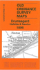


Droylsden And Medlock Vale 1906
Droylsden and Medlock Vale in 1906 in a fascinating series of reproductions of old Ordnance Survey plans in the Alan Godfrey Editions, ideal for anyone interested in the history of their neighbourhood or family. Selected towns in Great Britain and Ireland are covered by maps showing the extent of urban development in the last decades of the 19th and early 20th century.In this title: the map covers the northern part of Droylsden, north-east of Manchester; coverage stretches from Baguley Street Droylsden northward to Medlock Vale. Much of the map is semi-rural, but features include Droylsden station, Bee Hive Works, Albion Mill, Oakfield Mill, Daub Hole, Royal Mill, Droylsden cemetery, Lumb Farm, Lumb Mill, Cinderland Hall, Greenside, Clayton Bridge Dyeing Works (at left
margin), Medlock Vale Works etc. On the reverse are street directory entries for Greenside Lane, Market Street, Medlock Street and Moorside Street. About the Alan Godfrey Editions of the 25
margin), Medlock Vale Works etc. On the reverse are street directory entries for Greenside Lane, Market Street, Medlock Street and Moorside Street. About the Alan Godfrey Editions of the 25

Product Description
Reviews/Comments
Add New
Intelligent Comparison
Archived Product
Droylsden And Medlock Vale 1906 Stanfords
£3.50
Vouchers
No voucher codes found.
Do you know a voucher code for this product or supplier? Add it to Insights for others to use.
Do you know a voucher code for this product or supplier? Add it to Insights for others to use.
 Denmark