More From Contributor

£4.99
A quiet night`s sleep is never far away with these super soft ear plugs. Made from flexible memory foam they can be quickly & easily rolled to fit the ear canal, yet they return to their original shape when not in use. Fully reusable & comfy to wear, these foam ear plugs are supplied with a convenient travel carry case ensuring they stay 100% hygienic at all times.3 pairs per pack. ...
Archived Product
£6.99
Wherever you are
- at home, at work or on the move
- feel completely free to lose yourself in a world of blissful hush. Engineered

...
Archived Product
£3.50
Earlestown North in 1910 in a fascinating series of reproductions of old Ordnance Survey plans in the Alan Godfrey Editions, ideal for anyone interested in the history of their neighbourhood or family. The map covers the northern part of Earlestown & southern part of Haydock. Coverage stretches from Haydock Green southward to St John Street & Hotel Street, Earlestown. Features include Earlestown Town Hall, St John the Baptist church, Crow Lane Farm, Haydock Colliery Railway, Newton Race Course (disused), Lyme Pits (disused), Wood Pit Colliery, Haydock Colliery Engine & Wagon Shops, Haydock Green, pumping station, etc. On the reverse is a 1918 directory of Earlestown. About the Alan Godfrey Editions of the 25” OS Series: Selected towns in Great Britain & Ireland are covered by maps showing the extent of urban development in the last decades of the 19th & early 20th century. The plans have been taken from the Ordnance Survey mapping & reprinted at about 15 inches to one mile (1:4, 340). On the reverse most maps have historical notes & many also include extracts from contemporary directories. Most maps cover about one mile (1.6kms) north/south, one & a half miles (2.4kms) across; adjoining sheets can be combined to provide wider coverage.FOR MORE INFORMATION & A COMPLETE LIST OF ALL AVAILABLE TITLES PLEASE CLICK ON THE SERIES LINK. ...
Archived Product
£2.95
Earlestown South in 1891 in a fascinating series of reproductions of old Ordnance Survey plans in the Alan Godfrey Editions, ideal for anyone interested in the history of their neighbourhood or family. Selected towns in Great Britain & Ireland are covered by maps showing the extent of urban development in the last decades of the 19th & early 20th century. In this title: the map covers the southern part of Earlestown, extending westward to Collins Green. Features include Viaduct wagon works, St Helens Canal, Sankey Sugar Works, Vitrioal Square, Collins Green, Collins Green Colliery, LNWR railway with Collins Green station, Sankey Viaduct, Penkford Bridge, Bradley Hall, Haydock Crossing, Earle Street area, King Street area, Newton Common etc. On the reverse is a small Collins Green directory plus a Liverpool-Earlestown-Manchester railway timetable for 1897. About the Alan Godfrey Editions of the 25 ...
Archived Product
£3.50
Earlestown South in 1891 in a fascinating series of reproductions of old Ordnance Survey plans in the Alan Godfrey Editions, ideal for anyone interested in the history of their neighbourhood or family. Two versions have been published to this area. The maps cover the southern part of Earlestown, extending westward to Collins Green. Features include Viaduct wagon works, St Helens Canal, Sankey Sugar Works, Vitrioal Square, Collins Green, Collins Green Colliery, LNWR railway with Collins Green station, part of Earlestown station, Sankey Viaduct, Penkford Bridge, Bradley Hall, Haydock Crossing, Earle Street area, King Street area, Newton Common, etc. On the reverse are Liverpool-Earlestown-Manchester railway timetables for 1897. About the Alan Godfrey Editions of the 25” OS Series: Selected towns in Great Britain & Ireland are covered by maps showing the extent of urban development in the last decades of the 19th & early 20th century. The plans have been taken from the Ordnance Survey mapping & reprinted at about 15 inches to one mile (1:4, 340). On the reverse most maps have historical notes & many also include extracts from contemporary directories. Most maps cover about one mile (1.6kms) north/south, one & a half miles (2.4kms) across; adjoining sheets can be combined to provide wider coverage.FOR MORE INFORMATION & A COMPLETE LIST OF ALL AVAILABLE TITLES PLEASE CLICK ON THE SERIES LINK. ...
Archived Product
£3.50
Earlsheaton in 1905 in a fascinating series of reproductions of old Ordnance Survey plans in the Alan Godfrey Editions, ideal for anyone interested in the history of their neighbourhood or family. The map covers the eastern part of Dewsbury, centred on the village of Earlsheaton, & part of the village of Gawthorpe north-west of Ossett. Features include Chickenley, Chickenley Heath, Soothill Nether Cemtery, GNR Ossett & Dewsbury branch with Earlsheaton station, GNR Chickenley Heath branch with Chickenley Heath station, Ridings Colliery, Hoyle Head Mills, Little Royd Mills, Providence Mill, Jilling Ing Mills, Pildacre Mills, Pildacre Colliery, Savile Colliery, Bant Top Colliery (disused), Earlsheaton Hall, Syke Ing Mill, Bank Top Mill, Royds Mills, St Mary`s church, Greengates Mills, etc. On the reverse are directories of Earls Heaton, Gawthorpe & Ossett Street in 1889. About the Alan Godfrey Editions of the 25” OS Series: Selected towns in Great Britain & Ireland are covered by maps showing the extent of urban development in the last decades of the 19th & early 20th century. The plans have been taken from the Ordnance Survey mapping & reprinted at about 15 inches to one mile (1:4, 340). On the reverse most maps have historical notes & many also include extracts from contemporary directories. Most maps cover about one mile (1.6kms) north/south, one & a half miles (2.4kms) across; adjoining sheets can be combined to provide wider coverage.FOR MORE INFORMATION & A COMPLETE LIST OF ALL AVAILABLE TITLES PLEASE CLICK ON THE SERIES LINK. ...
Archived Product
£54.95
Fully illuminated, the 26cm (11) Early Explorer globe displays almost 3000 place names; this model

Includes::


...
Archived Product
£60.00
Our understanding of the British Palaeolithic & Mesolithic has changed dramatically over the last three decades, & yet not since H. J. Fleure`s A Natural History of Man in Britain (1951) has the New Naturalist Library included a volume focused on the study of early humans & their environment. In this long overdue new book, distinguished archaeologist Nick Ashton uncovers the most recent findings, following the remarkable survival & discovery of bones, stone tools & footprints which allow us to paint a picture of the first human visitors to this remote peninsula of north-west Europe. As part of the Ancient Human Occupation of Britain project & subsequent research, Ashton is involved in an unrivalled collaborative effort involving archaeologists, palaeontologists, & earth scientists at different British institutes, including the Natural History Museum & the British Museum. Using an interdisciplinary approach, the book explores the latest discoveries such as footprints at Happisburgh, Norfolk that are thought to be nearly one million years old, flint artefacts at Pakefield in Suffolk & mammoth remains at West Runton, among others. These remarkable remnants help our quest to unravel the interactions between the changing environments & their ancient human occupants, as well as their lifestyles & migrations. Early humans colonised our remote corner of the European mainland time & again, despite being faced with ice age climates with far-reaching consequences. Setting the scene on the Norfolk coast almost a million years ago, Ashton tells the story of the fauna, flora & developing geography of Britain against the backdrop of an ever-changing climate. Above all, he explores how early people began as brief visitors to this wild remote l&, but over time through better ways of acquiring food & developing new technologies, they began to tame, shape & dominate the countryside we see today. ...
Archived Product
£19.95
This book describes the emergence of the Buddhist landscapes of Myanmar. The authoritative text is framed by the artefacts, sites & ecology of Upper & Lower Myanmar, with coverage of the Paleolithic, Neolithic, Bronze-iron chiefdoms that preceded Hindu-Buddhist walled polities of the first millennium AD. Views & descriptions of sites, many not published in English before, include Letpanchibaw, Htaukmagon, Moegyobyin, Badigon, Tagaung, Halin, Sriksetra, Thaton & Dawei. The author`s extensive fieldwork with Myanmar academics over the last decade brings an original perspective on the catalysts that structure landscape interaction, enabling expansion of agriculture, resource utilization & international trade networks. While the book`s primary focus is the archaeology of Myanmar, this is linked to Yunnan, Thail&, Malaysia, Indonesia & South Asia. The central theme, however, remains the relationship between man & the environment; flexibility was the norm as seasons changed, rivers meandered & seasonal lakes formed, creating the shallow flooded terrain conducive to the early development of wet-rice cultivation, bronze-iron technology & brickwalled sites. Social changes later accelerated with the rise of the state but the author concludes that the most profound transformations were already in place in the first millennium AD landscape of Upper & Lower Myanmar. Profusely illustrated with site plans, site views, maps & artefacts, this book is aimed at encouraging research into the many new areas thrown up by its ground-breaking text. ...
Archived Product
£14.99
Take a journey back to the uncharted oceans with the most celebrated European explorers! Interest in Southeast Asian history & culture is higher than ever before. Ancient cartography of Oceania holds mysteries as old as time-were these early ocean maps molded as much by fantasy as fact? Early Mapping of the Pacific bravely delves into all the questions surrounding the history of maps. The Pacific Ocean remained a mystery to mapmakers until the latter part of the eighteenth century. This book traces the European exploration & charting of the vast ocean through a cornucopia of beautiful maps stretching from Japan on the northwest, through Juan Fernandez Island on the southeast, with the various islands of Oceania the primary focus. It follows the history of mapmaking from Classical times up to the turn of the twentieth century. The ancient seafarers who ventured eastward from Asia, & were the Pacific`s true pioneers, left no maps. They still helped make cartography history, thanks to the navigational genius their descendants passed to European visitors. Thus, the Pacific as we now know it was formally born when the colonization of America partitioned the seas between Europe & Asia into two. This gorgeous edition presents nearly 300 rare Asia maps & early prints, compiled by expert Thomas Suarez. Topics addressed include: The Pacific Islands & Their People Mariners, Mapmakers & the Great Ocean The Pacific Evolves after Magellan In the Wake of the Solomon Islands Earliest Mapping of Australia & New Zealand The Age of Enlightenment The Three Voyages of James Cook The Discovery of Tahiti & Hawaii Micronesia, the Elusive Isles Surveyors, Whalers, & Missionaries You, too, can share in the wonder of these explorers` vast geographical & cultural discoveries, & the voyages that led to them, in this comprehensive cartography book. ...
Archived Product

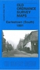
Earlestown South 1906

Earlestown South in 1906 in a fascinating series of reproductions of old Ordnance Survey plans in the Alan Godfrey Editions, ideal for anyone interested in the history of their neighbourhood or family. Two versions have been published to this area. The maps cover the southern part of Earlestown, extending westward to Collins Green. Features include Viaduct wagon works, St Helens Canal, Sankey Sugar Works, Vitrioal Square, Collins Green, Collins Green Colliery, LNWR railway with Collins Green station, part of Earlestown station, Sankey Viaduct, Penkford Bridge, Bradley Hall, Haydock Crossing, Earle Street area, King Street area, Newton Common, etc. On the reverse are Liverpool-Earlestown-Manchester railway timetables for 1897. About the Alan Godfrey Editions of the 25” OS
Series:Selected towns in Great Britain and Ireland are covered by maps showing the extent of urban development in the last decades of the 19th and early 20th century. The plans have been taken from the Ordnance Survey mapping and reprinted at about 15 inches to one mile (1:4, 340). On the reverse most maps have historical notes and many also include extracts from contemporary directories. Most maps cover about one mile (1.6kms) north/south, one and a half miles (2.4kms) across; adjoining sheets can be combined to provide wider coverage.FOR MORE INFORMATION AND A COMPLETE LIST OF ALL AVAILABLE TITLES PLEASE CLICK ON THE SERIES LINK.
RIP - This product is no longer available on our network. It was last seen on 25.09.2019

This page now acts as a permanent archive for this product. Add more information using the comments box below to ensure it can still be found by future generations.

Use our search facility to see if it is available from an alternative contributor.
  • Availability: Out Of Stock
  • Supplier: Stanfords
  • SKU: 9781847846594
Availability: In Stock
£3.50

Product Description

Earlestown South in 1906 in a fascinating series of reproductions of old Ordnance Survey plans in the Alan Godfrey Editions, ideal for anyone interested in the history of their neighbourhood or family. Two versions have been published to this area. The maps cover the southern part of Earlestown, extending westward to Collins Green. Features include Viaduct wagon works, St Helens Canal, Sankey Sugar Works, Vitrioal Square, Collins Green, Collins Green Colliery, LNWR railway with Collins Green station, part of Earlestown station, Sankey Viaduct, Penkford Bridge, Bradley Hall, Haydock Crossing, Earle Street area, King Street area, Newton Common, etc. On the reverse are Liverpool-Earlestown-Manchester railway timetables for 1897. About the Alan Godfrey Editions of the 25” OS Series: Selected towns in Great Britain & Ireland are covered by maps showing the extent of urban development in the last decades of the 19th & early 20th century. The plans have been taken from the Ordnance Survey mapping & reprinted at about 15 inches to one mile (1:4, 340). On the reverse most maps have historical notes & many also include extracts from contemporary directories. Most maps cover about one mile (1.6kms) north/south, one & a half miles (2.4kms) across; adjoining sheets can be combined to provide wider coverage.FOR MORE INFORMATION & A COMPLETE LIST OF ALL AVAILABLE TITLES PLEASE CLICK ON THE SERIES LINK.

Reviews/Comments

Add New

Intelligent Comparison

Oooops!
We couldn't find anything!
Perhaps this product's unique.... Or perhaps we are still looking for comparisons!
Click to bump this page and we'll hurry up.

Price History

Vouchers

No voucher codes found.
Do you know a voucher code for this product or supplier? Add it to Insights for others to use.

Facebook

Jargon Buster

Contemporary - Modern era design
Contemporary - A design reference to indicate post war modern design
Liverpool - A UK city on the east coast of England
History - Anything that happens in the past. An acedemic subject.
King - The figure head of a monarch
Sugar - A sweet substance, white in colour.
Contemporary - An object that is living in the same time.
Hall - A room at the inside of an entrance of a house.
Ideal - Something that satisfies a perfect criteria.
Family - A group of people that live together made up from parents and children.

Supplier Information

Stanfords
Stanfords was established in 1853 and opened their iconic Covent Garden flagship store in 1901. They have become the top retailer of maps, travel books and accessories in the UK and arguably offer the largest selection of maps and travel books worldwide. Famous names such as Captain Robert Falcon Scott, Ranulph Fiennes and Michael Palin have purchased from Stanfords. They now have a shop in Bristol and both stores together with other venues operate a calendar of events including talks, book signings and exhibitions. As a specialist map retailer, the map selection is comprehensive and includes road maps, street maps and walking maps from worldwide destinations, as well as a selection of world atlases and wall maps. Books include travel guides and travel literature. Stanfords also stock globes, from miniatures made of blue marble to magnificent floor-standing globes. The website features a selection of interesting articles on travel topics.
Page Updated: 2023-11-12 20:15:36

Community Generated Product Tags

Oh No! The productWIKI community hasn't generated any tags for this product yet!
Menu