More From Contributor
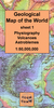
£15.99
A comprehensive geography encyclopedia with complete world atlas, packed with information about our remarkable planet, from its physical characteristics to a continent-by-continent look at the world`s peoples & governments. Richly illustrated with superb photographs, clear explanatory diagrams & 60 pages of detailed, up-to-date maps. Internet links via the Usborne Quicklinks Website to fascinating websites where readers can find further information, take virtual tours & lots more. ...
Archived Product
£12.99
Travel the world with Eric Weiner, the New York Times bestselling author of The Geography of Bliss, as he journeys from Athens to Silicon Valley-and throughout history, too-to show how creative genius flourishes in specific places at specific times. In The Geography of Genius, acclaimed travel writer Weiner sets out to examine the connection between our surroundings & our most innovative ideas. He explores the history of places, like Vienna of 1900, Renaissance Florence, ancient Athens, Song Dynasty Hangzhou, & Silicon Valley, to show how certain urban settings are conducive to ingenuity. &, with his trademark insightful humour, he walks the same paths as the geniuses who flourished in these settings to see if the spirit of what inspired figures like Socrates, Michelangelo, & Leonardo remains. In these places, Weiner asks, ” What was in the air, & can we bottle it?” This link can be traced back through history: Darwin`s theory of evolution gelled while he was riding in a carriage. Freud did his best thinking at this favourite coffee house. Beethoven, like many geniuses, preferred long walks in the woods. Sharp & provocative, The Geography of Genius redefines the argument about how genius came to be. His evaluation of the importance of culture in nurturing creativity is an informed romp through history. ...
Archived Product
£7.99
Are you ready for an amazing adventure that will test your brain power to the limit, full of mind-bending puzzles, twists & turns? You have been summoned to Professor Fustigate`s dusty study at the Ocean Explorers Museum. 300 years ago the pirate ship Shiver Me Timbers sank & the captain`s logbook was found ashore. Ever since, explorers have tried to find the wreck. Just yesterday, Professor Fustigate discovered that if you can follow the coded clues found in the logbook, you will be lead to the wreck & its treasure. Only with your help can the wreck be found, you`re being depended on to locate the treasure! Geography Quest follows the popular Maths Quest, Rubik Quest, Science Quest & History Quest series. Questions are carefully chosen to address important geographical subjects for the age group. Finding the answers enables readers to advance through the story, learning more about geography with every step taken. A glossary explains geographical words & provides added reference material. The four titles in the Geography Quest series are: Journey into the Earth
- 978-1-78493-009-7 Rapid River Rescue
- 978-1-78493-010-3 Mountain Peak Peril
- 978-1-78493-029-5 Deep Sea Danger
- 978-1-78493-030-1


...
Archived Product
£7.99
Are you ready for an amazing adventure that will test your brain power to the limit, full of mind-bending puzzles, twists & turns? You`ve been called urgently to the Television Wildlife Centre where Lucinda Lavender, the TV Director General, is waiting for you. Reports of a terrifying yeti in the Towering Mountains have been made. Sir Digby Tweedhop, the top wildlife presenter, was sent up the mountain to capture the yeti on film
- but he has disappeared without a trace! Only you, with your fantastic geography skills, will be able to find him. This is a life or death mission, create your own adventure & rescue Sir Digby Tweedhop from the mountain! Geography Quest follows the popular Maths Quest, Rubik Quest, Science Quest & History Quest series. Questions are carefully chosen to address important geographical subjects for the age group. Finding the answers enables readers to advance through the story, learning more about geography with every step taken. A glossary explains geographical words & provides added reference material. The four titles in the Geography Quest series are: Journey into the Earth
- 978-1-78493-009-7 Rapid River Rescue
- 978-1-78493-010-3 Mountain Peak Peril
- 978-1-78493-029-5 Deep Sea Danger
- 978-1-78493-030-1


...
Archived Product
£8.99
Ideas in Profile: Small Introductions to Big Topics Geography gives shape to our innate curiosity; cartography is older than writing. Channelling our twin urges to explore & underst&, geographers uncover the hidden connections of human existence, from infant mortality in inner cities to the decision-makers who fly overhead in executive jets, from natural disasters to over-use of fossil fuels. In this incisive introduction to the subject, Danny Dorling & Carl Lee reveal geography as a science which tackles all of the biggest issues that face us today, from globalisation to equality, from sustainability to population growth, from climate change to changing technology
- & the complex interactions between them all. Illustrated by a series of award-winning maps created by Benjamin D. Hennig, this is a book for anyone who wants to know more about why our world is the way it is today, & where it might be heading next.
...
Archived Product
£15.00
Original Title: A Delineation of the Strata of England & Wales with part of Scotland; exhibiting the collieries & mines, the marshes & fen lands originally overflowed by the sea, & the Varieties of Soil according to the variations in the Substrata, illustrated by the most Descriptive Names by W Smith. William Smith`s famous 1815 geological map of ` England & Wales with part of Scotland` was issued between 2nd Nov 1815 & 17th Dec 1815. The map was the subject of Simon Winchester`s book: The Map that Changed the World. The original map was never published as a single sheet: the large size of the original, & the size of the printing presses in the early 19th century, meant that it had to be published in fifteen sections, each folded into six `panels`. This reproduction was produced by scanning the original panels held in the BGS Library, & digitally removing the joins. At its original scale of five miles to the inch, the map would have been eight feet long by six feet wide (if it had been published as a single sheet): this version is published at half scale: ten miles to the inch, & is colour-matched to the original. ...
Archived Product
£49.95
The latest, 2005 edition of the geological map of Switzerl&, showing solid & quaternary geology, with extensive explainations in German & French. The base map has contours plus spot heights & shows the road network with the names numerous towns & villages, main peaks, valleys, & other geographical features. ...
Archived Product
£47.00
The latest, 2005 edition of the geological map of Switzerl&, showing solid & quaternary geology, with extensive explainations in German & French. The base map has contours plus spot heights & shows the road network with the names numerous towns & villages, main peaks, valleys, & other geographical features. ...
Archived Product
£5.95
Folded version of the Geological Map of the British Islands at 1:1, 584, 000 (1” to 25 miles) from the British Geological Survey, showing the bedrock (formerly ‘solid’) geology of the whole of the UK, Irel&, the Channel Islands & part of the English Channel coastline of France. The disposition at surface (outcrops) of the major rock types & named rock units are shown, with a geological map key giving the scale of geochronological eras & chronostratigraphical systems. The currently available edition is a 2014 reprint of the map’s 5th edition originally published in 1969. The underlying base map shows important towns & cities, main roads, major rivers, significant topographical features, & pre-1965 counties. Please note: this map is also available as a wall map. ...
Archived Product
£16.50
A Geological Map of the World by the CGMW, designed to show the earth’s physiography while highlighting volcanoes & meteoric impact craters. This is sheet 1 of a pair of complementary geological maps, each annotated in English & French & accompanied by a booklet of extensive explanatory notes. Colour tinting represents land altimetry & ocean bathymetry, with the latter including isobaths at -200m, -500m then every 1000m. Ice cap altitude contours are at 1000m intervals. Relief-shading is also applied to accentuate significant relief features eg. mountain ranges. The world’s highest peaks, lowest depressions & the deepest ocean trench are highlighted & identified, & symbols denote active submarine volcanoes & onshore volcanoes
- active & recent (< 10, 000 yrs B.P.). Meteor impact craters are also shown, distinguishing between those greater or less than 10km in diameter. in addition, the location of the Tunguska airblast is indicated. The main map is Pacific-centred on a Mercator projection, with the two polar areas on stereographic projections (1:46, 0000, 000). Latitude & longitude lines are drawn at 10° intervals. NB. No location names are included on the map. The map legend is in English & French. The accompanying booklet (English only) explains content & sources for maps 1 & 2.1st edition. Published in 2009.
...
Archived Product

Geologica

! Now at Stanfords’ special discounted price of £19.99 - £20.01 off the RRPMillennium House’s “Geologica” is an encyclopedic look at the Earth’s physical features, landscapes, plants and animals. The origins of the Earth are discussed, from tectonics to a journey through the Earth’s geological history, presenting each geological time period since its formation. “Geologica” presents an in-depth insight into the different types of landscapes. Volcanoes, caves, deserts, glaciers, and deltas are explored in relation to their geological heritage. How each type of landform is created is revealed, followed by an exploratory trip into the most extraordinary examples found in all parts of the world. Mountain ranges, rift valleys, archipelagos, deltas, and
geysers—and the geological processes that created them—are brought to life through pictures and mapping.Featuring over 700 color photographs of some of the world’s most impressive landscapes, and detailed world and regional maps, “Geologica” is a useful resource for the student and an ideal reference book for the home or school library.
RIP - This product is no longer available on our network. It was last seen on 25.09.2019

This page now acts as a permanent archive for this product. Add more information using the comments box below to ensure it can still be found by future generations.

Use our search facility to see if it is available from an alternative contributor.
  • External links may include paid for promotion
  • Availability: Out Of Stock
  • Supplier: Stanfords
  • SKU: 9781921209727
Availability: In Stock
£19.99

Product Description

! Now at Stanfords’ special discounted price of £19.99
- £20.01 off the RRPMillennium House’s “ Geologica” is an encyclopedic look at the Earth’s physical features, landscapes, plants & animals. The origins of the Earth are discussed, from tectonics to a journey through the Earth’s geological history, presenting each geological time period since its formation. “ Geologica” presents an in-depth insight into the different types of landscapes. Volcanoes, caves, deserts, glaciers, & deltas are explored in relation to their geological heritage. How each type of landform is created is revealed, followed by an exploratory trip into the most extraordinary examples found in all parts of the world. Mountain ranges, rift valleys, archipelagos, deltas, & geysers—and the geological processes that created them—are brought to life through pictures & mapping. Featuring over 700 color photographs of some of the world’s most impressive landscapes, & detailed world & regional maps, “ Geologica” is a useful resource for the student & an ideal reference book for the home or school library.

Reviews/Comments

Add New

Intelligent Comparison

Oooops!
We couldn't find anything!
Perhaps this product's unique.... Or perhaps we are still looking for comparisons!
Click to bump this page and we'll hurry up.

Price History

Vouchers

No voucher codes found.
Do you know a voucher code for this product or supplier? Add it to Insights for others to use.

Facebook

Jargon Buster

Physical - Used to describe strength or visual properties of an item
History - Anything that happens in the past. An acedemic subject.
World - A physical grouping, commonly used to describe earth and everything associated with ti
Earth - A planet third from the sun. Similar size to Venus but rich in water and complex life.
Home - A place of permanent residence for families.
Regional - An adjective to describe a set geographic area.
Reference - To prove evidence with a back up source.
Ideal - Something that satisfies a perfect criteria.

Supplier Information

Stanfords
Stanfords was established in 1853 and opened their iconic Covent Garden flagship store in 1901. They have become the top retailer of maps, travel books and accessories in the UK and arguably offer the largest selection of maps and travel books worldwide. Famous names such as Captain Robert Falcon Scott, Ranulph Fiennes and Michael Palin have purchased from Stanfords. They now have a shop in Bristol and both stores together with other venues operate a calendar of events including talks, book signings and exhibitions. As a specialist map retailer, the map selection is comprehensive and includes road maps, street maps and walking maps from worldwide destinations, as well as a selection of world atlases and wall maps. Books include travel guides and travel literature. Stanfords also stock globes, from miniatures made of blue marble to magnificent floor-standing globes. The website features a selection of interesting articles on travel topics.
Page Updated: 2023-11-12 20:15:36

Community Generated Product Tags

Oh No! The productWIKI community hasn't generated any tags for this product yet!
Menu