More From Contributor

£126.00
Known to have existed in Classical times & still being made for a mass market, globes represent the oldest continuous technique for picturing the Earth & heavens. Originally aids to philosophy, the Renaissance saw their development as compendia of rapidly expanding geographical & astronomical knowledge, & as instruments of navigation & cosmography. They have been produced as simple spheres & as sophisticated mechanical devices, as toys & as high -status furniture; used as classroom & other demonstrational tools & as a symbol in the art of many periods. Until the onset of modern industrial techniques, their manufacture as plaster, wood or metal spheres was complex & laborious, & the skills required for their graphic construction & publication no less so. The National Maritime Museum at Greenwich has one of the world's largest & finest collections of globes, comprising over 300 items including terrestrial & celestial examples, armillary spheres & planispheres. Many of these themselves derive from earlier holdings, such as the Barberini, Landau, & Gabb collections, which were acquired en bloc for the Museum in its formative years through the activities of its principal benefactor, Sir James Caird (1864-1954). The Greenwich collection has now been fully catalogued by one of the leading authorities on Western globes, Dr Elly Dekker, who undertook the task from 1993 to 1995 as the Museum's first Sackler Fellow in the History of Astronomy & Navigational Sciences. The catalogue

Includes::
full entries on all items in the Museum's collection, the overwhelming majority being illustrated. There are also nine introductory essays by Dr Dekker & other NMM specialists, & an integrated section on the Museum's Islamic globes, introduced & catalogued by Dr Silke Ackermann of the British Museum.

...
Archived Product
£14.99
Personalise your world with Globes in a Box, an exciting & unique resource that combines learning about maps & mapping with paper-craft fun. The box contains a CD-ROM complete with map projects, Geodisc globe templates, self-adhesive inkjet printing paper, full-colour project book & self-assembly spinning globe, which together let you create your own world views on your computer. Print out a selection of physical & political maps & wrap around the globe, or fold
- origami-style
- to create your own 3D models of the planet we live on. With full instructions in the accompanying book, as well as a detailed look at how the planet evolved & how cartographers transform it from a sphere to a printed map, Globes in a Box is all you need to create unique models of our world. Requirements:
- Windows XP or Vista.
- Mac OS X 10.3 & above.
- Printer.


...
Archived Product
£9.99
The highly successful Globetrotter Travel Series, which

Includes::
Travel Guides, Travel Maps, Road Atlases,

...
Archived Product
£19.95
In an era when the earth is our oyster, Michael Clinton is the premier globetrotter in search of its pearls. Over the course of more than 35 years, Clinton has travelled the seven continents documenting his experiences in photographs. Now, for the first time, Clinton tells it like it is. In Globetrotter Diaries, the author shares with us his adventures, his knowledge, & his witty reminiscences of his life on the road. As the author of five photography books with Glitterati, Clinton is well-versed in the native customs, rituals, & landscapes of the most popular & remote places around the world. This book provides the perfect companion piece to his photographic work. Here Clinton reveals himself as he learns the nature of humanity from its billions of inhabitants who make travel one of life's greatest pastimes. ...
Archived Product
£9.99
The handy pocket-size guide is packed with useful information, tips & recommendations, accompanied by colour photographs, charts & maps for the first-time traveller who wants to experience the major highlights that Corfu has to offer. The fold-out map of Corfu is ideal for tourists & visitors. The highly successful Globetrotter Travel Series, which

Includes::
Travel Guides, Travel Maps, Road Atlases, Best of Pocket Guides & In Your Pocket Language Guides, presently covers more than 90 destinations worldwide. The Packs are excellent value, including both guidebook & softcover version of the fold-out Globetrotter map of the region in a printed plastic wallet.

...
Archived Product
£80.00
Gloucestershire, an original antique map by G. Cole / J. Roper published in London, 1810-1843. Copperplate, coloured. Map size 17 x 23 cm, overall mounted size 32.5 x 38.5 cm. This detailed map of Glocestershire is from Dugdale's England & Wales Delineated. The map was drawn by G. Cole & engraved by John Roper for publication first in The Beauties Of England & Wales, issued in parts, from c.1804. Such was the success of the publication that the maps were re-used in other publications, as here. The maps show accurate geographical detail, including the turnpike, mail coach & principal roads, sites of Roman & other historical remains, as well as the seats of the nobility & the gentry, & market towns with their distances from London. The maps also show the division of the counties into hundreds or wapontakes. They are representative of the functional nineteenth-century approach to cartography, yet are not unattractive. Antique maps from various original publishers are presented on the Stanford ...
Archived Product
£140.00
Gloucestershire, an original antique map by R. Ramble, published in London, 1821-1844. Lithograph, original colour. Map size 15 x 18.5 cm, overall mounted size 30 x 33.5 cm. An attractive & uncommon miniature map surrounded by vignettes of the county's & London's landmarks. Ramble added these vignettes to Miller's maps of 1821 which were originally published as part of Miller's New Miniature Atlas.... With the decorative views added these maps were republished from 1844 in Reuben Ramble's Travels Through The Counties Of England
- a child's guide to the country. Antique maps from various original publishers are presented on the Stanford
...
Archived Product
£80.00
A New Map Of Glocester Shire, an original antique map by J. Lodge, published in London, c. 1782-1795. A copperplate engraving, coloured. Map size 32 x 26.5 cm, overall mounted size 47 x 41 cm.A plainly engraved yet attractive map of the county of Gloucestershire with clear geographical detail. A brief explanatory key appears at lower right next to a decorative compass rose. The map

Includes::
the county's roads, the locations of fairs, & the borough towns showing the number of Members returned to Parliament. John Lodge's county maps were originally published in The Political Magazine... from 1782-1790, appearing in atlas form with imprints & signature erased five years later. Antique maps from various original publishers are presented on the Stanford

...
Archived Product
£11.95
Glocknergruppe, map no. 40
- hiking edition, in a series of walking maps & ski produced by the German & Austrian Alpine Clubs
...
Archived Product
£10.50
Map No. 39, Glocknergruppe
- Hohe Tauern National Park, printed an sturdy waterproof & tear-resistant plastic paper & with a
...
Archived Product

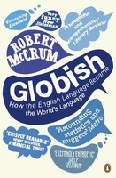
Globish - How The English Language Became The World`s Language

Go anywhere in the world today and you`ll see or hear English in some form. It may not necessarily be the Queen`s English that you`re hearing, but it is, nevertheless, a form of universally recognised English - it is Globish. In his wonderfully witty and informative new book, Robert McCrum explores the curious history, vivacity and endurance of English and ponders why, while British and American empires have waxed and waned, the English language, freer from its moorings like never before, has quietly taken over the world.
RIP - This product is no longer available on our network. It was last seen on 25.09.2019

This page now acts as a permanent archive for this product. Add more information using the comments box below to ensure it can still be found by future generations.

Use our search facility to see if it is available from an alternative contributor.
  • Availability: Out Of Stock
  • Supplier: Stanfords
  • SKU: 9780141027104
Availability: In Stock
£9.99

Product Description

Go anywhere in the world today & you`ll see or hear English in some form. It may not necessarily be the Queen`s English that you`re hearing, but it is, nevertheless, a form of universally recognised English
- it is Globish. In his wonderfully witty & informative new book, Robert Mc Crum explores the curious history, vivacity & endurance of English & ponders why, while British & American empires have waxed & waned, the English language, freer from its moorings like never before, has quietly taken over the world.

Reviews/Comments

Add New

Intelligent Comparison

Oooops!
We couldn't find anything!
Perhaps this product's unique.... Or perhaps we are still looking for comparisons!
Click to bump this page and we'll hurry up.

Price History

Vouchers

No voucher codes found.
Do you know a voucher code for this product or supplier? Add it to Insights for others to use.

Facebook

Jargon Buster

History - Anything that happens in the past. An acedemic subject.
World - A physical grouping, commonly used to describe earth and everything associated with ti
Language - the method of communication used in different areas. Humans and computers have many different languages.
Endurance - A measurement on how long something can last wear and tear.
Language - The way humans communicate either written and spoken.

Supplier Information

Stanfords
Stanfords was established in 1853 and opened their iconic Covent Garden flagship store in 1901. They have become the top retailer of maps, travel books and accessories in the UK and arguably offer the largest selection of maps and travel books worldwide. Famous names such as Captain Robert Falcon Scott, Ranulph Fiennes and Michael Palin have purchased from Stanfords. They now have a shop in Bristol and both stores together with other venues operate a calendar of events including talks, book signings and exhibitions. As a specialist map retailer, the map selection is comprehensive and includes road maps, street maps and walking maps from worldwide destinations, as well as a selection of world atlases and wall maps. Books include travel guides and travel literature. Stanfords also stock globes, from miniatures made of blue marble to magnificent floor-standing globes. The website features a selection of interesting articles on travel topics.
Page Updated: 2023-11-12 20:15:36

Community Generated Product Tags

Oh No! The productWIKI community hasn't generated any tags for this product yet!
Menu