More From Contributor

£80.00
A New Map Of Glocester Shire, an original antique map by J. Lodge, published in London, c. 1782-1795. A copperplate engraving, coloured. Map size 32 x 26.5 cm, overall mounted size 47 x 41 cm.A plainly engraved yet attractive map of the county of Gloucestershire with clear geographical detail. A brief explanatory key appears at lower right next to a decorative compass rose. The map

Includes::
the county's roads, the locations of fairs, & the borough towns showing the number of Members returned to Parliament. John Lodge's county maps were originally published in The Political Magazine... from 1782-1790, appearing in atlas form with imprints & signature erased five years later. Antique maps from various original publishers are presented on the Stanford

...
Archived Product
£11.95
Glocknergruppe, map no. 40
- hiking edition, in a series of walking maps & ski produced by the German & Austrian Alpine Clubs
...
Archived Product
£10.50
Map No. 39, Glocknergruppe
- Hohe Tauern National Park, printed an sturdy waterproof & tear-resistant plastic paper & with a
...
Archived Product
£13.99
Map No. 39, Glocknergruppe
- Hohe Tauern National Park, printed an sturdy waterproof & tear-resistant plastic paper & with a
...
Archived Product
£11.99
Glocknergruppe area of the Alps in a hiking edition at 1:25, 000 from a series of detailed, GPS compatible maps published by the DAV
- Deutscher Alpenverein & produced by the German & Austrian Alpine Clubs using cartography from their respective survey organizations. Maps in this series have topography vividly presented by contours at 20 metres intervals, enhanced by shading & finely drawn graphic relief. An overprint highlights hiking paths and/or ski routes (please see the note below), campsites & various types of mountain huts & refuges. The area covered by each map varies according to the scale; for 1:25, 000 maps it is Approx. 25x 18 km (15 x 11 miles). The maps have a 1-km UTM grid, plus margin ticks with latitude & longitude at intervals of 1`. Map legend is in German only.PLEASE NOTE – THE OVERPRINT FOR HIKING and/or SKI ROUTES: all Sheet Ref. numbers shown on the accompanying grid are available with an overprint highlighting hiking trails, indicating sections with fixed climbing ropes &, where appropriate, the waymarking route numbers. Several titles are now published with both hiking & ski routes on them. Other areas are covered by two separate maps: a hiking edition plus a ski edition. The type of the overprint is indicated in our title of each map. To see the list of titles in this series please click on the series link.
...
Archived Product
£23.99
Gloppen area in Norway in a series of GPS compatible recreational maps at 1:50, 000 with cartography from Norway’s topographic survey & additional tourist information. Contours lines are drawn at 20m intervals. The overprint varies from title to title, but

Includes::
local footpaths, in some cases distinguishing between easy & more difficult trails, as well as mountain huts & campsites. Many titles also indicate cycle or ski routes, other accommodation possibilities, sport & recreational facilities, including alpine skiing slopes, places of interest, etc. The maps have a UTM grid & margin ticks giving latitude & longitude. Map legend

Includes::
English. Several titles have on the reverse additional tourist information, although in most cases in Norwegian only. To see the list of Turkart maps at 1:50, 000 & links to Turkart series at 25K, 100K & Hiking Sets please click on the series link above.


...
Archived Product
£12.99
Map No. 1219bis, Glorenza/ Glurns, in the topographic survey of Switzerland at 1:25, 000 from Bundesamt für Landestopographie (swisstopo), covering the whole country on 247 small format sheets, with special larger maps published for popular regions including some titles now available in hiking versions. Highly regarded for their superb use of graphic relief & hill shading, the maps give an almost 3-D picture of Switzerland`s mountainous terrain. Contours are at 10 m intervals, with 20m intervals in the mountainous areas. All the maps have a 1-km grid for Swiss national coordinates (datum CH 1903). * Small format sheets (Nos. 1011
- 1374)* Map legend in the language of the area covered by the map. Additional margin ticks show latitude & longitude in steps of 2`. The area covered by each map is 17 x 12 km (11 x 7 miles approx). * Special larger sheets (Nos. from 2501 onwards) – STANDARD editions:* No map legend is included but a separate leaflet can be provided instead. The area covered by each map is 25 x 17 km (15 x 11 miles approx).* Special larger sheets (Nos. from 2501 onwards) – HIKING editions:* An overprint highlights hiking, mountain & alpine paths, including regional & national long-distance trails. The maps also show bus routes with bus stops, plus inns in remote locations. The area covered by each map is 25 x 17 km (15 x 11 miles approx).
...
Archived Product
£12.99
Glorenza/ Glurns, map No. 259bis, in the standard topographic survey of Switzerland at 1:50, 000 from Swisstopo, i.e. without the special overprint highlighting walking trails, local bus stops, etc, presented in Swisstopo’s hiking editions of the 50K survey. The map covers mainly Val Venosta / Vinschgau valley on the Italian side of the border. Highly regarded for their superb use of graphic relief & hill shading, the maps give an almost 3-D picture of Switzerland`s mountainous terrain. Contours are at 20m intervals. All the maps have a 1-km grid with the Swiss national coordinates. This standard version of the 50K survey covers the whole country on 78 small format sheets, with special larger format maps published for several popular tourist destinations. Small format sheets cover an area of 35 x 24 km (21 x 15 miles approx) & have map legend in the language of the area covered by the map. The special larger sheets cover 50 x 35 km (31 x 22 miles approx) & have no map legend, but a separate leaflet can be provided instead.PLEASE NOTE: the hiking editions of the 1:50, 000 Swisstopo survey are listed on our website in a separate series. ...
Archived Product
£12.99
Jamaica, 1938. Gloria Campbell is sixteen years old when a single violent act changes her life forever. She & her younger sister flee their hometown to forge a new life in Kingston. As all around them the city convulses with political change, Gloria's desperation & striking beauty lead her to Sybil & Beryl, & a house of ill-repute where she meets Yang Pao, a Kingston racketeer whose destiny becomes irresistibly bound with her own. Sybil kindles in Gloria a fire of social justice which will propel her to Cuba & a personal & political awakening that she must reconcile with the realities of her life, her love of Jamaica & a past that is never far behind her. Set against the turbulent backdrop of a country on the cusp of a new era, Gloria is an enthralling & illuminating story of love & redemption. ...
Archived Product
£8.99
Jamaica, 1938. Gloria Campbell is sixteen years old when a single violent act changes her life forever. She & her younger sister flee their hometown to forge a new life in Kingston. As all around them the city convulses with political change, Gloria`s desperation & striking beauty lead her to Sybil & Beryl, & a house of ill-repute where she meets Yang Pao, a Kingston racketeer whose destiny becomes irresistibly bound with her own. Sybil kindles in Gloria a fire of social justice which will propel her to Cuba & a personal & political awakening that she must reconcile with the realities of her life, her love of Jamaica & a past that is never far behind her. Set against the turbulent backdrop of a country on the cusp of a new era, Gloria is an enthralling & illuminating story of love & redemption. ...
Archived Product

Glommersträsk

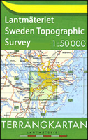
Topographic survey of Sweden at 1:50, 000, the Terrängkartan, from the Lantmäteriet, covering most of the country in 244 double-sided maps. Please note: the mountainous regions of central and northern Sweden are not covered by this series but presented in a separate “Fjällkartan - Mountain Map” series also listed on our website.Each 1:50, 000 topographic survey map covers an area of 37.5 x 40km. The maps have contours at 5 metre intervals, plus relief shading and graphics for rocky outcrops and boulders. Further graphics and/or colouring show different types of land use or vegetation (forests, arable land, orchards, marshes, peat bogs, etc). An unusual feature of this survey is the colouring indicating buildings below or above two storeys high and “leisure/holiday
homes”. The maps indicate privately maintained roads and include all other information expected of topographic survey at this scale. The maps have a 1-km UTM grid, plus latitude and longitude lines 5’ intervals. Map legend includes English.For coverage of the country’s most visited hiking areas in central and northern Sweden please see Lantmäteriet’s Mountain Map series, listed separately on our website.
RIP - This product is no longer available on our network. It was last seen on 25.09.2019

This page now acts as a permanent archive for this product. Add more information using the comments box below to ensure it can still be found by future generations.

Use our search facility to see if it is available from an alternative contributor.
  • Availability: Out Of Stock
  • Supplier: Stanfords
  • SKU: 9789158807266
Availability: In Stock
£16.99

Product Description

Topographic survey of Sweden at 1:50, 000, the Terrängkartan, from the Lantmäteriet, covering most of the country in 244 double-sided maps. Please note: the mountainous regions of central & northern Sweden are not covered by this series but presented in a separate “ Fjällkartan
- Mountain Map” series also listed on our website. Each 1:50, 000 topographic survey map covers an area of 37.5 x 40km. The maps have contours at 5 metre intervals, plus relief shading & graphics for rocky outcrops & boulders. Further graphics and/or colouring show different types of land use or vegetation (forests, arable l&, orchards, marshes, peat bogs, etc). An unusual feature of this survey is the colouring indicating buildings below or above two storeys high & “leisure/holiday homes”. The maps indicate privately maintained roads & include all other information expected of topographic survey at this scale. The maps have a 1-km UTM grid, plus latitude & longitude lines 5’ intervals. Map legend

Includes::
English. For coverage of the country’s most visited hiking areas in central & northern Sweden please see Lantmäteriet’s Mountain Map series, listed separately on our website.

Reviews/Comments

Add New

Intelligent Comparison

Oooops!
We couldn't find anything!
Perhaps this product's unique.... Or perhaps we are still looking for comparisons!
Click to bump this page and we'll hurry up.

Price History

Vouchers

No voucher codes found.
Do you know a voucher code for this product or supplier? Add it to Insights for others to use.

Facebook

Jargon Buster

Hiking - An outdoor activity envolving walking in nature
Graphics - A general term for visual aspects of an item/display
Km - Kilometre. A unit of measurement equal to 1000 metres.
Unusual - Something unique and different.
Metre - 100cm. A unit of length.
Feature - An attribute that makes something stand out.

Supplier Information

Stanfords
Stanfords was established in 1853 and opened their iconic Covent Garden flagship store in 1901. They have become the top retailer of maps, travel books and accessories in the UK and arguably offer the largest selection of maps and travel books worldwide. Famous names such as Captain Robert Falcon Scott, Ranulph Fiennes and Michael Palin have purchased from Stanfords. They now have a shop in Bristol and both stores together with other venues operate a calendar of events including talks, book signings and exhibitions. As a specialist map retailer, the map selection is comprehensive and includes road maps, street maps and walking maps from worldwide destinations, as well as a selection of world atlases and wall maps. Books include travel guides and travel literature. Stanfords also stock globes, from miniatures made of blue marble to magnificent floor-standing globes. The website features a selection of interesting articles on travel topics.
Page Updated: 2023-11-12 20:15:36

Community Generated Product Tags

Oh No! The productWIKI community hasn't generated any tags for this product yet!
Menu