
 United Kingdom
 France
 Germany
 Netherlands
 Sweden
 USA
USA
 Italy
Italy
 Spain
Spain
More From Contributor


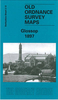


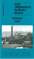
Glossop 1897
Glossop in 1897 in a fascinating series of reproductions of old Ordnance Survey plans in the Alan Godfrey Editions, ideal for anyone interested in the history of their neighbourhood or family. Selected towns in Great Britain and Ireland are covered by maps showing the extent of urban development in the last decades of the 19th and early 20th century.In this title: the map covers most of Glossop, extending from Wren Nest Mills eastward to Hurst Mill, and from Princess Street northward to The Park and Glossop Workhouse. Features include the town centre with Market Place, Drill Hall, station, football ground, Norfolk Arms Hotel, Howards Town Mills, St Mary's RC church, Shepley Mill, theatre, Wren Nest Mills, Spire Hollin House, Glossop Hall, Croft Mill, Wood's Hospital, St
Luke's church, All Saints RC church, Duke of Norfolk's school, Meadow Mills, All Saints church, Hawkshead Mill, Workhouse, Cowbrook Mill, Hurst Mill etc. On the reverse is a commercial directory of Glossop in 1891.About the Alan Godfrey Editions of the 25
Luke's church, All Saints RC church, Duke of Norfolk's school, Meadow Mills, All Saints church, Hawkshead Mill, Workhouse, Cowbrook Mill, Hurst Mill etc. On the reverse is a commercial directory of Glossop in 1891.About the Alan Godfrey Editions of the 25
Product Description
Reviews/Comments
Add New
Intelligent Comparison
Archived Product
Glossop 1897 Stanfords
£3.50
Vouchers
No voucher codes found.
Do you know a voucher code for this product or supplier? Add it to Insights for others to use.
Do you know a voucher code for this product or supplier? Add it to Insights for others to use.
 Denmark