More From Contributor

£12.99
This is an exciting voyage through the incredible Solar System. Glow In The Dark Stars & Planets is an asteroid-dodging journey into the inner workings of the Solar System, revealed planet by planet. If you`ve ever wondered, ” Why is Neptune blue?”, ” Which is the biggest planet?”, or ” Is there life on Mars?”, this book will have the answers for you! & the pull out poster & glow-in-the-dark stickers will make learning about planets fun! Start at the edge of the solar system & journey all the way to the sun & beyond, learning about our galaxy & all the planets that make up the Milky Way. Traverse Saturn`s rings, the ferocious storms on Jupiter & Venus` scorching volcanoes. Packed with pictures of different planets & space objects, Glow In The Dark Stars & Planets is also full of fun facts & stats, making learning about the sun & stars, planets, asteroids & comets not only interesting, but fun too! Plus, you`ll get an out-of-this-world pull out poster of the solar system with glow-in-the-dark stickers to use. Glow In The Dark Stars & Planets is perfect to explore with your child or for them to discover on their own. With colourful pictures & incredible information, their questions about the stars & planets will be answered in style. ...
Archived Product
£7.95
Stick to your belongings or clothes for a little extra glow. Perfect for finding your tent at festivals, leading the way to the campsite loos, lighting up the dance floor at parties, standing out during Fresher`s week & general good vibes. Peace out bro. ...
Archived Product
£12.99
Join one little astronaut & her space dog as they voyage through our solar system & see space as you`ve never seen it before! Journey from the sun, to the planets, asteroids & Kuiper belt, before folding out your glow-in-the-dark poster. Simply turn off the light to bring the incredible glow-in-the-dark ink to life. ...
Archived Product
£6.99
Kids will love to plot the planets & make an interesting display with these self-adhesive glow planets & stars. All year round & daylight visible, the eight colourful planets & 35 plastic stars produce a fascinating glow in the dark display. Just expose the stickers to a light source for a few minutes, turn off the light & watch them glow. Endless fun. ...
Archived Product
£12.95
This guide to backpacking 135 miles along Glyndwr`s Way National Trail through the county of Powys in mid-Wales, & back from Welshpool to the start at Knighton in 29 miles along the Offa`s Dyke Path, provides all the information you need to explore this unfrequented landscape. The trail commemorates the Welsh leader Owain Glyndwr, visiting landmarks such as Powis Castle & Glyndwr`s Parliament House at Machynlleth, as well as other historial & archeological sites. Easily accessed by train from Shrewsbury, the way is clearly waymarked throughout & there is accommodation available at the end of every stage, listed in full at the back of the guide to make planning easier. The description is broken into 9 stages of the main trail, & another 2 along Offa`s Dyke Path National Trail for those who prefer a circular route, & accompanied by OS map extracts, photographs & lots of information on facilities available & historical points of interest along the way. ...
Archived Product
£13.95
Glyndwr`s Way, a 217km / 135 mile long trail from Knighton in Powys to Welshpool presented at 1:40, 000 on a GPS compatible, light, waterproof & tear-resistant map from Harvey Map Services. The whole route is covered on eight overlapping panels. Map legend

Includes::
Welsh; most of the additional information is in English only. Maps in the Harvey’s series covering Great Britain’s national trails & other long-distance footpaths are printed on light, waterproof & tear-resistant synthetic paper & cover the routes at 1:40, 000 or 1:60, 000. Topography is shown by contours at 15m intervals, with additional spot heights plus colouring and/or graphics to provide a very detailed picture of the terrain (boulder fields, scree, crags, etc) & vegetation / land use (pastures, moorl&, woodlands, etc). In Scotland peaks & hills classified as Munros, Corbetts & Donalds are marked. The overprint for the long-distance trail shows sections on local or main roads (highlighting danger points), on tracks, & on footpaths, indicating intermittent or not visible paths. The maps also show other right of way paths, including permissive paths & bridleways. Symbols indicate various facilities & accommodation options (including campsites & youth hostels), pubs & refreshments, food shops, banks, information points, etc, both along the route itself & in the nearby locations. All maps are GPS compatible, with the British National Grid overprinted on each panel. The maps also include useful contact details & general advice. To see other titles in this series please click on the series link.

...
Archived Product
£9.95
Glyph is a visual exploration of marks & glyphs in the Latin alphabet
- some that we use every day, & some of which have been
...
Archived Product
£110.00
The GMDSS Manual provides, in a single comprehensive publication, an explanation of the principles upon which the GMDSS is based, the radiocommunication requirements & recommendations for its implementation, the operational performance standards & technical specifications to be met by GMDSS equipment, & the procedures for & method of operation of the various radio services which form the GMDSS & the Master Plan for the GMDSS. The 2017 edition is fully updated &
Includes::• A description of the development & the concepts of the GMDSS• A description of the components of the GMDSS, the carriage requirements & the operational procedures• Excerpts from the relevant SOLAS regulations for the GMDSS• Supporting resolutions & circulars relevant to the GMDSS• The IMO performance standards & related ITU-R Recommendations giving the technical detail of the radio equipment• The Joint IMO/IHO/WMO Manual on Maritime Safety Information (2015)• The NAVTEX Manual (2017)• The International Safety NET Manual (2017)• The current GMDSS Master Plan giving the details of the coastal infrastructure & services provided by member administrations• Extracts from the ITU-R Radio Regulations giving the radio regulatory background. The Manual is intended for use by ship personnel, shore operators, trainers, administrations, regulators & anyone else concerned with ship communication.
...
Archived Product
£70.00
Chapter IV of the International Convention for the safety of Life at Sea (SOLAS) & the regulations of the International Telecommunicaton Union (ITU) require that all GMDSS ships keep a radio log in a specified format & that certain items are recorded therein. This radio log book must be kept close to the radio installation & must be completed & retained onboard for inspection by any authorized person. The master of the ship is required to review the entries in this radio log on a daily basis & to countersign Section C of the log book to this effect. ...
Archived Product
£16.00

Includes: fields for: Date & Time (UTC) Station to Station from Operators actions/remarks, Log in/out Frequesncy, Channel
...
Archived Product

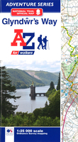
Glyndwr`s Way Adventure Atlas

The A-Z Adventure Series of maps combines the best of OS and A-Z, creating the perfect companion for walkers, off-road cyclists, horse riders and anyone wishing to explore the great outdoors. Glyndwr`s Way is a 135 mile (217 km) National Trail in mid-Wales from Knighton to Welshpool via Machynlleth. Linking locations connected with Owain Glynd rs, the trail passes through the tranquil Radnorshire Hills and across open moorland and rolling farmland with views over Cadair Idris and Lake Vyrnwy. The route on the map is clearly highlighted in yellow with mileage markers to gauge distances when planning sections of the walk to enjoy. This official National Trail Map of Glyndwr`s Way features 43 pages of continuous Ordnance Survey 1:25000 mapping providing complete coverage of Glynd r`s Way.
The atlas includes a route planner showing distances between places and the amenities available, featuring: Information Centres, Hotels/B&Bs, Youth Hostels, Campsites (seasonal opening), Public Houses, Shops, Restaurants, Cafes (seasonal opening) and Petrol Stations. Also featured is advice on safety and security when walking and a selection of QR codes linked to useful websites, including temporary route updates from the National Trails, regional information, map reading advice and weather reports. Unlike the original OS sheets, this A-Z Adventure Atlas includes a comprehensive index to towns, villages, hamlets and locations, natural features, nature reserves, car parks and youth hostels, making it easy to find the required location quickly.
RIP - This product is no longer available on our network. It was last seen on 25.09.2019

This page now acts as a permanent archive for this product. Add more information using the comments box below to ensure it can still be found by future generations.

Use our search facility to see if it is available from an alternative contributor.
  • External links may include paid for promotion
  • Availability: Out Of Stock
  • Supplier: Stanfords
  • SKU: 9781782571971
Availability: In Stock
£8.95

Product Description

The A-Z Adventure Series of maps combines the best of OS & A-Z, creating the perfect companion for walkers, off-road cyclists, horse riders & anyone wishing to explore the great outdoors. Glyndwr`s Way is a 135 mile (217 km) National Trail in mid-Wales from Knighton to Welshpool via Machynlleth. Linking locations connected with Owain Glynd rs, the trail passes through the tranquil Radnorshire Hills & across open moorland & rolling farmland with views over Cadair Idris & Lake Vyrnwy. The route on the map is clearly highlighted in yellow with mileage markers to gauge distances when planning sections of the walk to enjoy. This official National Trail Map of Glyndwr`s Way features 43 pages of continuous Ordnance Survey 1:25000 mapping providing complete coverage of Glynd r`s Way. The atlas

Includes::
a route planner showing distances between places & the amenities available, featuring: Information Centres, Hotels/B& Bs, Youth Hostels, Campsites (seasonal opening), Public Houses, Shops, Restaurants, Cafes (seasonal opening) & Petrol Stations. Also featured is advice on safety & security when walking & a selection of QR codes linked to useful websites, including temporary route updates from the National Trails, regional information, map reading advice & weather reports. Unlike the original OS sheets, this A-Z Adventure Atlas

Includes::
a comprehensive index to towns, villages, hamlets & locations, natural features, nature reserves, car parks & youth hostels, making it easy to find the required location quickly.

Reviews/Comments

Add New

Intelligent Comparison

Oooops!
We couldn't find anything!
Perhaps this product's unique.... Or perhaps we are still looking for comparisons!
Click to bump this page and we'll hurry up.

Price History

Vouchers

No voucher codes found.
Do you know a voucher code for this product or supplier? Add it to Insights for others to use.

Facebook

Jargon Buster

Yellow - A primary colour. The sun is often described as yellow
Car - A machine used for transport which runs on roads
Weather - is the change of an atmospheres conditions.
Safety - prevents damage being caused.
Natural - not manmade
Km - Kilometre. A unit of measurement equal to 1000 metres.
Adventure - an undertaking of an exciting challenge or experience.
Road - a manmade lane or a path that is used to speed up travel.
Horse - A large animal with four legs that tends to be ridden.
Regional - An adjective to describe a set geographic area.

Supplier Information

Stanfords
Stanfords was established in 1853 and opened their iconic Covent Garden flagship store in 1901. They have become the top retailer of maps, travel books and accessories in the UK and arguably offer the largest selection of maps and travel books worldwide. Famous names such as Captain Robert Falcon Scott, Ranulph Fiennes and Michael Palin have purchased from Stanfords. They now have a shop in Bristol and both stores together with other venues operate a calendar of events including talks, book signings and exhibitions. As a specialist map retailer, the map selection is comprehensive and includes road maps, street maps and walking maps from worldwide destinations, as well as a selection of world atlases and wall maps. Books include travel guides and travel literature. Stanfords also stock globes, from miniatures made of blue marble to magnificent floor-standing globes. The website features a selection of interesting articles on travel topics.
Page Updated: 2023-11-12 20:15:36

Community Generated Product Tags

Oh No! The productWIKI community hasn't generated any tags for this product yet!
Menu