
 United Kingdom
 France
 Germany
 Netherlands
 Sweden
 USA
USA
 Italy
Italy
 Spain
Spain
More From Contributor


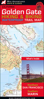
Golden Gate Hiking & Biking Trail Map
The Golden Gate National Recreation Area on both sides of the famous bridge on a waterproof and tear-resistant hiking and biking map for anyone who wants to get the best from the area’s picturesque terrain. Coverage in San Francisco starts just south of the Geary Boulevard and the Union Square, so includes Russian Hill and Fisherman’s Wharf, and continues across the Golden Gate Bridge beyond Sausalito and Marin City to include the Muir Woods National Monument, Mill Valley, Tiburon Peninsula and Angel Island.In the southern part of the Golden Gate NRA and north of the bridge topography is shown by contours at 50m intervals. Colouring indicates parks and conservation areas. Roads and trails are divided into hiking or minor hiking trails with no access for bikes, hike-&-bike trails,
paved roads with bicycle and pedestrian paths, plus fire roads with access for bikes. Symbols indicate information points, campgrounds, picnic areas, bus stops, car parks, etc. Also highlighted are 21 locations which have notes about them provided on the reverse. No geographical coordinates are markedm on the map. Within the city only main streets are named, and the map shows metro stations, main bus and cable car routes, ferry terminals and routes, etc. The areas around the southern end of the Golden Gate Bridge and of the Sausalito Steps are also shown in more detail on enlargements. The map has an index of points of interest, visitors centres, bicycle and outdoor shops, campsites and beaches, etc, plus advice on local public transport.Coverage further north continues on
the publishers’ Mt. Tam map.

Product Description
Reviews/Comments
Add New
Vouchers
No voucher codes found.
Do you know a voucher code for this product or supplier? Add it to Insights for others to use.
Do you know a voucher code for this product or supplier? Add it to Insights for others to use.
 Denmark