More From Contributor

£10.99
Golfe du Morbihan
- Belle-Île de Groix
- Presqu`Île de Quiberon region of Brittany in a series of GPS compatible, contoured

...
Archived Product
£110.00
The Golfer sky hook will be the perfect gift for the golfer in your family. Sitting atop the sky hook is a h&-painted, antique finished 1920s golfer wearing the traditional golf cap & jacket. Crafted from recycled metal, this balance toy is a replica of the classic home accessories used in the 18th & 19th centuries. When gently pushed by the flag-shaped handle, the sky hook will rock side to side on the metal st&, putting the golfer & his club into motion. The h&-crafted details of the Golfer antique sky hook will be a unique addition to any game room or home office. If we do not have this item in stock we will order it for you from our supplier. Delivery generally takes 3 weeks within the UK. For overseas delivery queries please email sales@stanfords.co.uk ...
Archived Product
£8.50
One of a series of four mini-guides to the golf courses of the Western Cape Province in a format of a folded map. Each golf club is presented as a separate panel with a course layout & full details, symbols indicating level of green fees & what facilities can be found there (caddies/clubs for hire, shop, restaurant, on site accommodation, etc.), plus contact details. Each title also

Includes::
a general road map of its area, highlighting the position of the clubs, as well as other places of interest. The 14 clubs covered by this title are: Atlantic Beach, Bellville, Clovelly, Durbanville, King David, Metropolitan, Milnerton, Mowbray, Parrow, Rodenbosch, Royal Cape, Simon’s Town, Steenberg, & Westlake.

...
Archived Product
£8.50
One of a series of four mini-guides to the golf courses of the Western Cape Province in a format of a folded map. Each golf club is presented as a separate panel with a course layout & full details, symbols indicating level of green fees & what facilities can be found there (caddies/clubs for hire, shop, restaurant, on site accommodation, etc.), plus contact details. Each title also

Includes::
a general road map of its area, highlighting the position of the clubs, as well as other places of interest. The 14 clubs covered by this title are: De Zaale, Devonvale, Durbanville, Erinvale, Helderberg Village, Kuilsrivier, Paarl, Paarl Valley, Somerset West, Stellenbosch, Str&, Theewaterskloof, Wellington, & Worcester.

...
Archived Product
£8.50
One of a series of four mini-guides to the golf courses of the Western Cape Province in a format of a folded map. Each golf club is presented as a separate panel with a course layout & full details, symbols indicating level of green fees & what facilities can be found there (caddies/clubs for hire, shop, restaurant, on site accommodation, etc.), plus contact details. Each title also

Includes::
a general road map of its area, highlighting the position of the clubs, as well as other places of interest. The 14 clubs covered by this title are: Arabella, Bonnievale, Bredasdorp, Caledon, Hermanus, Kleinmond, Montagu, Riversdale, Riverside, Riviersonderend, Stilbaai, Swellendam, Theewatersklooft, & Worcester.

...
Archived Product
£8.95
The coast of the Golfo de Tigullio at 1:25, 000 on a detailed contoured map from Litografia Artistica Cartografica showing the network of small local roads & highlighting various hiking trails waymarked by the Federazione Italiana Escursionismo. Coverage

Includes::
several popular resorts of the Italian Riviera, extending from Sestri Levante in the east, across Lavagna, Chiavari, Zoagli, Rapallo, S. Margherita, Portofino & Camogli to Recco. The map has somewhat old-fashioned cartography, but is contoured (interval 25m) with relief shading adding to the presentation of the topography. Road network

Includes::
cart tracks; diving distance are given on main routes. Local mule tracks & footpaths are

Includes::
, & the map highlights hiking trails waymarked by the Federazione Italiana Escursionismo, indicating their signage & difficult passage. Also marked are various places of interest, including beaches & campsites. The map has no geographical coordinates. Map legend

Includes::
English. The whole of the reverse side it taken by descriptions of various locations & sights, in Italian only. Also provided is a list of the waymarked trails, indicating approximate timing for each route.


...
Archived Product
£9.99
Golija
- Studenica Park & Biosphere Reserve, a UNESCO site, at 1:50, 000 on a detailed contoured map from the Belgrade based
...
Archived Product
£17.99
The 1:50 000 topographic map gives a more general picture of the ground features than a basic map. It shows settlements, houses, roads, cultivated areas, waterways, cutting areas, mires, rock exposures, & relief. One map sheet covers an area of 30 x 40 km & one centimetre corresponds to 500 metres on the ground. The 1:50, 000 topographic map is also an ideal complement to nautical charts as it provides useful information about the land areas adjacent to waterways. For example, all Finnish sea areas are covered by 1:50 000 topographic map sheets. ...
Archived Product
£6.95
La Gomera, map No. 1095/1101 in the topographic coverage of the Canary Islands at 1:50, 000 from the Instituto Geográfico Nacional
-
...
Archived Product
£14.95
La Gomera, including the Garajonay National Park, at 1:25, 000 on a contoured & GPS compatible map from IGN/CNIG with cartography from their topographic survey of Spain. The map is accompanied by a Spanish language guide with descriptions of walks, contact details for recommended accommodation, etc. The map has contours at 10m intervals enhanced by relief shading, plus colouring & graphics to show different types of vegetation. Hiking trails are highlighted, indicating routes which are described in the guide. A wide range of symbols indicate various facilities & places of interest, including different types of accommodation (campsites, refuges, etc), sites for other recreational pursuits, bird watching locations, etc. The map has a 1km UTM grid & margin ticks for latitude & longitude. Map legend

Includes::
English. On the reverse there are satellite images of the island & notes on its history & legends. The accompanying guide is in Spanish & describes 13 walks within the Garajonay National Park, plus 15 more trails outside the park boundary. Also included are suggestions for other recreational activities. The guide provides phone numbers for various accommodation options, general notes about the area, etc. To see the English version of this title & a list of other titles in this series please click on the series link

...
Archived Product

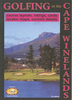
Golfing On The Garden Route

One of a series of four mini-guides to the golf courses of the Western Cape Province in a format of a folded map. Each golf club is presented as a separate panel with a course layout and full details, symbols indicating level of green fees and what facilities can be found there (caddies/clubs for hire, shop, restaurant, on site accommodation, etc.), plus contact details. Each title also includes a general road map of its area, highlighting the position of the clubs, as well as other places of interest.The clubs covered by this title are: George, Goose Valley, Knysna, Mossel Bay, Oubaai, Pezula, Pinnacle Point, Plettenberg, Simola, and the four golf courses of the Fancourt Hotel and Country Club Estate.
RIP - This product is no longer available on our network. It was last seen on 25.09.2019

This page now acts as a permanent archive for this product. Add more information using the comments box below to ensure it can still be found by future generations.

Use our search facility to see if it is available from an alternative contributor.
  • Availability: Out Of Stock
  • Supplier: Stanfords
  • SKU: 9780958490825
Availability: In Stock
£8.50

Product Description

One of a series of four mini-guides to the golf courses of the Western Cape Province in a format of a folded map. Each golf club is presented as a separate panel with a course layout & full details, symbols indicating level of green fees & what facilities can be found there (caddies/clubs for hire, shop, restaurant, on site accommodation, etc.), plus contact details. Each title also

Includes::
a general road map of its area, highlighting the position of the clubs, as well as other places of interest. The clubs covered by this title are: George, Goose Valley, Knysna, Mossel Bay, Oubaai, Pezula, Pinnacle Point, Plettenberg, Simola, & the four golf courses of the Fancourt Hotel & Country Club Estate.

Reviews/Comments

Add New

Intelligent Comparison

Oooops!
We couldn't find anything!
Perhaps this product's unique.... Or perhaps we are still looking for comparisons!
Click to bump this page and we'll hurry up.

Price History

Vouchers

No voucher codes found.
Do you know a voucher code for this product or supplier? Add it to Insights for others to use.

Facebook

Jargon Buster

Hotel - An establishment which provides lodging for a fee
Garden - An outside area with grass and foliage
garden - A planned space used for the display, cultivation and enjoyment of plants and other forms of nature.
Road - a manmade lane or a path that is used to speed up travel.
Golf - A sport played on a large outside grass course, the aim to hit a small ball with a club into small holes.
Accommodation - A room in which someone can live in, for example in a hotel
Estate - A group of houses on the same land or area.
Goose - A large bird that has a long neck, short broad bill and short legs with webbed feet.

Supplier Information

Stanfords
Stanfords was established in 1853 and opened their iconic Covent Garden flagship store in 1901. They have become the top retailer of maps, travel books and accessories in the UK and arguably offer the largest selection of maps and travel books worldwide. Famous names such as Captain Robert Falcon Scott, Ranulph Fiennes and Michael Palin have purchased from Stanfords. They now have a shop in Bristol and both stores together with other venues operate a calendar of events including talks, book signings and exhibitions. As a specialist map retailer, the map selection is comprehensive and includes road maps, street maps and walking maps from worldwide destinations, as well as a selection of world atlases and wall maps. Books include travel guides and travel literature. Stanfords also stock globes, from miniatures made of blue marble to magnificent floor-standing globes. The website features a selection of interesting articles on travel topics.
Page Updated: 2023-11-12 20:15:36

Community Generated Product Tags

Oh No! The productWIKI community hasn't generated any tags for this product yet!
Menu