
 United Kingdom
 France
 Germany
 Netherlands
 Sweden
 USA
USA
 Italy
Italy
 Spain
Spain
More From Contributor


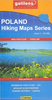

Gorce
Gorce at 1:50, 000 on a contoured and GPS compatible map from CartoMedia highlighting waymarked hiking trails, mountain huts and campsites, places of interest, etc, plus street plans of local towns and resorts: Kroscienko nad Dunajcem, Nowy Targ, Mszana Dolna and Rabka Zdrój, plus a panorama of the Tatra Mountains as seen from the peaks of Luban and Turbacz.Maps in the Cartomedia hiking series present topography is by contours at 20m intervals, enhanced by relief shading and, where appropriate, graphic relief for exposed rocky areas. Waymarked hiking trails indicate approximate walking times in both directions and possible danger points. Most titles also show cross-country and alpine ski routes and mountain bike trails. Symbols mark various types of tourist accommodation
including mountain huts and campsites, mountain rescue and medical facilities, places of interest, etc. Road network indicates scenic routes, petrol stations and border crossings for motorized traffic. The maps have latitude and longitude lines at 1’ intervals. Map legends include English.On the reverse most titles carry additional tourist information, including directories of accommodation and other relevant tourist facilities, street plans, etc.PLEASE NOTE: to see the list of all the titles in this series please click on the series link.
including mountain huts and campsites, mountain rescue and medical facilities, places of interest, etc. Road network indicates scenic routes, petrol stations and border crossings for motorized traffic. The maps have latitude and longitude lines at 1’ intervals. Map legends include English.On the reverse most titles carry additional tourist information, including directories of accommodation and other relevant tourist facilities, street plans, etc.PLEASE NOTE: to see the list of all the titles in this series please click on the series link.

Product Description
Reviews/Comments
Add New
Intelligent Comparison
Archived Product

Gorce Stanfords
£6.99
Archived Product

Gorce Stanfords
£5.95
Archived Product

Grace Stanfords
£12.99
Archived Product
Greece Stanfords
£10.95
Archived Product
Greece Stanfords
£13.59
Archived Product
Greece Stanfords
£12.79
Archived Product
Greece Stanfords
£15.99
Archived Product
Greece Stanfords
£16.99
Vouchers
No voucher codes found.
Do you know a voucher code for this product or supplier? Add it to Insights for others to use.
Do you know a voucher code for this product or supplier? Add it to Insights for others to use.
 Denmark