
 United Kingdom
 France
 Germany
 Netherlands
 Sweden
 USA
USA
 Italy
Italy
 Spain
Spain
More From Contributor


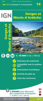
Gorges And Monts D`Ardèche IGN 75014
Selected tourist regions of the France on GPS compatible, contoured TOP 75 maps at 1:75, 000 from the IGN, highlighting local and long-distance hiking paths, cycling routes and sites for other recreational activities. Each title includes five large panels with mapping at 1:25, 000 to cover its most popular areas in greater detail. Cartography of the main map at 1:75, 000 is a direct enlargement of the mapping used in the IGN’s TOP100 series. Contours are at 40m intervals, enhanced by relief shading; additional colouring shows different types of vegetation (woods, brushwood, vineyards/orchards). Boundaries of national parks and other protected areas are marked. An overprint highlights long-distance GR hiking routes and cycling trails. Symbols - more numerous than on the TOP100 maps
- indicate various places of interest including mountain refuges and gîtes d’etape (but not campsites, see below), areas for other recreational pursuits such as climbing, hand gliding or water and winter sports, historic or cultural sites, etc. The maps have a UTM grid and an index of communes. Map legend includes English. Each title also contains five enlargements of popular areas which benefit from presentation at a more detailed scale of 1:25, 000. These are extracts from IGN’s topographic survey maps and in addition to the GR routes also highlight local hiking paths and provide more information on tourist facilities including campsites.
- indicate various places of interest including mountain refuges and gîtes d’etape (but not campsites, see below), areas for other recreational pursuits such as climbing, hand gliding or water and winter sports, historic or cultural sites, etc. The maps have a UTM grid and an index of communes. Map legend includes English. Each title also contains five enlargements of popular areas which benefit from presentation at a more detailed scale of 1:25, 000. These are extracts from IGN’s topographic survey maps and in addition to the GR routes also highlight local hiking paths and provide more information on tourist facilities including campsites.

Product Description
Reviews/Comments
Add New
Vouchers
No voucher codes found.
Do you know a voucher code for this product or supplier? Add it to Insights for others to use.
Do you know a voucher code for this product or supplier? Add it to Insights for others to use.
 Denmark