
 United Kingdom
 France
 Germany
 Netherlands
 Sweden
 USA
USA
 Italy
Italy
 Spain
Spain
More From Contributor


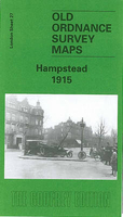
Hampstead 1915
Hampstead in 1915 in a fascinating series of reproductions of old Ordnance Survey plans in the Alan Godfrey Editions, ideal for anyone interested in the history of their neighbourhood or family.Three versions of this map have been published, covering most of Hampstead Village and much of Hampstead Heath. Coverage extends from Finchley Road and Platts Lane eastward to Parliament Hill Road, and from Leg of Mutton Pond southward to Arkwright Road. Features include Hampstead High Street, Christ Church, Workhouse, Rosslyn Hill, Rosslyn Park, Hampstead Heath station, North Western Fever Hospital, Hampstead Ponds, East Heath, West Heath, Frognal Park, Westfield College, tramway to South End Green and depot, Fitzjohns Avenue, Vale of Health and West End. The 1915 map has a good
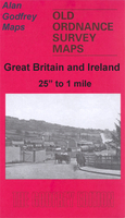
selection of street directories.About the Alan Godfrey Editions of the 25” OS Series:Selected towns in Great Britain and Ireland are covered by maps showing the extent of urban development in the last decades of the 19th and early 20th century. The plans have been taken from the Ordnance Survey mapping and reprinted at about 15 inches to one mile (1:4, 340). On the reverse most maps have historical notes and many also include extracts from contemporary directories. Most maps cover about one mile (1.6kms) north/south, one and a half miles (2.4kms) across; adjoining sheets can be combined to provide wider coverage.FOR MORE INFORMATION AND A COMPLETE LIST OF ALL AVAILABLE TITLES PLEASE CLICK ON THE SERIES LINK.
selection of street directories.About the Alan Godfrey Editions of the 25” OS Series:Selected towns in Great Britain and Ireland are covered by maps showing the extent of urban development in the last decades of the 19th and early 20th century. The plans have been taken from the Ordnance Survey mapping and reprinted at about 15 inches to one mile (1:4, 340). On the reverse most maps have historical notes and many also include extracts from contemporary directories. Most maps cover about one mile (1.6kms) north/south, one and a half miles (2.4kms) across; adjoining sheets can be combined to provide wider coverage.FOR MORE INFORMATION AND A COMPLETE LIST OF ALL AVAILABLE TITLES PLEASE CLICK ON THE SERIES LINK.

Product Description
Reviews/Comments
Add New
Intelligent Comparison
Archived Product
Hamstead 1913 Stanfords
£2.95
Archived Product
Hamstead 1913 Stanfords
£3.50
Archived Product

Hampstead 1894 Stanfords
£3.50
Archived Product

Wanstead 1915 Stanfords
£3.50
Archived Product

Hampstead 1866 Stanfords
£3.50
Archived Product

Hampstead Past Stanfords
£15.95
Archived Product

Plumstead 1914 Stanfords
£3.50
Vouchers
No voucher codes found.
Do you know a voucher code for this product or supplier? Add it to Insights for others to use.
Do you know a voucher code for this product or supplier? Add it to Insights for others to use.
 Denmark