More From Contributor

£15.00
The recorded history of Hampstead goes back a thousand years. but it was only in the 18th century, with the first Hampstead Spa, that it became fashionable. Building took place on part of the heath l&, but local opposition stopped further exploitation of this picturesque open space favoured by artists & the general public. Hampstead retains many of its 18th century buildings & still has much charm, liveliness & distinctive character. This is a well illustrated book written by an eminent Hampstead expert & resident. ...
Archived Product
£5.99
The Artography Map of Hampstead Heath is a beautiful h&-illustrated map & guide to the joys of the Heath, the timeless oasis of countryside & parkland at the heart of North London that has famously inspired generations of authors & artists. The map shows the full area of the heath, with wooded areas, pond & paths marked, & gives surrounding street detail, particularly for Hampstead & Highgate Villages. Over 50 inset illustrations & paintings highlight some of the Heath ...
Archived Product
£9.99
David Mc Dowall’s Walker’s Guide to Hampstead Heath gives the reader 10 enormously detailed walking tours for exploring the Heath, that much-loved slice of undeveloped, beautiful countryside at the heart of North London, & its famed surrounding areas. Far from merely outlining routes & providing directions, this guide constitutes one of the best-researched, most detailed works on the Heath available. Each short stage of each walk is accompanied by explanatory text, giving an extraordinary amount of information on the Heath’s deep, rich history of human activity, its ecology, flora & fauna, & the cast of characters who have lived in & around the Heath & been inspired by it. Contains many h&-drawn black & white illustrations, diagrams, landscapes & maps to supplement the text.”I have great pleasure in recommending this delightful book to you. Hampstead Heath
- arguably the best loved of London’s open spaces
- is many things to many people, but above all it is a place of great beauty & surprising antiquity. For those who wish to walk & discover the hidden joys & treasures which are to be found within the Heath, this book is your passport to a very pleasurable experience & to a fuller understanding of the unique importance of this special place.”
- Christine M. Cohen, Chairman, Hampstead Heath Management Committee, Corporation of London


...
Archived Product
£15.95
The recorded history of Hampstead goes back a thousand years. but it was only in the 18th century, with the first Hampstead Spa, that it became fashionable. Building took place on part of the heath l&, but local opposition stopped further exploitation of this picturesque open space favoured by artists & the general public. Hampstead retains many of its 18th century buildings & still has much charm, liveliness & distinctive character. This is a well illustrated book written by an eminent Hampstead expert & resident. ...
Archived Product
£3.50
Hampton in 1894 in a fascinating series of reproductions of old Ordnance Survey plans in the Alan Godfrey Editions, ideal for anyone interested in the history of their neighbourhood or family. Two versions for this area have been published, stretching from Hampton Village eastward to Chestnut Walk, & from the Manor House southward to Ash Isl&. Features include St Mary`s church, High Street, Southwark & Vauxhall Water Works, Station Road (but not as far as the station), Hurst Park race course (on 1894 version), a stretch of the Thames including Taggs Isl&, The Green, Hampton Court House (but not the Palace), part of Bushy Park, Bushy House. Contemporary Hampton directories are included on the reverse of each version. Please note that on the 1934 version the small Surrey area south of the Thames is left blank. About the Alan Godfrey Editions of the 25” OS Series Selected towns in Great Britain & Ireland are covered by maps showing the extent of urban development in the last decades of the 19th & early 20th century. The plans have been taken from the Ordnance Survey mapping & reprinted at about 15 inches to one mile (1:4, 340). On the reverse most maps have historical notes & many also include extracts from contemporary directories. Most maps cover about one mile (1.6kms) north/south, one & a half miles (2.4kms) across; adjoining sheets can be combined to provide wider coverage.FOR MORE INFORMATION & A COMPLETE LIST OF ALL AVAILABLE TITLES PLEASE CLICK ON THE SERIES LINK. ...
Archived Product
£35.00
Hampton Court
- probably Britain's most important secular historic building complex
- is a fascinating collection of buildings,

...
Archived Product
£3.50
Hampton Court & East Molesey in 1912 in a fascinating series of reproductions of old Ordnance Survey plans in the Alan Godfrey Editions, ideal for anyone interested in the history of their neighbourhood or family. The map covers parts of both Middlesex & Surrey. Hampton Court Palace is shown with its magnificent grounds, & features include The Wilderness, Maze, Royal Mews, Cardinal Wolsey Inn, Ash Isl&. On the Surrey side are East Molesey village, station, St Mary`s church, St Paul`s church, part of Hurst Park racecourse, Molesey Lock, engine shed, The Clump. On the reverse are directorie of Hampton Court in 1890 & East Molesey in 1903. About the Alan Godfrey Editions of the 25” OS Series: Selected towns in Great Britain & Ireland are covered by maps showing the extent of urban development in the last decades of the 19th & early 20th century. The plans have been taken from the Ordnance Survey mapping & reprinted at about 15 inches to one mile (1:4, 340). On the reverse most maps have historical notes & many also include extracts from contemporary directories. Most maps cover about one mile (1.6kms) north/south, one & a half miles (2.4kms) across; adjoining sheets can be combined to provide wider coverage.FOR MORE INFORMATION & A COMPLETE LIST OF ALL AVAILABLE TITLES PLEASE CLICK ON THE SERIES LINK. ...
Archived Product
£12.95
Situated beside the River Thames south-west of London, Hampton Court Palace was a centre of court life in England from 1529 to 1737 & remains one of the finest palaces in Europe. The Official Illustrated History celebrates this intriguing architectural ensemble, including the palace`s original sixteenth-century building of Henry VIII`s reign. It features full coverage of the famous formal gardens & also reveals the lifestyles of monarchs, mistresses & courtiers.

Includes::
full coverage of Hampton Court`s famous & everpopular formal gardens, a precious survival of gardening 300 years ago In the same series as Merrell`s highly popular official illustrated histories of the Tower of London, Kensington Palace & Kew Palace

...
Archived Product
£3.50
Hampton Wick in 1934 in a fascinating series of reproductions of old Ordnance Survey plans in the Alan Godfrey Editions, ideal for anyone interested in the history of their neighbourhood or family. Two versions for this area have been published to show how it developed across the years, but please note that as usual with Middlesex maps in the 1930s, the area in Surrey is left blank. The 1894 map covers both the Middlesex & the Surrey sides of the river by Kingston Bridge. On the Surrey side is the town centre of Kingston, as far east as Richmond Road & Fairfield West, & south to Orchard Road; it

Includes::
the station, All Saints church, Clattern Place, Eden Street, Clarence Street, Horse Fair, brewery, gasworks, etc. Across the river is Hampton Wick, including the station, St John`s church & High Street. The map also extends north to cover a few streets in South Teddington, including Wick Road, Upper Teddington Road, Normansfield. There is also a large expanse of Bushy Park, including Hawthorn Lodge. On the reverse is a list of Private Residents for Hampton Wick, plus street directories for Church St, Market Place & Richmond Rd in Kingston. The 1934 map covers only the Middlesex side of the map, basically Hampton Wick & part of Bushy Park, & also has a directory of Hampton Wick. The introduction

Includes::
an explanation why the OS left Surrey areas blank at this time. About the Alan Godfrey Editions of the 25” OS Series Selected towns in Great Britain & Ireland are covered by maps showing the extent of urban development in the last decades of the 19th & early 20th century. The plans have been taken from the Ordnance Survey mapping & reprinted at about 15 inches to one mile (1:4, 340). On the reverse most maps have historical notes & many also include extracts from contemporary directories. Most maps cover about one mile (1.6kms) north/south, one & a half miles (2.4kms) across; adjoining sheets can be combined to provide wider coverage.FOR MORE INFORMATION & A COMPLETE LIST OF ALL AVAILABLE TITLES PLEASE CLICK ON THE SERIES LINK.


...
Archived Product
£16.99
Sverigeserien is an outdoor map series consisting of 116 sheets with coverage of southern & central Sweden & the northern coastline. The map is suitable for outdoor activities such as hiking, excursions, trail running, hunting, fishing, riding, cycling, mountain biking, paddling, skating & much more. Every sheet covers an area of 45x 68km. These topographical maps in scale 1:50 000 contain all the information needed for outdoor activities: Terrain information, hiking trails, illuminated tracks, camping, shelters, golf courses, leisure baths, historical remains, roads in different categories, railway lines & much more. Easy to read topography with contour lines, vertical interval 5 m. Sverigeserien is a high-quality map series & is durable for frequent use! Updated content with map data from Lantmäteriet (National Land Survey of Sweden) & printed on Polyart which is water & tear resistant. This means that the map can be folded repeatedly without breaking & can withstand the challenging weather in Sweden during both winter & summer. Legend is in Swedish, English & German. ...
Archived Product

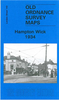
Hampton And Bushy Park 1934

Hampton and Bushy Park in 1934 in a fascinating series of reproductions of old Ordnance Survey plans in the Alan Godfrey Editions, ideal for anyone interested in the history of their neighbourhood or family. Two versions for this area have been published, stretching from Hampton Village eastward to Chestnut Walk, and from the Manor House southward to Ash Island. Features include St Mary`s church, High Street, Southwark & Vauxhall Water Works, Station Road (but not as far as the station), Hurst Park race course (on 1894 version), a stretch of the Thames including Taggs Island, The Green, Hampton Court House (but not the Palace), part of Bushy Park, Bushy House. Contemporary Hampton directories are included on the reverse of each version. Please note that on the 1934 version the
small Surrey area south of the Thames is left blank.About the Alan Godfrey Editions of the 25” OS SeriesSelected towns in Great Britain and Ireland are covered by maps showing the extent of urban development in the last decades of the 19th and early 20th century. The plans have been taken from the Ordnance Survey mapping and reprinted at about 15 inches to one mile (1:4, 340). On the reverse most maps have historical notes and many also include extracts from contemporary directories. Most maps cover about one mile (1.6kms) north/south, one and a half miles (2.4kms) across; adjoining sheets can be combined to provide wider coverage.FOR MORE INFORMATION AND A COMPLETE LIST OF ALL AVAILABLE TITLES PLEASE CLICK ON THE SERIES LINK.
RIP - This product is no longer available on our network. It was last seen on 25.09.2019

This page now acts as a permanent archive for this product. Add more information using the comments box below to ensure it can still be found by future generations.

Use our search facility to see if it is available from an alternative contributor.
  • External links may include paid for promotion
  • Availability: Out Of Stock
  • Supplier: Stanfords
  • SKU: 9781847841544
Availability: In Stock
£3.50

Product Description

Hampton & Bushy Park in 1934 in a fascinating series of reproductions of old Ordnance Survey plans in the Alan Godfrey Editions, ideal for anyone interested in the history of their neighbourhood or family. Two versions for this area have been published, stretching from Hampton Village eastward to Chestnut Walk, & from the Manor House southward to Ash Isl&. Features include St Mary`s church, High Street, Southwark & Vauxhall Water Works, Station Road (but not as far as the station), Hurst Park race course (on 1894 version), a stretch of the Thames including Taggs Isl&, The Green, Hampton Court House (but not the Palace), part of Bushy Park, Bushy House. Contemporary Hampton directories are included on the reverse of each version. Please note that on the 1934 version the small Surrey area south of the Thames is left blank. About the Alan Godfrey Editions of the 25” OS Series Selected towns in Great Britain & Ireland are covered by maps showing the extent of urban development in the last decades of the 19th & early 20th century. The plans have been taken from the Ordnance Survey mapping & reprinted at about 15 inches to one mile (1:4, 340). On the reverse most maps have historical notes & many also include extracts from contemporary directories. Most maps cover about one mile (1.6kms) north/south, one & a half miles (2.4kms) across; adjoining sheets can be combined to provide wider coverage.FOR MORE INFORMATION & A COMPLETE LIST OF ALL AVAILABLE TITLES PLEASE CLICK ON THE SERIES LINK.

Reviews/Comments

Add New

Intelligent Comparison

Oooops!
We couldn't find anything!
Perhaps this product's unique.... Or perhaps we are still looking for comparisons!
Click to bump this page and we'll hurry up.

Price History

Vouchers

No voucher codes found.
Do you know a voucher code for this product or supplier? Add it to Insights for others to use.

Facebook

Jargon Buster

Contemporary - Modern era design
Contemporary - A design reference to indicate post war modern design
water - A chemical substance. Chemical formula H2O.
History - Anything that happens in the past. An acedemic subject.
Small - something that takes up less space than normal.
Road - a manmade lane or a path that is used to speed up travel.
Vauxhall - A british car company, known as OPEL in europe. Vauxhall is owned by General Motors (GM) who are an American based multinational car corporation.

Vauxhall has a wide range of cars covering all market sectors including:
Ampera
Antara
Astra
Corsa
Insignia

Vauxhall also produces a range of commercial vehicles including the Combo Van which is popular with the Royal Mail and the Vivaro and Movano.
Contemporary - An object that is living in the same time.
Ideal - Something that satisfies a perfect criteria.
Family - A group of people that live together made up from parents and children.

Supplier Information

Stanfords
Stanfords was established in 1853 and opened their iconic Covent Garden flagship store in 1901. They have become the top retailer of maps, travel books and accessories in the UK and arguably offer the largest selection of maps and travel books worldwide. Famous names such as Captain Robert Falcon Scott, Ranulph Fiennes and Michael Palin have purchased from Stanfords. They now have a shop in Bristol and both stores together with other venues operate a calendar of events including talks, book signings and exhibitions. As a specialist map retailer, the map selection is comprehensive and includes road maps, street maps and walking maps from worldwide destinations, as well as a selection of world atlases and wall maps. Books include travel guides and travel literature. Stanfords also stock globes, from miniatures made of blue marble to magnificent floor-standing globes. The website features a selection of interesting articles on travel topics.
Page Updated: 2023-11-12 20:15:36

Community Generated Product Tags

Oh No! The productWIKI community hasn't generated any tags for this product yet!
Menu