More From Contributor
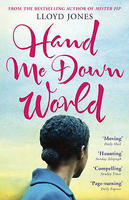
£3.50
Hampton Wick in 1934 in a fascinating series of reproductions of old Ordnance Survey plans in the Alan Godfrey Editions, ideal for anyone interested in the history of their neighbourhood or family. Two versions for this area have been published to show how it developed across the years, but please note that as usual with Middlesex maps in the 1930s, the area in Surrey is left blank. The 1894 map covers both the Middlesex & the Surrey sides of the river by Kingston Bridge. On the Surrey side is the town centre of Kingston, as far east as Richmond Road & Fairfield West, & south to Orchard Road; it

Includes::
the station, All Saints church, Clattern Place, Eden Street, Clarence Street, Horse Fair, brewery, gasworks, etc. Across the river is Hampton Wick, including the station, St John`s church & High Street. The map also extends north to cover a few streets in South Teddington, including Wick Road, Upper Teddington Road, Normansfield. There is also a large expanse of Bushy Park, including Hawthorn Lodge. On the reverse is a list of Private Residents for Hampton Wick, plus street directories for Church St, Market Place & Richmond Rd in Kingston. The 1934 map covers only the Middlesex side of the map, basically Hampton Wick & part of Bushy Park, & also has a directory of Hampton Wick. The introduction

Includes::
an explanation why the OS left Surrey areas blank at this time. About the Alan Godfrey Editions of the 25” OS Series Selected towns in Great Britain & Ireland are covered by maps showing the extent of urban development in the last decades of the 19th & early 20th century. The plans have been taken from the Ordnance Survey mapping & reprinted at about 15 inches to one mile (1:4, 340). On the reverse most maps have historical notes & many also include extracts from contemporary directories. Most maps cover about one mile (1.6kms) north/south, one & a half miles (2.4kms) across; adjoining sheets can be combined to provide wider coverage.FOR MORE INFORMATION & A COMPLETE LIST OF ALL AVAILABLE TITLES PLEASE CLICK ON THE SERIES LINK.


...
Archived Product
£16.99
Sverigeserien is an outdoor map series consisting of 116 sheets with coverage of southern & central Sweden & the northern coastline. The map is suitable for outdoor activities such as hiking, excursions, trail running, hunting, fishing, riding, cycling, mountain biking, paddling, skating & much more. Every sheet covers an area of 45x 68km. These topographical maps in scale 1:50 000 contain all the information needed for outdoor activities: Terrain information, hiking trails, illuminated tracks, camping, shelters, golf courses, leisure baths, historical remains, roads in different categories, railway lines & much more. Easy to read topography with contour lines, vertical interval 5 m. Sverigeserien is a high-quality map series & is durable for frequent use! Updated content with map data from Lantmäteriet (National Land Survey of Sweden) & printed on Polyart which is water & tear resistant. This means that the map can be folded repeatedly without breaking & can withstand the challenging weather in Sweden during both winter & summer. Legend is in Swedish, English & German. ...
Archived Product
£2.95
Hamstead in 1913 in a fascinating series of reproductions of old Ordnance Survey plans in the Alan Godfrey Editions, ideal for anyone interested in the history of their neighbourhood or family. Selected towns in Great Britain & Ireland are covered by maps showing the extent of urban development in the last decades of the 19th & early 20th century. In this title: the map covers the Hamstead area, part of Perry Barr. Features include railway with Great Barr station, Hamstead Colliery, Hamstead Brick Works, Tame Valley Canal, industrial tramways etc. On the reverse is a timetable for the Birmingham-Walsall/ Wolverhampton line in 1897. About the Alan Godfrey Editions of the 25 ...
Archived Product
£3.50
Hamstead in 1913 in a fascinating series of reproductions of old Ordnance Survey plans in the Alan Godfrey Editions, ideal for anyone interested in the history of their neighbourhood or family. The map covers the Hamstead area, part of Perry Barr. Features include railway with Great Barr station, Hamstead Colliery, Hamstead Brick Works, Tame Valley Canal, industrial tramways, etc. On the reverse is a timetable for the Birmingham-Walsall/ Wolverhampton line in 1897. About the Alan Godfrey Editions of the 25” OS Series: Selected towns in Great Britain & Ireland are covered by maps showing the extent of urban development in the last decades of the 19th & early 20th century. The plans have been taken from the Ordnance Survey mapping & reprinted at about 15 inches to one mile (1:4, 340). On the reverse most maps have historical notes & many also include extracts from contemporary directories. Most maps cover about one mile (1.6kms) north/south, one & a half miles (2.4kms) across; adjoining sheets can be combined to provide wider coverage.FOR MORE INFORMATION & A COMPLETE LIST OF ALL AVAILABLE TITLES PLEASE CLICK ON THE SERIES LINK. ...
Archived Product
£12.99
The superb photographs in this book take the reader on a fascinating journey through the recent history of Hampstead, Kilburn, ...
Archived Product
£19.99
In H&, Reef & Steer
- winner of the Best Book of the Sea Award
- Tom explains the different sailing characteristics of classic

...
Archived Product
£25.00
Tom Cunliffe is one of the world`s greatest champions of traditional sailing boats, & is considered the guru of gaff rig sailors. Having worked these beautiful boats all his life, his knowledge is second to none. In H&, Reef & Steer
- winner of the Best Book of the Sea Award
- Tom explains the different sailing characteristics of classic craft & shares his knowledge of the special skills required to handle them. He describes how to manage heavy loads using tackles rather than winches & reveals the mysteries of making the boat work for you rather than fighting with her gear. He shares step by step advice on setting up the rig; sail handling skills (hoisting, setting & reefing) heavy & light air sailing; manouevring a long-keel boat; losing way, scandalizing & steering with sails, topsails, watersails, single-luff spinnakers & fisherman staysails; & much, much more. & for this new edition Tom had added new material on modern gaffers, replicas & a whole new section on sailing aspirational large gaffers. H&, Reef & Steer, with its wonderful watercolour drawings & atmospheric photos, will delight all who love the unique character & grace of classic craft.` Superb` Cruising `A delightful book` Wooden Boat

...
Archived Product
£16.95
Hand Drawn Maps is a fun `how to` book about hand drawn cartography. It is introduced by a brief history of maps & map making, followed by five sections covering everything you need to know to make your own maps. Section 1 covers the practicalities, so by the end of it you are equipped to create your own map using compasses, neatlines, cartouche, handlettering, & your own symbols. Section 2 looks at different types of map, from picture & word maps to architectural blueprints & video game maps. Section 3 uses a wide range of examples to show the reader how to create maps of places, from early strip maps used to describe the journeys taken by 18th-century stagecoaches to dungeon & treasure maps. Section 4 covers maps of ideas. There are exercises throughout to enable the reader to build on the knowledge they have just gained. The book is completed by six st&-alone projects. ...
Archived Product
£14.99
A lined journal, in an ingeniously printed faux leather cover which captures the flavour of finely wrought Renaissance-style leather bindings. It is intricately embellished with one of three designs to reproduce the delicate gold tooling which was brought to Europe via the flourishing trade routes with the east. Closes with a fold-over cover flap. Smythe sewn with 144 pages, plus memento pouch & ribbon page marker. 18x 23cm ...
Archived Product
£10.99
A slim format lined journal, with one of three printed cover designs, inspired by the beauty & feel of 15th century Italian-bound books which were often made from goatskin leather, embellished with gold foil. These books have a subtly weighted magnetic strap for secure closing, ribbon page markers & a memento pouch. Smythe sewn with 176 pages, 9x 18cm ...
Archived Product

Hand Me Down World

Sometimes a person passes through your world and you don`t forget them. She is like that. She is crossing continents, searching for her missing child. Everyone she comes into contact with has a tale to tell: the truck driver who mistook her for a prostitute, the hunters who almost shot her, the Frenchman who loved her, the blind man and the lodger. This is her story.
RIP - This product is no longer available on our network. It was last seen on 25.09.2019

This page now acts as a permanent archive for this product. Add more information using the comments box below to ensure it can still be found by future generations.

Use our search facility to see if it is available from an alternative contributor.
  • External links may include paid for promotion
  • Availability: Out Of Stock
  • Supplier: Stanfords
  • SKU: 9781848544802
Availability: In Stock
£7.99

Product Description

Sometimes a person passes through your world & you don`t forget them. She is like that. She is crossing continents, searching for her missing child. Everyone she comes into contact with has a tale to tell: the truck driver who mistook her for a prostitute, the hunters who almost shot her, the Frenchman who loved her, the blind man & the lodger. This is her story.

Reviews/Comments

Add New

Intelligent Comparison

Oooops!
We couldn't find anything!
Perhaps this product's unique.... Or perhaps we are still looking for comparisons!
Click to bump this page and we'll hurry up.

Price History

Vouchers

No voucher codes found.
Do you know a voucher code for this product or supplier? Add it to Insights for others to use.

Facebook

Jargon Buster

Hand - A part of the body at the end of the arm
Hand - A pointer which indicates time on a clock face
World - A physical grouping, commonly used to describe earth and everything associated with ti

Supplier Information

Stanfords
Stanfords was established in 1853 and opened their iconic Covent Garden flagship store in 1901. They have become the top retailer of maps, travel books and accessories in the UK and arguably offer the largest selection of maps and travel books worldwide. Famous names such as Captain Robert Falcon Scott, Ranulph Fiennes and Michael Palin have purchased from Stanfords. They now have a shop in Bristol and both stores together with other venues operate a calendar of events including talks, book signings and exhibitions. As a specialist map retailer, the map selection is comprehensive and includes road maps, street maps and walking maps from worldwide destinations, as well as a selection of world atlases and wall maps. Books include travel guides and travel literature. Stanfords also stock globes, from miniatures made of blue marble to magnificent floor-standing globes. The website features a selection of interesting articles on travel topics.
Page Updated: 2023-11-12 20:15:36

Community Generated Product Tags

Oh No! The productWIKI community hasn't generated any tags for this product yet!
Menu