More From Contributor

£7.99
” Enemy Of Rome”: The great Carthaginian general, Hannibal, has never forgotten the defeat & humiliation of his father by Rome. Now he plans his revenge & the destruction of the old enemy. ” Soldier Of Carthage”: While Hannibal prepares for war, the young son of one of his most trusted military commanders goes on an innocent adventure with his best friend
- & disappears. ” Slavery”: Captured by pirates, put up for sale in the slave market, one of the boys is sold as a gladiator, the other as a field slave. They believe they will never see home or family again. ”A World Aflame”: But their destiny
- interwoven & linked with that of their Roman masters
- is to be an extraordinary one. The devastating war unleashed upon Rome by Hannibal will last for nearly twenty years. It will change their lives
- & history
- forever.


...
Archived Product
£6.99
The killing fields of Cannae provide the setting for one of the bloodiest battles in history. But who will triumph? Hannibal & his warrior army, or the mighty legions of Rome. By the Sunday Times bestselling author of The Forgotten Legion trilogy. Hannibal`s campaign to defeat Rome continues as he marches south to confront his enemy. With him is a young soldier, Hanno. Like his general, Hanno burns to vanquish Rome. Never has the possibility seemed so likely. But a stealthy game of cat & mouse is being played as Rome`s generals seek to avoid confrontation. Eventually the two armies meet under a fierce summer sun. The place is Cannae
- the fields of blood. The battle will go down in history as one of the bloodiest ever fought, a battle in which Hanno knows he must fight as never before
- just to stay alive.

...
Archived Product
£6.50
ADAC, Germany's equivalent of the British Automobile Association publishes an extensive series of street plans which provide detailed high-quality mapping of all the major towns & cities, including their outer suburbs. The plans name all the individual streets & indicate all the main landmarks & public buildings. All public transport facilities are shown: buses, trams, underground & overland rail lines. One way streets & car parks are indicated. Plans of larger cities include an enlargement for the city centre. The plans also show the administrative & postal divisions & have an extensive street index which, where appropriate, shows individual postal codes for each street. On the reverse, each plan has a road map at 1:100, 000, covering a very wide area around the city. Map legend

Includes::
English.

...
Archived Product
£8.99
Hannover on a topographic map at 1:200, 000 from the Bundesamt für Kartographie und Geodäsie, Germany’s federal mapping agency. The map covers an area of Approx. 100 x 90km. This map is belongs to a series of 58 topographic maps from Bundesamt für Kartographie und Geodäsie, the federal cartographic agency of Germany responsible for topographic mapping at 1:200, 000 & maps at smaller scales (the more detailed topographic & leisure maps are prepared & published by the survey organizations of the individual states). Cartography is from the 200K topographic survey & the maps have very elegant, modern look whilst retaining the traditional German presentation of names of smaller towns & villages in italics. Contours are at 12, 5m intervals, enhanced by relief shading, with colouring for woodlands, moors, marches, vineyards & hop plantations. Waterways & rivers are also described in detail, with currents, waterfalls, dams, & jetties clearly marked. Road network, graded into five types, highlights in colour national & regional roads; no driving distances are marked Railway network is also shown in detail, with stations, goods only lines, etc. The maps show administrative boundaries of states & counties, & have a UTM grid plus margin ticks for latitude & longitude at 2’ intervals. Map legend is in German only.PLEASE NOTE: maps in this series provide an excellent presentation of the areas covered by them, with plenty of place names & detailed representation of the road network, & will appeal to anyone who likes quality cartography, but they are not necessarily the best option for holiday & business travel. To see other titles in this series please click on the series link. ...
Archived Product
£25.99
Hannover
- Hildesheim Region Street Atlas in a series of detailed atlases covering the whole of Germany at 1:20, 000 with UTM
...
Archived Product
£6.50
About these maps: Street maps covering a slightly smaller area than that represented on the Falk Extra edition, thus folding down to a more handy size (10 x 17cm). Some of them are drawn with a varying scale which, for clarity, presents the city centre at a slightly larger scale than the outer districts. Main landmarks & public buildings are indicated, also one-way streets, car parks & all the public transport facilities eg. tram & bus routes, U-bahns. These plans of larger cities include a separate map of the town centre at a more detailed scale & a diagram of the U-Bahn & the suburban rail network. The plans also show the postal divisions & have an extensive street index on the reverse side which, where appropriate, shows individual postal codes for each street. Also included is a smaller scale map of the city & its immediate environs, showing main roads & railways. Map legend

Includes::
English.

...
Archived Product
£9.99
Street plan of the Hannover conurbation in Falk’s Special Fold format, designed to show only a small section of the map at one time. The whole map can be opened but it will be cut in several places. Many find these street plans very user-friendly & easier to handle than conventional maps, others simply hate them!* About Falk street plans:* The plans indicate main landmarks & public buildings & show all the public transport facilities, one way streets & car parks. Plans of larger cities include a separate diagram of the public transport network & an enlargement of the town centre at a more detailed scale. The plans also show postal divisions & have an extensive street index which, where appropriate, shows individual postal codes for each street. * Map legend

Includes::
English.* Falk street plans are published in three different map formats, plus in a series of regional street atlases.* Falk Extra* plans are folded in a standard way, where the whole map can be opened to view the entire area it covers. In most plans on the reverse is a road map of the surrounding area. Latest editions have a UTM grid.* Falk Special Fold* plans, published only for larger cities, have a folding system designed to show only a small section of the map at one time. The whole map can be opened but it will be cut in several places. Many find these street plans very user-friendly & easier to handle than conventional maps, others simply hate them!* Falk City Plans*, published only for main cities, use the same mapping but cover a smaller area then the Extra plans & have a larger map of the city centre.

...
Archived Product
£19.95
One of the titles in a series of regional street atlases providing detailed mapping of the main urban conurbations in Germany. The plans name all the individual streets & indicate all the main landmarks & public buildings. All public transport facilities are shown: buses, trams, underground & overland rail lines. One way streets & car parks are indicated. Each atlas also

Includes::
enlargements showing town centres at a more detailed scale, a general road map of the area, & diagrams of motorways with exits & service areas. The plans also show the postal divisions & have an extensive street index which, where appropriate, shows individual postal codes for each street. Map legend

Includes::
English. In this atlas: the area around Hannover, including Hildesheim, Nienburg, Celle, Stadthagen, Peine, & Hameln.


...
Archived Product
£9.99
”A gripping thriller, an unspeakable crime, an essential history”. (John Le Carre). Hanns Alexander was the son of a prosperous German family who fled Berlin for London in the 1930s. Rudolf Hoss was a farmer & soldier who became the Kommandant of Auschwitz Concentration Camp & oversaw the deaths of over a million men, women & children. In the aftermath of the Second World War, the first British War Crimes Investigation Team is assembled to hunt down the senior Nazi officials responsible for the greatest atrocities the world has ever seen. Lieutenant Hanns Alexander is one of the lead investigators, Rudolf Hoss his most elusive target. In this book Thomas Harding reveals for the very first time the full account of Hoss` capture. Moving from the Middle-Eastern campaigns of the First World War to bohemian Berlin in the 1920s, to the horror of the concentration camps & the trials in Belsen & Nuremberg, Hanns & Rudolf tells the story of two German men whose lives diverged, & intersected, in an astonishing way. ...
Archived Product
£9.50
Topographical survey of Belgium at 1:20, 000 from Nationaal Geografisch Instituut / Institut Géographique National, the country’s national survey organization. Each 20K map covers one quarter of the corresponding 1:50, 000 map (with adjustments in the border & coastal areas). The maps provide all the information expected of topographic mapping at this scale & in addition have an unusually large amount of vegetation and/or land use information (different types of woodlands, gardens, orchards, heath, etc). The maps have a 1-km UTM grid, with margin ticks for latitude & longitude at intervals of 1`. Map legend & a glossary of terms used on the maps include English. Stanfords keeps as regular stock 20K maps for the World War I battlefields around the Ypres, Messines & Passchendaele, & for the area of the Battle of Waterloo. The 1:20, 000 survey covers the whole of Belgium & maps for other regions can be supplied as special orders. To see the list of titles in this series please click on the series link.PLEASE NOTE: the Long-Distance Footpaths Map of Belgium at 1:300, 000 which shows the division of Belgium into the 50K survey sheets can also be used to see in more detail coverage by the 20K maps. ...
Archived Product

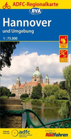
Hannover - Weserbergland Cycling Map

Hannover – Weserbergland on a waterproof, tear-resistant, GPS compatible cycling map at 1:75, 000 from the ADFC (Allgemeiner Deutscher Fahrrad-Club - the official German cycling federation), in a series of maps with extensive overprint for long-distance and local cycling routes. GPS waypoints, route profiles, details of online links for information about accommodation etc. are also provided.Maps included in this series are contoured and the interval varies according to the type of the terrain. Steep sections are annotated with gradient markings. Colouring and/or graphics show various types of landscape: woods, vineyards, etc. An overprint highlights both the national long-distance cycling routes and the shorter local cycling trails, each clearly identified by a symbol and/or an
abbreviation of its name. Sections with heavy traffic and/or poor road surface are clearly marked. Symbols indicate various facilities, such as railway stations with cycle hire, cycle repair shops, campsites, youth hostels, shelters, country restaurants/bars, sport and leisure facilities. Maps have a UTM grid for measuring distances and for determining location using GPS device and they are printed on weather resistant and tear-resistant paper. Each map covers an area of approximately 87 x 130 km and the map legend is in German only.To see all the titles in this series please click on the series link.
RIP - This product is no longer available on our network. It was last seen on 25.09.2019

This page now acts as a permanent archive for this product. Add more information using the comments box below to ensure it can still be found by future generations.

Use our search facility to see if it is available from an alternative contributor.
  • External links may include paid for promotion
  • Availability: Out Of Stock
  • Supplier: Stanfords
  • SKU: 9783870738426
Availability: In Stock
£10.99

Product Description

Hannover – Weserbergland on a waterproof, tear-resistant, GPS compatible cycling map at 1:75, 000 from the ADFC (Allgemeiner Deutscher Fahrrad-Club
- the official German cycling federation), in a series of maps with extensive overprint for long-distance & local cycling routes. GPS waypoints, route profiles, details of online links for information about accommodation etc. are also provided. Maps included in this series are contoured & the interval varies according to the type of the terrain. Steep sections are annotated with gradient markings. Colouring and/or graphics show various types of landscape: woods, vineyards, etc. An overprint highlights both the national long-distance cycling routes & the shorter local cycling trails, each clearly identified by a symbol and/or an abbreviation of its name. Sections with heavy traffic and/or poor road surface are clearly marked. Symbols indicate various facilities, such as railway stations with cycle hire, cycle repair shops, campsites, youth hostels, shelters, country restaurants/bars, sport & leisure facilities. Maps have a UTM grid for measuring distances & for determining location using GPS device & they are printed on weather resistant & tear-resistant paper. Each map covers an area of Approx. 87 x 130 km & the map legend is in German only. To see all the titles in this series please click on the series link.

Reviews/Comments

Add New

Intelligent Comparison

Oooops!
We couldn't find anything!
Perhaps this product's unique.... Or perhaps we are still looking for comparisons!
Click to bump this page and we'll hurry up.

Price History

Vouchers

No voucher codes found.
Do you know a voucher code for this product or supplier? Add it to Insights for others to use.

Facebook

Jargon Buster

GPS - Global Positioning System - Global position using satellites
Paper - A thin sheet mainly used for writing. Available in a variety of colours. Made mainly from wood pulp.
Graphics - A general term for visual aspects of an item/display
Waterproof - Resistant to water, usualy specified by depth in metres
heavy - A concept of weight indicating an item may require some effort to lift or move
Weather - is the change of an atmospheres conditions.
Km - Kilometre. A unit of measurement equal to 1000 metres.
Road - a manmade lane or a path that is used to speed up travel.
Resistant - Something that can repel against something.
Accommodation - A room in which someone can live in, for example in a hotel

Supplier Information

Stanfords
Stanfords was established in 1853 and opened their iconic Covent Garden flagship store in 1901. They have become the top retailer of maps, travel books and accessories in the UK and arguably offer the largest selection of maps and travel books worldwide. Famous names such as Captain Robert Falcon Scott, Ranulph Fiennes and Michael Palin have purchased from Stanfords. They now have a shop in Bristol and both stores together with other venues operate a calendar of events including talks, book signings and exhibitions. As a specialist map retailer, the map selection is comprehensive and includes road maps, street maps and walking maps from worldwide destinations, as well as a selection of world atlases and wall maps. Books include travel guides and travel literature. Stanfords also stock globes, from miniatures made of blue marble to magnificent floor-standing globes. The website features a selection of interesting articles on travel topics.
Page Updated: 2023-11-12 20:15:36

Community Generated Product Tags

Oh No! The productWIKI community hasn't generated any tags for this product yet!
Menu