More From Contributor
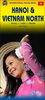
£6.50
About these maps: Street maps covering a slightly smaller area than that represented on the Falk Extra edition, thus folding down to a more handy size (10 x 17cm). Some of them are drawn with a varying scale which, for clarity, presents the city centre at a slightly larger scale than the outer districts. Main landmarks & public buildings are indicated, also one-way streets, car parks & all the public transport facilities eg. tram & bus routes, U-bahns. These plans of larger cities include a separate map of the town centre at a more detailed scale & a diagram of the U-Bahn & the suburban rail network. The plans also show the postal divisions & have an extensive street index on the reverse side which, where appropriate, shows individual postal codes for each street. Also included is a smaller scale map of the city & its immediate environs, showing main roads & railways. Map legend

Includes::
English.

...
Archived Product
£9.99
Street plan of the Hannover conurbation in Falk’s Special Fold format, designed to show only a small section of the map at one time. The whole map can be opened but it will be cut in several places. Many find these street plans very user-friendly & easier to handle than conventional maps, others simply hate them!* About Falk street plans:* The plans indicate main landmarks & public buildings & show all the public transport facilities, one way streets & car parks. Plans of larger cities include a separate diagram of the public transport network & an enlargement of the town centre at a more detailed scale. The plans also show postal divisions & have an extensive street index which, where appropriate, shows individual postal codes for each street. * Map legend

Includes::
English.* Falk street plans are published in three different map formats, plus in a series of regional street atlases.* Falk Extra* plans are folded in a standard way, where the whole map can be opened to view the entire area it covers. In most plans on the reverse is a road map of the surrounding area. Latest editions have a UTM grid.* Falk Special Fold* plans, published only for larger cities, have a folding system designed to show only a small section of the map at one time. The whole map can be opened but it will be cut in several places. Many find these street plans very user-friendly & easier to handle than conventional maps, others simply hate them!* Falk City Plans*, published only for main cities, use the same mapping but cover a smaller area then the Extra plans & have a larger map of the city centre.

...
Archived Product
£19.95
One of the titles in a series of regional street atlases providing detailed mapping of the main urban conurbations in Germany. The plans name all the individual streets & indicate all the main landmarks & public buildings. All public transport facilities are shown: buses, trams, underground & overland rail lines. One way streets & car parks are indicated. Each atlas also

Includes::
enlargements showing town centres at a more detailed scale, a general road map of the area, & diagrams of motorways with exits & service areas. The plans also show the postal divisions & have an extensive street index which, where appropriate, shows individual postal codes for each street. Map legend

Includes::
English. In this atlas: the area around Hannover, including Hildesheim, Nienburg, Celle, Stadthagen, Peine, & Hameln.


...
Archived Product
£9.99
”A gripping thriller, an unspeakable crime, an essential history”. (John Le Carre). Hanns Alexander was the son of a prosperous German family who fled Berlin for London in the 1930s. Rudolf Hoss was a farmer & soldier who became the Kommandant of Auschwitz Concentration Camp & oversaw the deaths of over a million men, women & children. In the aftermath of the Second World War, the first British War Crimes Investigation Team is assembled to hunt down the senior Nazi officials responsible for the greatest atrocities the world has ever seen. Lieutenant Hanns Alexander is one of the lead investigators, Rudolf Hoss his most elusive target. In this book Thomas Harding reveals for the very first time the full account of Hoss` capture. Moving from the Middle-Eastern campaigns of the First World War to bohemian Berlin in the 1920s, to the horror of the concentration camps & the trials in Belsen & Nuremberg, Hanns & Rudolf tells the story of two German men whose lives diverged, & intersected, in an astonishing way. ...
Archived Product
£9.50
Topographical survey of Belgium at 1:20, 000 from Nationaal Geografisch Instituut / Institut Géographique National, the country’s national survey organization. Each 20K map covers one quarter of the corresponding 1:50, 000 map (with adjustments in the border & coastal areas). The maps provide all the information expected of topographic mapping at this scale & in addition have an unusually large amount of vegetation and/or land use information (different types of woodlands, gardens, orchards, heath, etc). The maps have a 1-km UTM grid, with margin ticks for latitude & longitude at intervals of 1`. Map legend & a glossary of terms used on the maps include English. Stanfords keeps as regular stock 20K maps for the World War I battlefields around the Ypres, Messines & Passchendaele, & for the area of the Battle of Waterloo. The 1:20, 000 survey covers the whole of Belgium & maps for other regions can be supplied as special orders. To see the list of titles in this series please click on the series link.PLEASE NOTE: the Long-Distance Footpaths Map of Belgium at 1:300, 000 which shows the division of Belgium into the 50K survey sheets can also be used to see in more detail coverage by the 20K maps. ...
Archived Product
£5.59
Hanoi & Halong Bay in the Encounter Guide Series from Lonely Planet, exploring a range of cities & regions worldwide in a handy, pocket-sized format designed to introduce visitors to the distinctive neighbourhoods of the destination. Frank & informal in style, the guides are renowned for their appeal to independent travellers & are written & researched by local authors. Each guide is organised into 5 distinct sections
- Highlights, Diary, Itineraries, Neighbourhoods & Snapshots
- recommending a series of essential encounters for visitors to the region. Each guide opens with a

...
Archived Product
£8.99
Hanoi & Northern Vietnam in the Footprint Focus Guides, which are targeted at cities, regions & countries worldwide that have no, or very limited, coverage from other publishers. Widely recognised for their reliability & independent writing style, Footprint Focus guides all have the same layout. Smaller than their sister Handbooks, the Focus guides are intended to streamline the information contained so that you have more of what you need, without losing Footprint ...
Archived Product
£8.99
Rugged scenery, vibrant colour, diverse people & the thrill of discovering the unknown: the north represents the finest Vietnam has to offer. Explore the charming, tree-lined boulevards of Hanoi, visit hill tribe minorities, & marvel at the jagged islands of Halong Bay; Footprint Hanoi & Northern Vietnam covers the top attractions in this magnificent region, plus lesser-known sights off the beaten track. Provides recommendations for all budgets on where to eat, sleep & try the local beer, as well as the low-down on the best food markets & water puppet theatre. Essentials section with practical advice on getting there & around. Highlights map so you know what not to miss. Comprehensive listings including where to eat, sleep & relax. Detailed street maps for Hanoi & other key locations in northern Vietnam. Slim enough to fit in your pocket yet loaded with advice & information, this concise Footprint guide will help you get the most out of Hanoi & northern Vietnam without weighing you down. ...
Archived Product
£9.99
Double-sided map from ITMB combining a street plan of Hanoi at 1:14, 000 with a road map of the northern part of Vietnam, plus a street plan of Hue & enlargements of the environs of both cities. On one side is an indexed street plan of Hanoi, prepared by ITMB’s Vietnamese cartographers & highlighting a wide range of facilities & places of interest in the capital, including numerous hotels, restaurants, shopping centres, embassies, cultural institutions & historic sites, etc. Bus routes are shown with line numbers & for divers the plan indicates main traffic arteries. The index

Includes::
lists of embassies, tourist offices & points of interest. The plan is accompanied by a road map at 1:500, 000 covering the Hanoi’s outlying urban area with locations of numerous pagodas. On the reverse is an indexed map at 1:925, 000 of northern Vietnam, extending south just beyond Hue. Altitude colouring shows the topography, with numerous peaks & spot heights in mountainous areas. Swap areas are also marked. National parks & other protected areas are highlighted. Road network

Includes::
selected local roads, tracks & trails, with driving distances on main routes & locations of border crossings. Various routes of the Ho Chi Minh Trail are highlighted. Railway lines & local airports are included. The map indicates numerous places of interest, both historic sites & natural curiosities, some annotated with brief descriptions. The map is indexed & has latitude & longitude lines drawn at intervals of 1°. Additional panels present in greater detail the environs of Hue plus a street plan of the city, both highlighting numerous historic sights. Also included is an administrative map of Vietnam showing the division of the country into provinces.


...
Archived Product

Hanoi

Hanoi in the Luxe city guides series, which are slim and small enough to fit easily in a pocket or handbag. Information is distilled from elite suggestions by city residents, specially selected for their style, knowledge and expertise.Luxe guides aim at the upper end of the market and subjectively edit to choose the very best recommendations for shopping, restaurants, leisure options and nightlife. Half day shopping and activity itineraries are suggested for you to mix and match your visit to suit your timetable.When folded close the cardboard guide slots into its own protective plastic frame. Vanity Fair magazine calls them
RIP - This product is no longer available on our network. It was last seen on 25.09.2019

This page now acts as a permanent archive for this product. Add more information using the comments box below to ensure it can still be found by future generations.

Use our search facility to see if it is available from an alternative contributor.
  • External links may include paid for promotion
  • Availability: Out Of Stock
  • Supplier: Stanfords
  • SKU: 9789888000791
Availability: In Stock
£4.99

Product Description

Hanoi in the Luxe city guides series, which are slim & small enough to fit easily in a pocket or handbag. Information is distilled from elite suggestions by city residents, specially selected for their style, knowledge & expertise. Luxe guides aim at the upper end of the market & subjectively edit to choose the very best recommendations for shopping, restaurants, leisure options & nightlife. Half day shopping & activity itineraries are suggested for you to mix & match your visit to suit your timetable. When folded close the cardboard guide slots into its own protective plastic frame. Vanity Fair magazine calls them

Reviews/Comments

Add New

Intelligent Comparison

Oooops!
We couldn't find anything!
Perhaps this product's unique.... Or perhaps we are still looking for comparisons!
Click to bump this page and we'll hurry up.

Price History

Vouchers

No voucher codes found.
Do you know a voucher code for this product or supplier? Add it to Insights for others to use.

Facebook

Jargon Buster

Plastic - A generic term for a synthetic product used in the manufacture of products
Day - The time it takes a planet or other space objects to complete one rotation.
Small - something that takes up less space than normal.
Pocket - A bag shaped insert in clothing used to carry items
Slots - A narrow opening which something can be inserted into, or a machine commonly found in casinos to win money and tokens.

Supplier Information

Stanfords
Stanfords was established in 1853 and opened their iconic Covent Garden flagship store in 1901. They have become the top retailer of maps, travel books and accessories in the UK and arguably offer the largest selection of maps and travel books worldwide. Famous names such as Captain Robert Falcon Scott, Ranulph Fiennes and Michael Palin have purchased from Stanfords. They now have a shop in Bristol and both stores together with other venues operate a calendar of events including talks, book signings and exhibitions. As a specialist map retailer, the map selection is comprehensive and includes road maps, street maps and walking maps from worldwide destinations, as well as a selection of world atlases and wall maps. Books include travel guides and travel literature. Stanfords also stock globes, from miniatures made of blue marble to magnificent floor-standing globes. The website features a selection of interesting articles on travel topics.
Page Updated: 2023-11-12 20:15:36

Community Generated Product Tags

Oh No! The productWIKI community hasn't generated any tags for this product yet!
Menu