More From Contributor

£29.99
Topographic survey of Denmark at 1:100, 000 from Kort & Matrikelstyrelsen, the country’s national survey organization. The maps have contours at 5 metre intervals, with colouring and/or graphics showing various types of terrain & land use: woodlands, orchards, heath, sand & dunes, tidal flats, meadows & marshl&, etc. The maps provide detailed presentation of the road & rail networks & other information expected of topographic mapping at this scale. No specifically tourist information such as waymarked cycling or hiking routes is shown. Standard size sheets cover an area of 56 x 45km / 35x 28 miles approx. Map legend

Includes::
English. To see other titles in this series please click on the series link.IMPORTANT – PLEASE NOTE BEFORE ORDERING:AVAILABILITY: all the maps are now printed on dem&. Delivery from Denmark can take over 4 weeks. Once an order has been placed we cannot accept any returns for credit.COORDINATES: although the maps are meant to have UTM coordinates for EUREF 89 (WGS 84) datum, sheets are sometimes delivered printed without any grid or margin ticks for UTM or latitude & longitude.

...
Archived Product
£3.50
Hanwell & Norwood Green in 1894 in a fascinating series of reproductions of old Ordnance Survey plans in the Alan Godfrey Editions, ideal for anyone interested in the history of their neighbourhood or family. Two versions of this map have been published to show how the area developed across the years. The maps cover the southern portion of Hanwell around St Mark`s church in the north-eastern corner, extending south & west to include the village of Norwood Green, with St Mary`s church in the south-western corner. The GWR Brentford branch, Windmill Lane, & the Grand Junction Canal run through the map. The principal feature is the Hanwell Lunatic Asylum, opened in 1831, & part of the map covers the northern section of Osterley Park. Extracts from early directories on the reverse on the 1894 map; the 1934 map has entries K-Z of the Hanwell entry from a 1933 directory. About the Alan Godfrey Editions of the 25” OS Series: Selected towns in Great Britain & Ireland are covered by maps showing the extent of urban development in the last decades of the 19th & early 20th century. The plans have been taken from the Ordnance Survey mapping & reprinted at about 15 inches to one mile (1:4, 340). On the reverse most maps have historical notes & many also include extracts from contemporary directories. Most maps cover about one mile (1.6kms) north/south, one & a half miles (2.4kms) across; adjoining sheets can be combined to provide wider coverage.FOR MORE INFORMATION & A COMPLETE LIST OF ALL AVAILABLE TITLES PLEASE CLICK ON THE SERIES LINK. ...
Archived Product
£3.50
Hanwell & Norwood Green in 1934 in a fascinating series of reproductions of old Ordnance Survey plans in the Alan Godfrey Editions, ideal for anyone interested in the history of their neighbourhood or family. Two versions of this map have been published to show how the area developed across the years. The maps cover the southern portion of Hanwell around St Mark`s church in the north-eastern corner, extending south & west to include the village of Norwood Green, with St Mary`s church in the south-western corner. The GWR Brentford branch, Windmill Lane, & the Grand Junction Canal run through the map. The principal feature is the Hanwell Lunatic Asylum, opened in 1831, & part of the map covers the northern section of Osterley Park. Extracts from early directories on the reverse on the 1894 map; the 1934 map has entries K-Z of the Hanwell entry from a 1933 directory. About the Alan Godfrey Editions of the 25” OS Series: Selected towns in Great Britain & Ireland are covered by maps showing the extent of urban development in the last decades of the 19th & early 20th century. The plans have been taken from the Ordnance Survey mapping & reprinted at about 15 inches to one mile (1:4, 340). On the reverse most maps have historical notes & many also include extracts from contemporary directories. Most maps cover about one mile (1.6kms) north/south, one & a half miles (2.4kms) across; adjoining sheets can be combined to provide wider coverage.FOR MORE INFORMATION & A COMPLETE LIST OF ALL AVAILABLE TITLES PLEASE CLICK ON THE SERIES LINK. ...
Archived Product
£3.50
Hanwell Village in 1894 in a fascinating series of reproductions of old Ordnance Survey plans in the Alan Godfrey Editions, ideal for anyone interested in the history of their neighbourhood or family. Two versions of this map have been published; each map covers the same area, still largely rural in 1894, stretching from Mount Pleasant & Dormers Wells Lane eastward to Hanwell Park & Cuckoo Lane, & from Central London District School southward to Hanwell High Street. By 1934 the area is more built up & the later map covers Hanwell Village & the area north & west, with the eastern part of Southall around Burns Avenue & Dormers Wells. Features include Hanwell station, Hanwell Bridge, Broadway, Elthorne Heights, Brent Lodge Park, St Mary`s church, Church Road, Mill Farm. The 1934 version

Includes::
the A-J entries from a contemporary trade directory. About the Alan Godfrey Editions of the 25” OS Series: Selected towns in Great Britain & Ireland are covered by maps showing the extent of urban development in the last decades of the 19th & early 20th century. The plans have been taken from the Ordnance Survey mapping & reprinted at about 15 inches to one mile (1:4, 340). On the reverse most maps have historical notes & many also include extracts from contemporary directories. Most maps cover about one mile (1.6kms) north/south, one & a half miles (2.4kms) across; adjoining sheets can be combined to provide wider coverage.FOR MORE INFORMATION & A COMPLETE LIST OF ALL AVAILABLE TITLES PLEASE CLICK ON THE SERIES LINK.

...
Archived Product
£3.50
Hanwell Village in 1934 in a fascinating series of reproductions of old Ordnance Survey plans in the Alan Godfrey Editions, ideal for anyone interested in the history of their neighbourhood or family. Two versions of this map have been published; each map covers the same area, still largely rural in 1894, stretching from Mount Pleasant & Dormers Wells Lane eastward to Hanwell Park & Cuckoo Lane; from Central London District School southward to Hanwell High Street. By 1934 the area is more built up & the later map covers Hanwell Village & the area north & west, with the eastern part of Southall around Burns Avenue & Dormers Wells. Features include Hanwell station, Hanwell Bridge, Broadway, Elthorne Heights, Brent Lodge Park, St Mary`s church, Church Road, Mill Farm. The 1934 version

Includes::
the A-J entries from a contemporary trade directory. About the Alan Godfrey Editions of the 25” OS Series: Selected towns in Great Britain & Ireland are covered by maps showing the extent of urban development in the last decades of the 19th & early 20th century. The plans have been taken from the Ordnance Survey mapping & reprinted at about 15 inches to one mile (1:4, 340). On the reverse most maps have historical notes & many also include extracts from contemporary directories. Most maps cover about one mile (1.6kms) north/south, one & a half miles (2.4kms) across; adjoining sheets can be combined to provide wider coverage.FOR MORE INFORMATION & A COMPLETE LIST OF ALL AVAILABLE TITLES PLEASE CLICK ON THE SERIES LINK.

...
Archived Product
£3.50
Hanworth Park in 1934 in a fascinating series of reproductions of old Ordnance Survey plans in the Alan Godfrey Editions, ideal for anyone interested in the history of their neighbourhood or family. The map catches the area at the peak of its fame, when the London Air Park was thriving. This airport was twice visited by the Graf Zeppelin, & survived until 1947, by which time it was too close to the expanding Heathrow. The map

Includes::
the Air Park & the area east towards New Hanworth, & north towards the SR Windsor line of which just a small section is shown. The map is crossed diagonally by Hampton Road, becoming Uxbridge Road, & other roads include Hounslow Road, Waverley Avenue, Twickenham Road. Other features include farms & nurseries, while the River Crane meanders through the map. There is a directory of Hanworth on the back, together with a very informative history of the area by Tony Painter. About the Alan Godfrey Editions of the 25” OS Series: Selected towns in Great Britain & Ireland are covered by maps showing the extent of urban development in the last decades of the 19th & early 20th century. The plans have been taken from the Ordnance Survey mapping & reprinted at about 15 inches to one mile (1:4, 340). On the reverse most maps have historical notes & many also include extracts from contemporary directories. Most maps cover about one mile (1.6kms) north/south, one & a half miles (2.4kms) across; adjoining sheets can be combined to provide wider coverage.FOR MORE INFORMATION & A COMPLETE LIST OF ALL AVAILABLE TITLES PLEASE CLICK ON THE SERIES LINK.

...
Archived Product
£16.99
Topographic survey of Sweden at 1:50, 000, the Terrängkartan, from the Lantmäteriet, covering most of the country in 244 double-sided maps. Please note: the mountainous regions of central & northern Sweden are not covered by this series but presented in a separate “ Fjällkartan
- Mountain Map” series also listed on our website. Each 1:50, 000 topographic survey map covers an area of 37.5 x 40km. The maps have contours at 5 metre intervals, plus relief shading & graphics for rocky outcrops & boulders. Further graphics and/or colouring show different types of land use or vegetation (forests, arable l&, orchards, marshes, peat bogs, etc). An unusual feature of this survey is the colouring indicating buildings below or above two storeys high & “leisure/holiday homes”. The maps indicate privately maintained roads & include all other information expected of topographic survey at this scale. The maps have a 1-km UTM grid, plus latitude & longitude lines 5’ intervals. Map legend

Includes::
English. For coverage of the country’s most visited hiking areas in central & northern Sweden please see Lantmäteriet’s Mountain Map series, listed separately on our website.


...
Archived Product
£16.99
A breathtaking novel from Orange Prize-shortlisted & Commonwealth Writers` Prize-winning author Aminatta Forna Waterloo Bridge, London. Two strangers collide. Attila, a Ghanaian psychiatrist, & Jean, an American studying the habits of urban foxes. From this chance encounter in the midst of the rush of a great city, numerous moments of connections span out & interweave, bringing disparate lives together. Attila has arrived in London with two tasks: to deliver a keynote speech on trauma & to check up on the daughter of friends, his `niece`, Ama, who hasn`t called home in a while. It soon emerges that she has been swept up in an immigration crackdown
- & now her young son Tano is missing. When, by chance, Attila bumps into Jean again, she joins him in his search for Tano, mobilizing into action the network she has built up, mainly from the many West African immigrants working London`s myriad streets, of volunteer fox-spotters: security guards, hotel doormen, traffic wardens. All unite to help & as the search continues, a deepening friendship between Attila & Jean unfolds. In this delicate yet powerful novel of loves lost & new, of past griefs & of the hidden side of a teeming metropolis, Aminatta Forna asks us to consider the values of the society we live in, our co-existence with one another & all living creatures
- & the true nature of happiness.

...
Archived Product
£7.99
Happiness & How it Happens reveals how happiness-the state of being we all aspire to-is a natural state for us, & so is attainable for all. The Happy Buddha explores what happiness actually is & how we all can achieve it through the transformational practice of mindfulness meditation. Sharing personal & philosophical reflections, practical teachings, & enlightening insights into trust, compassion, radical self-acceptance, & the value of contentment, The Happy Buddha draws upon Buddhism, psychotherapy, & focusing (a method of listening to our intuitive wisdom) to reveal the true riches of wellbeing. ...
Archived Product
£9.99
As a Professor of Behavioural Science at the London School of Economics, Dolan conducts original research into the measurement of happiness & its causes & consequences, including the effects of our behaviour. Here he creates a new outlook on the pursuit of happiness
- it`s not just how you feel, it`s how you act. Happiness by Design shows that being happier requires us to actively re-design our immediate environment. Enough has been written on how to think happy. Happiness by Design is about how to behave happy & how to incorporate the most recent research findings into our everyday lives.
...
Archived Product

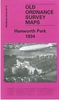
Hanworth And North West Hampton 1934

Hanworth and North West Hampton in 1934 in a fascinating series of reproductions of old Ordnance Survey plans in the Alan Godfrey Editions, ideal for anyone interested in the history of their neighbourhood or family. The map covers parts of Hampton and Hanworth, stretching from Castle Way eastward to Nightingale Road and southward to Barlow Road. Features include centre of Hanworth with war memorial, St George`s church, Tudor Court, reservoirs and pumping station, many nursery greenhouses, isolation hospital, All Saints church etc. On the reverse are 1890 and 1933 directories for Hanworth.About the Alan Godfrey Editions of the 25” OS Series:Selected towns in Great Britain and Ireland are covered by maps showing the extent of urban development in the last decades of the 19th and
early 20th century. The plans have been taken from the Ordnance Survey mapping and reprinted at about 15 inches to one mile (1:4, 340). On the reverse most maps have historical notes and many also include extracts from contemporary directories. Most maps cover about one mile (1.6kms) north/south, one and a half miles (2.4kms) across; adjoining sheets can be combined to provide wider coverage.FOR MORE INFORMATION AND A COMPLETE LIST OF ALL AVAILABLE TITLES PLEASE CLICK ON THE SERIES LINK.
RIP - This product is no longer available on our network. It was last seen on 25.09.2019

This page now acts as a permanent archive for this product. Add more information using the comments box below to ensure it can still be found by future generations.

Use our search facility to see if it is available from an alternative contributor.
  • External links may include paid for promotion
  • Availability: Out Of Stock
  • Supplier: Stanfords
  • SKU: 9781847846310
Availability: In Stock
£3.50

Product Description

Hanworth & North West Hampton in 1934 in a fascinating series of reproductions of old Ordnance Survey plans in the Alan Godfrey Editions, ideal for anyone interested in the history of their neighbourhood or family. The map covers parts of Hampton & Hanworth, stretching from Castle Way eastward to Nightingale Road & southward to Barlow Road. Features include centre of Hanworth with war memorial, St George`s church, Tudor Court, reservoirs & pumping station, many nursery greenhouses, isolation hospital, All Saints church etc. On the reverse are 1890 & 1933 directories for Hanworth. About the Alan Godfrey Editions of the 25” OS Series: Selected towns in Great Britain & Ireland are covered by maps showing the extent of urban development in the last decades of the 19th & early 20th century. The plans have been taken from the Ordnance Survey mapping & reprinted at about 15 inches to one mile (1:4, 340). On the reverse most maps have historical notes & many also include extracts from contemporary directories. Most maps cover about one mile (1.6kms) north/south, one & a half miles (2.4kms) across; adjoining sheets can be combined to provide wider coverage.FOR MORE INFORMATION & A COMPLETE LIST OF ALL AVAILABLE TITLES PLEASE CLICK ON THE SERIES LINK.

Reviews/Comments

Add New

Intelligent Comparison

Oooops!
We couldn't find anything!
Perhaps this product's unique.... Or perhaps we are still looking for comparisons!
Click to bump this page and we'll hurry up.

Price History

Vouchers

No voucher codes found.
Do you know a voucher code for this product or supplier? Add it to Insights for others to use.

Facebook

Jargon Buster

Contemporary - Modern era design
Contemporary - A design reference to indicate post war modern design
History - Anything that happens in the past. An acedemic subject.
Road - a manmade lane or a path that is used to speed up travel.
Contemporary - An object that is living in the same time.
Ideal - Something that satisfies a perfect criteria.
Family - A group of people that live together made up from parents and children.

Supplier Information

Stanfords
Stanfords was established in 1853 and opened their iconic Covent Garden flagship store in 1901. They have become the top retailer of maps, travel books and accessories in the UK and arguably offer the largest selection of maps and travel books worldwide. Famous names such as Captain Robert Falcon Scott, Ranulph Fiennes and Michael Palin have purchased from Stanfords. They now have a shop in Bristol and both stores together with other venues operate a calendar of events including talks, book signings and exhibitions. As a specialist map retailer, the map selection is comprehensive and includes road maps, street maps and walking maps from worldwide destinations, as well as a selection of world atlases and wall maps. Books include travel guides and travel literature. Stanfords also stock globes, from miniatures made of blue marble to magnificent floor-standing globes. The website features a selection of interesting articles on travel topics.
Page Updated: 2023-11-12 20:15:36

Community Generated Product Tags

Oh No! The productWIKI community hasn't generated any tags for this product yet!
Menu