
 United Kingdom
 France
 Germany
 Netherlands
 Sweden
 USA
USA
 Italy
Italy
 Spain
Spain
More From Contributor


Harborne South 1901
Harborne South in 1901 in a fascinating series of reproductions of old Ordnance Survey plans in the Alan Godfrey Editions, ideal for anyone interested in the history of their neighbourhood or family. The map covers the southern part of Harborne and the northern fringe of Northfield. Coverage stretches from Victoria Road southward to Weoley Park Farm and the northern tip of Selly Oak Park, and from Metchley Lane westward to Barnes Hill. Features include St Peter`s church, Harborne Hall, Mill Farm, Dudley Canal, California area, site of Weoley Castle, Metchley Grange, The Grove, Harborne House, Gravel Bank, Welsh House Farm, etc. On the reverse are street directory entries for Harborne Lane, Metchley Lane, Northfield Road, Old Church Road, St Mary`s Road, St Peter`s Road
and Victoria Road. This title also includes Worcestershire sheet 5.15.About the Alan Godfrey Editions of the 25” OS Series:Selected towns in Great Britain and Ireland are covered by maps showing the extent of urban development in the last decades of the 19th and early 20th century. The plans have been taken from the Ordnance Survey mapping and reprinted at about 15 inches to one mile (1:4, 340). On the reverse most maps have historical notes and many also include extracts from contemporary directories. Most maps cover about one mile (1.6kms) north/south, one and a half miles (2.4kms) across; adjoining sheets can be combined to provide wider coverage.FOR MORE INFORMATION AND A COMPLETE LIST OF ALL AVAILABLE TITLES PLEASE CLICK ON THE SERIES LINK.
and Victoria Road. This title also includes Worcestershire sheet 5.15.About the Alan Godfrey Editions of the 25” OS Series:Selected towns in Great Britain and Ireland are covered by maps showing the extent of urban development in the last decades of the 19th and early 20th century. The plans have been taken from the Ordnance Survey mapping and reprinted at about 15 inches to one mile (1:4, 340). On the reverse most maps have historical notes and many also include extracts from contemporary directories. Most maps cover about one mile (1.6kms) north/south, one and a half miles (2.4kms) across; adjoining sheets can be combined to provide wider coverage.FOR MORE INFORMATION AND A COMPLETE LIST OF ALL AVAILABLE TITLES PLEASE CLICK ON THE SERIES LINK.
Product Description
Reviews/Comments
Add New
Intelligent Comparison
Archived Product

Harborne 1901 Stanfords
£3.50
Archived Product
Harborne 1901 Stanfords
£2.95
Archived Product

Colne South 1910 Stanfords
£3.50
Archived Product

Barnsley South 1904 Stanfords
£3.50
Archived Product
Arbroath South 1901 Stanfords
£2.95
Archived Product

Dundee South 1901 Stanfords
£3.50
Archived Product
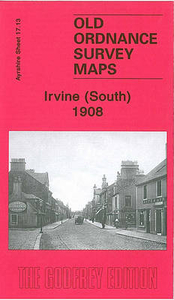
Irvine South 1908 Stanfords
£3.50
Archived Product

York South 1907 Stanfords
£3.50
Vouchers
No voucher codes found.
Do you know a voucher code for this product or supplier? Add it to Insights for others to use.
Do you know a voucher code for this product or supplier? Add it to Insights for others to use.
 Denmark